A journal of canoe expeditions along the rivers of Australia's Murray Darling Basin using photographs, stories and information to highlight the beauty, challenges and history of these rivers and the communities they flow through.
Starting point 4 km from Howlong, at 2124, not far from Kismet Caravan Park.
Finish point 12km downstream of Corowa at Stanton Bend 2070km.
We had a disturbed night. At about 1am there was crash, disturbingly close to our tent. On further investigation, we found that a 4 m long branch had fallen from a young redgum adjacent to our tent. It missed us, but not by much, instead it landed flat across the front of our boats. Thank god they are not made of fibreglass. We could not find a mark. Gopro and all other equipment fine. We had been careful with our tent site, but the fall was disturbingly close, all the more so because it was from a young tree and in the middle of a near vertical branch. In addition it happened in a time of absolute wind still. Needless to say, our antennas will be even more sensitive in future.
Parks Victoria advice on camping around Redgums. According to some research, mature trees are the most likely to drop branches. The most common branch size dropped is between 10 and 30cm in diameter, and that only 25% of tree drop their branches. Those that have dropped branches in the past are likely to drop them in the future. Location also has an effect, the following study found that if a tree drops its branches in a particular location, other trees in that location are also likely to drop their branches.
I have noticed that trees in saturated ground topple easily, no matter how large. Along beaches, root systems are flat and unable to penetrate the soil further than the water level. These are easily blown over in the wind. An Adelaide tree surgery report suggests that limbs fall because of minor structural flaws, such a cracks on limbs that reach above the canopy and are thus exposed to more wind than the rest of the surrounding trees, limbs that extend horizontally rather than vertically, branches which do not taper, but remain the same diameter, or those that have been damaged and include hollows.
University of California Professor Richard W. Harris found that high humidity in the tree canopy and a reduced flow of water in the xylem (i.e. the wood) caused a build-up of pressure weakening cell wall strength. He found that breakages usually happen between 1 and 4m from where branches join the trunk.
Locally, limbs seem to fall just as much during the night as during the day. Perhaps changes in humidity have something to do with it. Hot days and the nights following them are known risks - so take care.
After that luck escape... and a few hours sleep... finally, we were on our way.
Early morning departure to beat the heat.
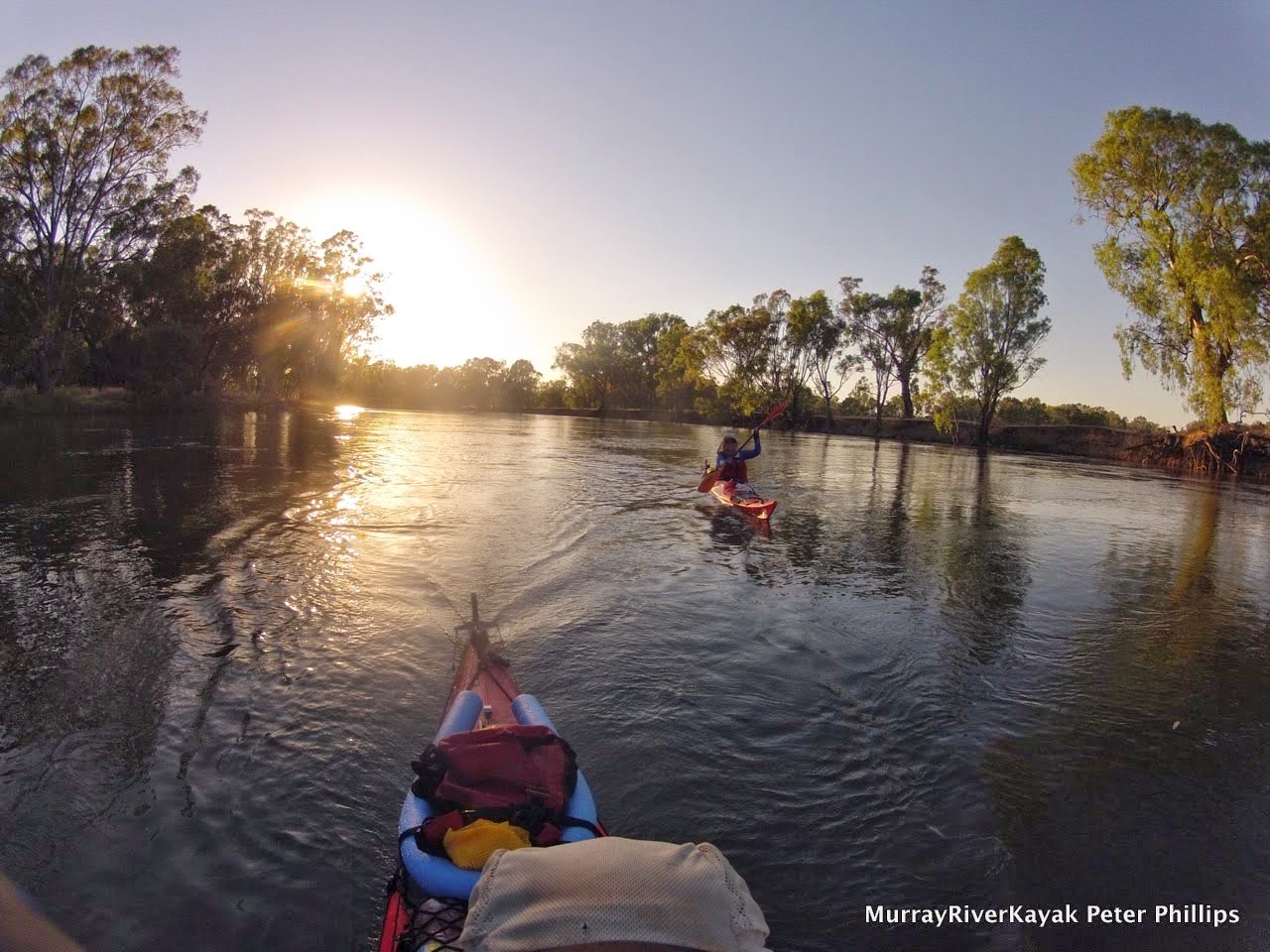
It is nice to be able to share the journey.
We did not sleep well for a couple of hours after that incident. Not surprisingly, when we got up at 5:30 for our planned early start to beat the heat, we were still quite tired. The early morning light was beautiful.
Cockatoos
Every tree is an individual in its own way. each has its story, a reason for being the way it is, a reason why it has been able to withstand the floods and droughts which are inevitable on the Murray.
Our first stop was 'cow beach' downstream from McVean Island at about 2108. Cow beach because of its friendly inhabitants. Whilst we rested, a large group of cows decided it was time for a drink. Once in our boats a few curious individuals needed to find out more and had a sniff, first of Ruth's spray deck and then the front of my boat. The cow that sniffed my boat turned out to be her mum, she brought her calf along a minute or so later. I almost fell out of my boat laughing. I have never thought of cows as cute before, but these definitely were.
Years ago on a round Australia trip, we came across a man sitting on the side of the road in a deck chair. We were driving from Darwin to Cairns and were looking for a place to spend the night. Company is good in that part of the world, so we decided to pull up near this man and his caravan. After settling in, we wandered over to say hello, to find the man now leaning on the barbed wire fence alongside the road, binoculars in hand. He had been there most of the day. He was a retired farmer, he told us, and he missed his cows. It is funny the things that you learn in a trip down the Murray. I felt that now, so many years later, I finally understood this man.
Cow lick beach.
Curious cow.
From there we made our way to Corowa, practising our cooling down technique for the four days where over 40 degrees celsius is predicted from tomorrow. This involved wetting ourselves down regularly, a break every 10km, and best of all, floating with the boats for a hour in the hottest part of the day. After the float we did some synchronised paddling, in time and only a meter and a half apart. We listened to music from my iPhone as we paddled the last 8 km into camp at Stanton's bend. These last two things were the highlights of my day. Loved sharing them with ruth. Wonderful experiences.
Refreshing milkshakes - worth the walk into town.
Corowa's historic bridge. The 1892 John Foord bridge in Corowa is the only iron lattice bridge on the Murray river. It was the fourth bridge built across the Murray and established Corowa as a centre of commerce. It is the only bridge named across the Murray named after a pioneer settler. Though a second bridge has been built, it is such a part of the heritage and identity of the town that it is still in action. it is also the shortest way a very popular fish and chip shop across the river in Wahgunyah.
Floating 4 km in the heat of the day: refreshing and fun.
Evening swim at our campsite at Stanton Beach, 12 km downstream of Corowa.
The river is so different up here, fast flowing and low banks. Here we navigated two small islands in the middle of the river. From the air the river twists and turns. Billabongs are everywhere. It is a haven for wildlife. We saw flocks of black and brown kites, wedge tailed eagles, pelicans, ibis, rainbow bee eaters, grey tree creepers and at one stage flocks of low flying swallows which seemed to cover the river.
Its banks are lush and green. It feels as if it would be easy to pull up and camp anywhere. There is little or no housing development to be seen. This seemingly tame, rural environment is a stark contrast to the dry bush of further downstream. European trees are common, in particular poplars and willows. One island we passed was covered in elm trees and ivy, in the moist soil the forest looked like a patch of Europe.
Poplars and willows are common along the Upper Murray.
The river is swirly and fast. Care needs to be taken to steer away from willows well before the bends as the current often sweeps directly into and under their overhanging branches. It is also a good idea to have minimum gear on deck on these first few days: the likelihood of losing it is high.
Taking a break as the heat of the day settles in.
In this satellite photo you can see how the river twists and turns, abandoning old courses as billabongs and forging new ones. It is hemmed in by hills to the North and South. The Hume freeway in the South and Riverina Highway in the North run along the edges of those hills.
The Murray is a natural waterway managed in a human environment. Whilst the satellite picture that you have just seen shows how the river has changed and continues to change, the amount of water allowed to run down it and when that water is allowed to run is controlled in a bid to meet the needs of people all along the river as well as to keep the river and its wetlands healthy. At present, about 20,000 ML a day are being released from Hume dam, so the river is near the tops of the banks and most of the gravel races are underwater. This is because the summer months is when farmers irrigate. In the winter months, flow can be as low as 600 ML a day. This is in stark contrast to the natural patterns of flood and low river along the catchment. It has contributed to the demise of health of river red gum forests which depend on short, sharp winter floods to reproduce and rejuvenate the soil. In the last drought many wetlands and lakes were filled or allowed to dry out depending on the effectiveness of lobbying from groups and states concerned about them. The communities of Lake Boga and Pyramid Hill almost disappeared when the water they depended on did. The new Murray Darling Basin Plan contains strategies to ensure that these areas are not forgotten. It is motivated by the stories of real people and real places behind the controversy.
The basin plan is an attempt to make the way we use water in the Murray Darling Basin sustainable. The Living Murray Initiative in addition identifies six icon sites as being of particular significance and focus. One of these is the river bed itself, others are areas which the river supports, like the Barmah-Millewa Redgum Forests. Wetlands and lakes can now be filled using systems of channels which run off weirs like Yarrawonga, Torrumbarry and reserves like Lake Victoria. They keep the river alive and help us to grow enough food for our increasingly urban populations. Improved systems of dams, gates, channels and levees in the red gum forests mean that these can now be watered at the right time, whatever the level of the river (Barham Koondrook Perricoota Forest Works. Updates).
Whilst the management of the Murray River and its flow are a necessity for the populations that live along it, it is refreshing to find an unregulated river. The Kiewa river may flow through farmland for much of its course, but it is still wild. It enters the river quietly most of the time, but can be a raging torrent. It is easy to paddle past and not recognise its significance: one of the last free mountain catchments in the Murray Darling Basin.
The Kiewa River Junction.
The junction of the Murray and Kiewa rivers. The Kiewa, Ovens (and its tributary, the King river) rivers remain undamed, the only mountain catchments to remain in their natural state. This means that they can flood quickly following heavy rain. Care needs to be taken when camping on their shores. The Kiewa has its headwaters around Mt Bogong, whereas the Ovens begins near Mt. Buffalo. Both are very pretty valleys, are heritage listed and are very popular amongst fishermen. There was not much coming down the Kiewa today, but there were times when it was in flood last year. Things would have looked different then.
Active steps are being taken to improve the catchment health of both basins. Fish are being used as indicators of the river quality, in particular the presence of cod and trout cod. The following oral history was is an exerpt from True tales of trout cod: River Histories of the Murray Darling Basin: Ch 11, Kiewa River Catchment. You can read more at Australianriverrestorationcentre.com.au.
OH 95
Bill Murphy of Kergunyah was interviewed in April 2008 at an age of 73 years.
I was born in ’35. I remember my uncle went down here and all the lobsters were in the back of the Ford. I saw the lobsters; they were coming out of the river after the fires. He was fishing down here and there was a 70 pound cod dead, down near Doug Austin’s. Cliff Cooper told me there was cod all the way up past Tawonga before the fires. Apparently there was a few about 90 pound caught around here. There was an old bridge just below my boundary; there was a 90 pounder there. There used to be a few Catfish here, my father used to catch them in ‘the old river’, where it cuts through the paddock. He also talked about getting some other type of fish there. The Blackfish were in the little creeks, some people used to get a feed of them. There used to be some in the Bells Creek and the Running Creek. There were no yellowbelly here, not as I remember, and grunter, no.
When I left school the river was full of trout, you could catch them on worms up to 11 pound, then they started to disappear. The redfin then used to be thick, then they disappeared with a fish disease. I saw them dying in the river about 25, 30 years ago. I haven’t caught a carp for two to three years. I once saw six about 10 pound each eating the leaves off the willows. Now the river is full of small cod, though they get a bit of a hiding. Felix Carmody was a character and a well-known poacher.. He used to catch black snakes and once he tipped one out in the pub, that soon cleared the bar!
The Red Eye Cicada can be very common in one year, with thousands of individuals in one tree and completely absent the next (ref). Different cicadas emerge at different times of the year.They make good, although short-lived children's pets (ref).
This little fella was too big for the camera. Almost broke the lense. The cicadas are enormous up here... And loud. We had to abandon one potential campsite because we thought we would not be able to get to sleep with the noise. The cicadas answered each other on different sides of the river; one side would listen whilst the other would perform, before performing itself. They make their loud noise by rubbing thick chitinous plates on their abdomen together. These vibrate as they pass over each other causing the noise - much like finger nails on a black board. Later, we were told that cicadas are only noisey in the daytime, that they are quiet at night. Potentially we could have kept that first campsite, but we would have needed ear protection if they hadn't quietened down... and we would never have found the lovely island campsite that we eventually found for the night.
If you have really had enough, I found out that cicadas may be eaten, they were on the menu in China, Burma, Latin America, the Congo and in a single batch of ice-cream at Sparky's in Missouri, Columbia. They were warned by health authorities not to make a second batch and complied.
Cicadas spend most of their life feeding on the roots of trees, they emerge en masse to overwhelm predators.
Island campsite.
Cooling down after a long day in the sun.
We eventually found a nice spot a little over 50km down from the Hume. It is a small island, which is nice. I like camping on Islands. The current is fast here. Not even sand can settle. There are little trails of sand behind the tree trunks from when it has been covered by flood waters. All around the island are pebbles and gravel races.
Other paddlers have since told me that they too had camped on this island, however no trace of their passing could be seen. This is the way it should be. We should strive to leave so little impact that the people who follow experience the environment in as good, or better condition than we found it in.
More and more people want to enjoy our rivers, which is great, however the very people who love the environment can destroy it. Outdoor education teaches mantras such as leave only the lightest of footprints, take only photographs. As canoeists, our touch should be particularly light. Make it a challenge.
This website from Backcounttry Atittude outlines steps you can take to minimise your impact. It starts with good planning. Leave No Trace Outdoor Ethics & Skills For Outdoor Users. Many families who camp along the Murray pick up rubbish left by less careful occupants. It is a good example to follow.
The Murray River Guardian is a free magazine put out as a cooperative project between Parks Victoria and NSW National Parks. It is a guide to camping along the Murray in both of those states and contains practical tips and valuable information. It is worth getting your hands on one before you paddle.
Parks Victoria's website on the River Murray Reserve provides up to date information on changes in conditions along the river. Check it out.