Point Sturt to the Murray Mouth
This day’s story was told in the form of annotations from photographs posted on Facebook.

After thunderstorms for most of the night and 75 km winds predicted for the day, at 6am there was a window of calm, which I took. It did not take long for the waves to build however, and soon I found myself pushing through 1m high waves and 50 km hour winds. I made it around Sturt Point to Clayton Bay, where I stored the boat at the yacht club and waited for the calm weather predicted for the next day.

My camp at Sturt Point was a true shelter in a storm. There is a small grassy area where you can pull in and a sandy spot behind the reeds. I camped up on the slight rise, which provided a lovely view over the lake and the thunderstorms that evening.

Leaving Sturt Point, whilst the water was still calm at 6 am. It did not take long till I was fighting my way through 50km winds and 1m rollers and chop, which gave me a real workout. With the weather deteriorating I decided to stop at Clayton Bay and finish the journey the next day when the weather was predicted to improve.

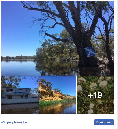
This old stone building had a 'secret entrance' below eye level. When the reeds grow high it would not be visible. Made me think of pirate stories and smuggler's caves. Arrrr... to be sure.


Pelicans feeding along the edge of the reeds in a residential area on the outskirts of Goolwa.

Oscar W, looking in great condition at the Goolwa Wharf.

Goolwa barrage has a lock with sliding gates. It’s worth going through, even if it is for the chat with the lock master. I forgot to ring ahead, but they saw me coming and came out to see us.

Coorong National Park and three cormorants who think the sign is a pretty good place to sit.

t was a treat to have my son, Tim accompany me for the last 25 kilometres to the Murray Mouth. We took our time, enjoying the opportunity to see the wildlife so close.

After being let through the Goolwa barrage, we entered the Coorong National Park. The water is shallow and full of bird life. I had the feeling that not many boats pass through here. It was the realm of wildlife. Within the space of 10 minutes, Tim and I saw 5 Australian fur seals, two playing with fish they had just caught and followed eagerly by small groups of seagulls.

Paddling the Goolwa channel was a nice experience. First to see the civilisation and boat culture of Goolwa. Almost every house had at least one boat. They came in all shapes and sizes. And almost every house had a flag pole. The water's edge was thick with reeds, which water birds like black swans, purple swamp hens, cormorants, terns and ducks used to protect their young, or rest. We saw lots of pelicans fishing.
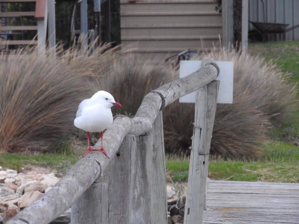
Many places have piers. They protect the shore, but from the viewpoint of this seagull, provide excellent places to sit.

Just in front of the Murray Mouth. Wasn't sure about getting too close as the currents were pretty strong. Will check it out a bit more tomorrow.

Paddling towards my family after reaching the Murray Mouth. Satisfaction, pride, relief and a sense of gratitude.

Putting in a big finish as I paddle the last couple of hundred meters towards the mouth.

Feeling euphoric on reaching the Murray Mouth. 2,224km and 36,000 photos later. Ruth, Anna and Tim met me there. Tim paddled the last 25km with me. Although it was a relaxed wind-down, especially after the heavy weather of the last few days, I could not help a sprint towards the mouth. You always gotta give your best at the finish. — in Goolwa South.

Pulling out at Sugars Beach after paddling to the mouth. There is something special about following a river to the sea. Its passage affects so many people, so many environments and touches on history way longer than our own, and yet its importance is here and now. It connects communities, ecosystems and enterprises and each has the possibility to positively complement the other. You often see the best of people around rivers. I have seen wonderful things and met great people on this trip. You often get compliments at the end of these things, but really, it has been my privilege: a privilege made first and foremost possible by my family.

My journey from the Hume to the Murray Mouth is over. Thank you to everyone who has been following me, who has shown their support along the way, be it sponsorship, words of encouragement, a cup of tea when it was needed most, a bed for the night, transport help, company on the water, a hot meal or shower, showing friendliness, even liking and sharing my posts. I hope that the results of my study will make a difference. Your support has made the world of difference to me. I will always appreciate it.


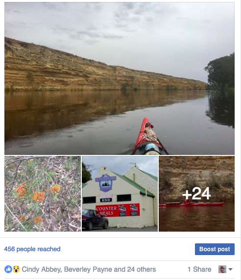

 ;). I wanted to get into Waikerie early enough to check out the situation and, if it turned out not to be suitable, to have enough time to find an alternative further down the river.