Day 48: 276 km Blanchetown 2nd Dec 2016
Apostle birds - Morgan - Houseboats - Fellow kayakers - Blackwater - Floods - Murrumbidgee River - Itldoo Station - Shacks - Crooks Landing - Halvorsen cruiser - Murray Gorges - Ecosystem dynamics - Mosaic - Ted the boat dog
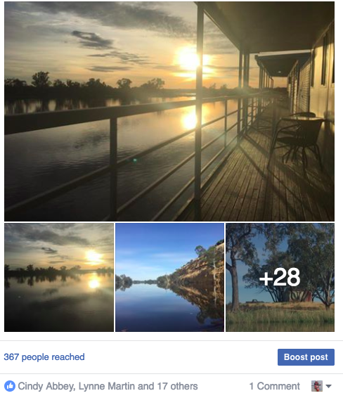
Morgan to Blanchetown
A big thank you to Kev who put me up for the night, laid on dinner, beers and breakfast. Kev is planning to paddle the Murray in Aug next year. He has read all the trip reports he can get his hands on. He has even seen what the trip can do to you... (Clarkies' unique finishing photo may never be upstaged)... and he's still keen to do it. Kev has a backyard full of chooks and apostle birds. There is a constant argument going on as to who’s boss. The apostle birds have adopted Kev, they come up and sit near him and eat from his hands, even though they are wild birds.
Morgan is full of houseboats. The shores are busy places. Sounds of angle grinders, hammers and lawn mowers in preparation for weekend and summer holiday guests. Prime real estate is down by the waterside, with even a shed going for around 300,000. In a twist on the past, places up on the hill, built of solid stone, symbols of wealth in the paddle Steamer times era are a fraction of the price now.
I paddled out of Morgan with Rordon and Dale, two Cairns based paddlers who had come down to paddle the Murrumbidgee River from Gundagai to where it meets the Murray near Boundary Bend. They had to call off their trip at Hay because the black water and the amount of dead stock in the river had made it unpleasant and potentially unsafe for their dog Ted. Ted is a true boat dog. He sits on a mat between the front and back seat of their kayak. Their kayak is the best appointed that I have ever seen. Rordon made it himself from a kit. It is wooden, with fiberglass internal and external layers, roomy and cuts the water beautifully. We paddled the first 10 kilometers together until the appropriately named 'Itlldoo' Station, where they turned around and made their way back to Morgan. Rordon and Dale hope to continue their bidgee paddle once the high water has passed, but enjoyed sharing their memories of their full distance Murray paddle in 2014.
After about 15 km, the shacks (as even the luxury riverside houses are called) finally gave way to bush. Patches of development continued around high ground, which usually still had the historical name of the property whose Landing Paddlesteamers had stopped to trade at in bygone days. Most shacks have lawn down to the water’s edge and many have sprinkler systems set up. I suspect these are to discourage campers and unwelcome boats and their passengers mooring on their property. Looking for a shady place to pull in for lunch, I eventually decided to brave having the sprinklers turned on on me and pulled into Crooks Landing at Ridgeway Station for lunch break. Above me cockatoos are nibbling the seed pods of the River Myalls. A cool breeze was blowing and I soon drifted off to sleep.
There weren't as many boats to photograph today, however there were a few notables. One was a Halvorsen Cruiser, every bit the battleship in pocket format. Another was a modern version of it, with similar lines, but twice as long. There were also little gems, home built paddle steamers and 1920's excursion boats and almost every shack had a tinny.
Probably the most notable thing today was that the river headed due South, with little deviation East or West. I had a 25 km/hr headwind, which kept me on my toes, but as it was not constant, was not too bad. The valley the river runs through is actually the path the ancient Murray. A much bigger river than today's Murray. Geologists have determined that the gorges it cut were 80m deep. The ancient Murray, at first held back by the uplifted land, formed a huge lake, which in spilling, found and enlarged its original path. The deep gorges formed by the ancient Murray are mostly filled with sediment from today's river, creating the gentle gradient we are familiar with in the lower part of the Murray today. At some points, the original gorge is little more than a kilometer wide. Too narrow to meander, the river moves from side to side, leaving billabongs and sand dunes parallel to the main stream. Where the river has not changed its path for thousands of years, flood plains gradually build high enough to support black box. Where it changes more frequently, it erodes these high flood plains, creating low country ideal for red gums with their requirement of frequent flooding. In this way the two habitats can be seen to be competing within the one environment. The floodplain is both building and eroding at the same time. In these narrow gorges this creates a mosaic habitat which is a stark contrast to the arid zone either side.
I reached Blanchetown just after 5pm, half an hour after the last passage was allowed. I could almost have ducked over the barrier rope, however if my kayak had gotten stuck I could have been in real trouble. The better decision was to turn around and return to the caravan park I had seen about 1 km upstream.
The manager had just settled into the pool when I found her. She gave me a nice shady spot with plenty of green grass, near the entrance. I packed my gear into duffle bags and walked it into the park, following eventually with my boat.