A journal of canoe expeditions along the rivers of Australia's Murray Darling Basin using photographs, stories and information to highlight the beauty, challenges and history of these rivers and the communities they flow through.
Goulburn River Paddle Day 3: Trawool - Nagambie.
114km - 181km Stocker's Hut to Lake Nagambie.
Today I would like to start backwards, for in my books it is hard to beat a cold VB on a deck overlooking the river. Add a cool breeze and the memories of the more difficult parts of the day are washed away. I am sitting at Chinaman's Bridge Cafe, just downstream of the old wooden bridge of the same name waiting for a pub sized parmi. Clouds from the long forecast storm have blocked the heat out of the sun which I have been in all day. Sacred Ground by Goanna is playing on the cafe stereo. The river is full of cockatoos noisily seeking roosting sites. I actually planned a bush camp for tonight, but it's been a big day, almost 70 km on pretty green arms. Severe weather warnings pushed me to look for storm safe camp sites. I thought that Michelton Winery would have been good and pulled in there, but the days when they allowed camping on their lower slopes seem long gone: so I pushed on. I was also keen to get across Lake Nagambie as early as possible the next day. The thought that the weather is usually calmer early in the morning and that most self respecting speedboat owners would still be in bed before 9 am motivated me to get as far as I could today. Eventually I ended up at Lake Nagambie, sipping a cold beer. Sometimes the most memorable things happen when things don't go to plan.
Enjoying a cold beer on the balcony at Chinaman's Bridge Cafe. Lake Nagambie after a long and at times, hot days paddle.
Chinaman's bridge at the entrance to Lake Nagambie.
Tree full of long-billed corellas.
My campsite. After 3 sticky days on the river, I really appreciated the hot showers.
Old farm shed between Michelton and Tahbilk Wineries.
Long billed corellas.
Last night was hot. The mercury barely dropped below 30 and following the thunderstorm the air was humid. Tim thought he might sleep on the verandah of the hut, but the mossies soon convinced him otherwise. A wet towel on our heads and the occasional gentle breeze helped in an otherwise rather sleepless night.
Stocker's hut, where we camped for the night. It had been a humid and sticky night, with very little air movement. It was a relief to get up once the first light of morning light arrived and to get moving again.
From our camp where the river turns west after Trawool we paddled into Seymour around 9:30am.
On the water again, working through the initial stiffness.
The weather was much friendlier than the day before.
There were some fast stretches coming into Seymour, where the river dropped like a big winding escalator. Lots of fun to paddle on.
A fast stretch of water before Seymour.
The first of a series of three bridge crossings at Seymour, two rail bridges for the North Eastern Railway. The first railway bridge is concrete and carries the Sydney to Melbourne line and the branch line to Shepparton. The second bridge is cast iron and carries bike riders on the Goulburn High Country Rail Trail on the last leg of their journey to Seymour. The cast iron bridge was built in 1873, the same year that the rail line from Melbourne reached the Murray River at Wodonga. The line from Sydney joined it at Albury ten years later. Before federation the states could not agree on how far rails should be apart: Victoria decided for broad gauge, NSW for standard gauge and QLD, narrow gauge. Up until 1962 all passengers had to change trains in Albury. Since 1962 standard gauge is used for the entire distance. ref
Tim and I packed early and were on the water at 7:30 am. Our arms had recovered
strength and we managed to set a good pace, arriving in Seymour just after 9:30 where we met Ruth and loaded Tim's boat onto the Echo soon afterwards. I plan to continue on to Echuca, weather permitting.
A look back at the railway bridge as we approach Seymour.
The old road bridge, now derelict.
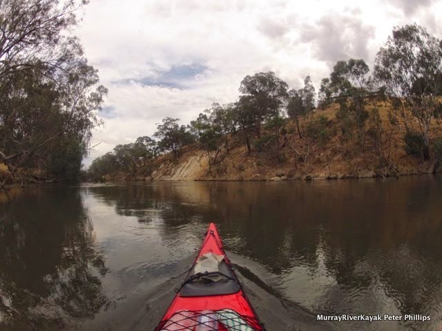
The landscape in between Trawool and Nagambie is rocky and includes more bush than the last few days. Up until Hughes Creek (24 km from Nagambie) the river alternatively flows through deep pools and then races. One race near Seymour ran through several tight bends, accelerating us up to 16 km/hr for a short while. Other than pressure waves and the odd snag in the middle of the flow there is nothing to watch out for. They can be paddled in an open Canadian canoe. The 20 km after crossing under the Hume Freeway (10 km downstream from Seymour) has gravel races at low water, but at summer levels there were few signs of these. From Hughes Creek the Goulburn comes under the influence of the Goulburn Weir, the water becomes deeper, the levels less variable and the current all but disappears.
Hume and Hovell, during their epic adventure, reached the junction of the Goulburn River & the Dabyminga Creek on 23rd December 1824. In those days the Goulburn was known as the Hovell and the Dabyminga as Reedy Creek. Hume’s mare was bitten by a snake so they decided to camp for a few days at the foot of a hill now known as Camp Hill, allowing time for the horse to recover.
Hume’s edited account runs as follows: “From the top of the hill we obtained a fine view of the river flowing from the north east through a gap in the mountain range distant about eight to ten miles where after a considerable curve to the west it eventually turned north west in which direction it was visible at a great distance” . Hume & Hovell observed Christmas Day at their camp “to avail themselves of the fine fish which abounded in the river”. On Boxing Day, Hume’s mare had now recovered from the snake bite and they crossed the river at a ford slightly to the north of the junction of the Goulburn and Dabyminga Rivers. It was this journey, which opened up Victoria and inspired explorers such as Hawdon, Gardiner and Hepburn (who became known as the ‘Overlanders’) to travel to the region. They reached the area in 1836. Hawdon was so impressed with the area that he took up 27,520 acres which was known as ‘Tallarook Run’. Tallarook Mechanics Institute.
Hawdon took sheep to Melbourne when that settlement consisted of only a few slab huts to test the viability of driving stock from NSW to the South Australia, which in 1837 was threatened with famine. Prior to this time stock had been shipped from Tasmania, or South Africa. The trip was seen as foolhardy, but following the Murray, Hawdon found that despite the heat, the cattle fattened on the reeds growing alongside the rivers. Within two years of their arrival, the first herd of 480 cattle had increased threefold (ref).
Tallarook means 'the call of the wattle birds' in the language of the Goulburn aborigines. The town was founded in 1860 on land from Joseph Hawdon's run. Joseph Hawdon was one of the original overlanders who, on hearing explorer Thomas Mitchell's reports of the rich, tall grasslands of the riverine plains, decided to follow the explorer's route, staking a claim in the area (Tallarook Mechanics Institute) which he called the Tallarook Run. As an overlander, he drove stock first to Melbourne and later to Adelaide. In 1872, the North-Eastern Line pushed through the town and onto Molesworth, provided more employment and helped develop the timber industry supplying firewood to Melbourne. In 1890, the population of the town rose to 200 (Mitchell Shire historical documents). Today the population is around 800 (ref). Visiting the town is like a step back in time, with many of the original buildings preserved much as they were when they were built over a hundred years ago. As an interesting aside, the granite from the hills through which the Goulburn winds in this area was used in the building of Flinders Street Station (ref).
In Seymour, the Goulburn River Caravan Park has a public boat ramp, from which it is only a short walk into town. The caravan park is just before the railway bridge. There is another boat ramp at the well maintained Lions Park, about 1 km downstream from the old bridge. In the old days, Seymour was known as the New Crossing Place, after the Mitchell's crossing near Mitchelton was abandoned in favour of Hume and Hovell's at Seymour. This became the place of choice to take stock across the Goulburn River on the route between Melbourne and Sydney. As traffic increased so did the infrastructure developed to take it: both the Sydney to Melbourne Railway and the Hume freeway still cross the Goulburn at, or near this point.
The New Crossing Place and Lions Park information sign, telling a little of the history of the town.
On my own again after Ruth picked up Tim.
Our dog Harry trying the boat out for size. Despite the brave look, it wasn't really his thing.
Remains of the old wharf in Seymour. Before the Goulburn weir blocked the River at Nagambie, paddle steamers made it as far up the Goulburn as Seymour.
The first Emily Jane paddle steamer was designed specifically to service trade on the Goulburn River from Echuca to Seymour. She was built at Wyuna in Thomas Buzza’s saw mill and boat building yard in partnership with Charles Wordsworth and William Rose, to the design of T. Price of Echuca. Murchison Historical Society.
Hume freeway bridge about 10km downstream from Seymour.
Flocks of corellas, more of a lower river bird than the Sulfur crested cockatoo.
We saw our first corella today, it sat a most a group of cockatoos, as if hoping to be included. Closer to Nagambie there were flocks of them. I also startled some sheep and cows, not deliberately, it happens when I drift silently around a corner. I had fun photographing a sheep as it realised there was a big red thing in front of it that wasn't there when it put its head down to drink and was a few seconds later and had to decide what to do.
Round Seymour real estate became more elaborate and expensive. The 20 km after Seymour has limited access, great views and is only a stone's throw from Melbourne.
The height of the pump house indicates how high the river rises in floods. Farmers are forever seeking ways to stop their expensive electrical pumps from being ruined by flood waters. This one was on a solid looking concrete block.
Nice looking camping spot and shelter.
A surprised sheep.
Beginning in Trawool, but concentrating around Seymour and in the areas of the Goulburn near Nagambie were elaborate properties and houses. Most were two stories and architect designed. In Trawool they ran sheep, in Seymour horse and near Nagambie, cultured wine. Scattered amongst them are the remains of original fishing shacks and camp shelters, good places to go to when lightning is an issue.
Michelton winery and Tabilk winery are a real pleasure to go to. Michelton has its iconic tower with an observation deck up high which you can catch a lift to for free. There are excellent views of the stretches of the Goulburn you have just paddled, restaurants and an impressive pergola. Michelton is also the site of the first crossing of the Goulburn by settlers on the overland trail from Sydney. There is a plaque in Michelton which reads...
"The old crossing place marks the point where the majors line from Portland Bay crosses the Goulburn River and where the first citizens of Victoria, overland era from New South Wales to the new district of Australia Felix, forded their stock and property, just below Mr. Clarke's Inn. The old crossing place became known as such after a new crossing place was established in late 1830 a few miles upstream from Michellstown at what later became known as Seymour."
Mitchelton's 55 metre tower was designed by renowned Australian architect Ted Ashton.
On their website, Michelton Winery acknowledge the importance of the Goulburn in developing the unique taste of their wines and a sustainable land management style which respects and cares for the environment that nourishes it.
Seasonal tributaries, shifting flood-lines and receding watercourses have stamped their presence on the landscape of Mitchelton. The ancestral courses that ebbed and flowed across the property over the last two hundred thousand years have resulted in a complex matrix of soil types that in turn nourish unique and distinct qualities in the vines that prosper on individual blocks.
The Environment: Mitchelton Estate’s influential and ever-present neighbour, the Goulburn River demands a holistic winery and vineyard approach. Banked by red gums and widening into billabongs, the river is an intrinsic part of a sensitive natural cycle. The Mitchelton team are dedicated to managing their entrusted backyard as custodians of a sustainable and distinct eco-system.
Michelton Winery: https://mitchelton.com.au/
The river between Michelton and Tahbilk. Note that the river is closer to the top of its banks as it nears Goulburn weir.
Some straights stretch for several kilometres. Just before Tahbilk I passed through a dedicated water skiing zone. Whilst river traffic was controlled and disciplined in these areas, there were quite a few boats and jet skis which did not obey the speed restrictions either side. It is a good thing the river is wide and that there is plenty of room for everyone.
Just before Lake Nagambie is Tabilk winery, established in 1860, it is the oldest in Victoria. It boasts a wharf, many original buildings, a restaurant and a wetland Eco trail - all of which are worth a look. Tahbilk sits between the Goulburn River and a billabong. Tahbilk have built 4 kilometres of walking tracks, run eco-cruise tours through the billabong's wetlands and have a café with bushland views. The Purbrick family, which has run Tahbilk for five generations, is committed to maintaining the environmental and cultural connections that make this area one of the premier wine growing regions in Victoria.
"The fabric of Tahbilk, its buildings, its estate vineyards, its 1860 shiraz block, and its idyllic setting by the Goulburn River (and its anabranches) all have history so seamlessly woven through its fabric that it's become timeless. Nothing will be changed or added in the future unless it is part of the continuity stretching back to 1860." Tahbilk: Our Story.
"Your first sight should be the 1860 Shiraz vines. They are a thing of beauty, diminished in number due to age, but still productive and found alongside the dirt road into the property." - AUSTRALIAN GOURMET TRAVELLER WINE
Erosion on an outside bend of the river approaching Lake Nagambie. The rest of the fence has disappeared. In some parts of our inland rivers banks have changed little since white settlement; in others banks are visibly crumbling. Action by authorities to reduce the speed of erosion is happening, but seems to concentrate on a limited number of areas.
Original farmhouse, just upstream from Lake Nagambie.
Old farm shed.
Chinaman's bridge at the entrance to Lake Nagambie.
Chinaman's bridge was constructed in 1891 and at the time known as Kerris Bridge, the bridge included a lift span to enable sawmill and recreation steamers to continue to utilise the Goulburn River. It carried the Nagambie-Heathcote Road, originally known as Chinaman's Road because of the number of Chinese market gardens in the area at the time. The timbers are hand hewn and it is one of the earliest timber bridges in Victoria. The draw bridge was replaced in 1940 with a steel span. (Victorian Heritage Database).
Chinaman's bridge. Still in use.
Chinaman's bridge caravan park.
My camping site at Chinaman's bridge caravan park. Very clean, great facilities, but not cheap.
In contrast to the deep areas of the Goulburn upstream of Seymour, there are wake boats and jet skies everywhere here. They do laps in the their favourite areas, putting up large wash in the process. It doesn't seem to matter where in the river you paddle the waves seem to get to you.
The caravan park I am staying in is full of the sound of children. They roam freely around the park, on bikes, on foot, or at the basketball courts, with family, friends, or as a group of similarly aged kids who have found each other. They are happy noises. It seems like an excellent family holiday - particularly if you like water sports.
It is drizzling tonight and with the promise of a good nights sleep, I will leave this blog for the day. Hope it makes sense, I kept falling asleep whilst writing it. Perhaps it was those beers on the balcony.
Hi Peter, Many thanks for your interest and ongoing support of our lesser known & respected river systems. Thoroughly enjoyed reading again,your Goulburn river trip report from 2015. I have canoed various aspects of the Goulburn, initially with the National Fitness council as a 16 year old. Fast forward 50 years, and now looking at Rowing a St Ayles 6mt wooden skiff which has 4 rowers with sweep oars, plus a cox. The St Ayles Skiff design is based on an old Scottish fishing dory, very roomy & quite stable & quite relaxing to row. We are looking at basing our group at Majors creek between the two wineries, with various skiff members joining in over a 9 day period. I'm looking at a 3day row from Trawool up to Nagambie, then social rows in & around the wineries & the Lake & the wier for the not so adventurous rowers. Just thought I drop you a line, hope you are doing well, and keep you notified of our adventure when it eventually happens in early 2021
Kindest regards, Geoffrey Daniel Mordialloc Sailing Club St Ayles skiff co-ordinator.


Hi Peter,
ReplyDeleteMany thanks for your interest and ongoing support of our lesser known & respected river systems. Thoroughly enjoyed reading again,your Goulburn river trip report from 2015.
I have canoed various aspects of the Goulburn, initially with the National Fitness council as a 16 year old.
Fast forward 50 years, and now looking at Rowing a St Ayles 6mt wooden skiff which has 4 rowers with sweep oars, plus a cox. The St Ayles Skiff design is based on an old Scottish fishing dory, very roomy & quite stable & quite relaxing to row.
We are looking at basing our group at Majors creek between the two wineries, with various skiff members joining in over a 9 day period.
I'm looking at a 3day row from Trawool up to Nagambie, then social rows in & around the wineries & the Lake & the wier for the not so adventurous rowers.
Just thought I drop you a line, hope you are doing well, and keep you notified of our adventure when it eventually happens in early 2021
Kindest regards, Geoffrey Daniel
Mordialloc Sailing Club
St Ayles skiff co-ordinator.
How did your adventure go Mordy?
Delete