Sustaining River Life:

A years K - 12 curriculum and activities guide for teachers and natural resources managers. Sustaining River Life has been designed to be an instructional resource for educators who care about natural resources and the environment - beginning with the recognition that healthy waterways are vital to both people and wildlife. It is a collection of good learning activities that can be used in both outdoor and classroom settings designed to support the academic standards appropriate for years K-12 in the Australian Capital Territory, New South Wales, Queensland, Victoria and South Australia. The 24 lesson plans it contains were assembled by Tanya Rucosky Noakes (ACT Waterwatch), with RiverSmart providing overall project coordination.
River Ecology and Research
A blog by CSU researcher Paul Humphries all about the science of rivers. It highlights ideas, concepts and research of interest to students, researchers and managers. As well as Paul's take on river ecology and research worldwide, it includes river links, PhDs in river ecology, information on fish ecology (especially freshwater fish) and undergraduate student teaching.
River Smart Australia

'Rivers for people, wildlife and sustainability' - mobilising people to take a more active role in revitalising our ailing rivers and floodplains. All Australians, irrespective of where we live, have an impact on the health of our rivers. They call this your 'river footprint®'. Every Australian can also play a role in seeing our rivers and streams rehabilitated. RiverSmart aims to offer these opportunities, whether it be in your home, your workplace, your farm or your school.
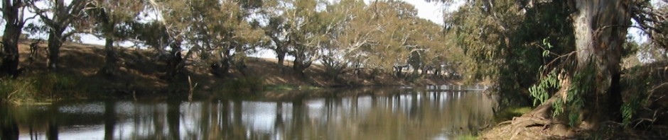
Murray Darling Basin: about the basin.
*** Murray-Darling-Basin-Teacher-Kit A detailed and well written resource including data, background information, student worksheets and lesson plans. A must read.

This site has a big job to do. It aims to provide up to date information about the ecology and geography of the entire Murray Darling Basin, one of the largest river systems in the world and one of the driest. It is divided into the northern Basin (Darling system) and the southern Basin (Murray system). The Basin is ecologically diverse, supporting a wide range of nationally and internationally significant plants, animals and ecosystems. It includes the Willandra Lakes Region World Heritage site, where the remains of Mungo Man and Mungo Lady were discovered. MDBA.
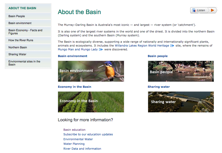
| Useful educational links in the MDBA site: |
Our Rivers Our Lifeblood: Environment Victoria.
Victoria’s rivers are the lifeblood of our landscapes. They connect, support and nurture communities of all kinds - animals, plants and people. They give us water to drink and to grow our crops, they clean up pollution and bring fertility to the soil. They enhance our lives and give us places to love and enjoy. In this Atlas we take a tour around Victoria, from the Snowy in the east to the Glenelg in the west, from the Murray in the north to the Bunyip in the south. We look at the key values, identify the biggest threats and assess the health of the rivers. We tell stories about the animals, the people, the history, what’s been lost and gained.

UNSW Centre for Ecosystem Research:

Rivers and Wetlands: We are particularly interested in the “boom” and “bust” ecology of inland river systems, focusing a considerable amount of our work in the Murray-Darling Basin and its more important wetlands. We have major study sites in the Macquarie Marshes on the Macquarie River, the Lowbidgee wetlands on the Murrumbidgee River and the Barmah-Millewa Forest on the River Murray. Various other projects cover most of the major wetlands in the Murray-Darling Basin (see waterbirds). An important part of this work is investigating the relationships and importance of environmental flows for large wetland systems, particularly through the lens of different animals, plants and ecosystem processes that depend on these flows. We are also investigating relationships between flow regimes and flooding to determine long term impacts of development and options for rehabilitation of wetland systems. A strong focus is the ecology of waterbirds and effects of water resource management on their populations. The Centre also runs one of the longer wildlife surveys in the world, started in 1983 and continuing every year, the aerial survey of waterbirds in eastern Australia.
Streamwatch
The Australian Museum took over Streamwatch from Sydney Water in January 2013, bringing fresh enthusiasm to the Streamwatch program. With our commitment to citizen science programs and history in documenting and tracking wildlife distributions, water quality monitoring will be another avenue to gather valuable data that can help in assessments of environmental sustainability and change.
- Waterbug Watch 2014
- Streamwatch Climate Change Event
- Tank Stream Tour
- Streamwatch Quality Assurance Event 2014
Australian Rivers Restoration Centre (ARRC)
Rivers provide multiple benefits – life-giving water, plants, animals, transport, economic wealth, recreation, and the spiritual connection so many of us feel when we sit or walk along a riverbank. The ARRC is a not-for-profit organisation that brings together people to work on river and knowledge sharing projects. The Australian River Restoration Centre (ARRC) believes in sharing knowledge, restoring and protecting rivers for all to enjoy, and valuing people and the work they do. ARRC aim to inspire and support people who are passionate about rivers through their magazine (RipRap), river management and fininterest (fish management) pages:
Fact sheets about river management...

Fishinterest: information about fisheries management...

Fact Sheets about fish in the Murray Darling Basin
River Health Melbourne Water

Healthy rivers provide water for homes and businesses, sustain wildlife and are enjoyable places to visit. However, our rivers face a variety of threats including the effects of a growing population and climate change. Importance of river health: healthy rivers provide everyone with:
- a healthy environment
- healthy habitats for plants and animals to live in
- attractive places for families and tourists to enjoy
- better quality water for use in agriculture and in our homes
- Rivers are diverse and complex ecosystems and– they host a great many communities of plants and animals that exist together in balance. When something disrupts that balance, the chain of effects can be very destructive and widespread.
Cool Australia:

Curriculum materials at this site include teacher and student standards referenced worksheets. Cool Australia focuses on sustainability issues across a broad range of area, but includes K - 10 materials which help students to investigate the water cycle, pollution and sharing water equitably in the Murray Darling Basin. This site includes teacher dashboards where students submit their work. Examples of lessons include:
My Enviro (App).

From the Australian Government, Department of Sustainability, Environment, Water, Population and Communities. Find the Australian environmental places and species that make up your neighbourhood or area of interest. MyEnvironment uses the GPS to show assets around you. See the heritage places, wetlands, protected species, protected areas, weeds and invasive species near you. Includes research on animal and plant species in your area, historical and geographic information. A must have... and free!
Ribbons of Blue:
This site is now assumed into Western Australia's 'Nearer to Nature' program as part of budget cuts in 2013. It resources are still available on that website, however a little difficult to find. They include 100's of lesson plans and other resources which support field work. Ribbons of blue was associated with Waterwatch and much of its content reflects that emphasis, however, it expands that focus and takes on a more holistic view, looking at the causes of water pollution and factors that affect water quality. Here are the links to lessons within the site (still active on Sept. 2014).
Basin Futures: ANU

Water reform in the Murray-Darling Basin, edited by Daniel Connell and R. Quentin Grafton. Australian National University Press. Downloadable book providing a comprehensive collection of peer reviewed papers describing the basin and its dynamics, freshwater ecosystem conservation (principles versus policy), environmental water (benefits of ecological goods and services), climate change and its impacts (current understanding and future directions), community perspectives, a media guide to the basin plan, thriving or dying communities, economic costs and benefits, and groundwater extraction.
Field Guides
Field Guide to Victorian Fauna: Museum Victoria
Explore Victoria's unique and diverse wildlife at home or in the great outdoors with Museum Victoria’s free Field Guide app: descriptions of over 950 species, including birds, mammals, fishes, reptiles, frogs and invertebrates from terrestrial, freshwater and marine environments, with stunning imagery, as well as animal calls, distribution maps, conservation status, butterfly flight times, frog calling times and depth information for marine species.

Atlas of Living Australia

Explore Victoria's unique and diverse wildlife at home or in the great outdoors with Museum Victoria’s free Field Guide app: descriptions of over 950 species, including birds, mammals, fishes, reptiles, frogs and invertebrates from terrestrial, freshwater and marine environments, with stunning imagery, as well as animal calls, distribution maps, conservation status, butterfly flight times, frog calling times and depth information for marine species.
Atlas of Living Australia
The Atlas of Living Australia (Atlas) contains information on all the known species in Australia aggregated from a wide range of data providers: museums, herbaria, community groups, government departments, individuals and universities.
- access information pages for each species containing photos, descriptions, maps and observations
- access scientific and common names
- explore the flora and fauna reported around your neighbourhood
- learn about Australia’s biodiversity collections at museums, herbaria and other institutions
- learn about citizen science projects
- map, analyse and visualise biodiversity and environmental data and trends
- access tools to help track changes in biodiversity and the environment
- download and use open source tools
- download biodiversity data
- access images, literature and genetic information through Australian nodes of international data repositories
- volunteer for digitisation projects.
Birds in Backyards: Bird Finder
The Bird Finder allows you to search, browse or find information about individual Australian birds based on size, shape, or distinctive feature. A great site if you are not so sure about your birds.


A guide for the keen birdwatcher's smartphone. This one is not free, however has high quality images covering over 790 bird species and detailed distribution map showing any subspecies that occur and more detail than most free apps, including songs and calls, measurements and breeding behaviour.

Frog Field Guide: Australian Museum

This app is still in the developmental stages, but is getting better all the time. The Frogs Field Guide is a great way to identify and explore Australia's unique frog fauna... Browse comprehensive information about frogs, including photographs and calls. Discover Nearby frogs. Explore frogs by body colour, toe pad size, webbing and belly colour. Use the Frog Log to compile your own location-based collection of frog sightings and images. Discover frog species near you, listen to calls, view images, 'Explore' frog attributes and log your own sightings of frogs.
This app is still in the developmental stages, but is getting better all the time. The Frogs Field Guide is a great way to identify and explore Australia's unique frog fauna... Browse comprehensive information about frogs, including photographs and calls. Discover Nearby frogs. Explore frogs by body colour, toe pad size, webbing and belly colour. Use the Frog Log to compile your own location-based collection of frog sightings and images. Discover frog species near you, listen to calls, view images, 'Explore' frog attributes and log your own sightings of frogs.
Australian Wildflowers
This app makes identifying flowers a breeze. Refreshingly simple compared to using a botanical key, users choose the shape of the flower and then the region they live in. Not free, but at only a few dollars, it is a good deal - especially if you like walking in the bush.

Weed ID: The Ute Guide
This app is designed for farmers, but has a section on native plants as well. Again, its free. Where possible, photos have been provided for each stage of the weed’s lifecycle, from seed and seedling through to mature and flowering plants. These are categorised by plant type, and results for each can be refined by state and lifecycle, and whether they are native, currently flowering or have a distinctive smell.

This app makes identifying flowers a breeze. Refreshingly simple compared to using a botanical key, users choose the shape of the flower and then the region they live in. Not free, but at only a few dollars, it is a good deal - especially if you like walking in the bush.
Weed ID: The Ute Guide
This app is designed for farmers, but has a section on native plants as well. Again, its free. Where possible, photos have been provided for each stage of the weed’s lifecycle, from seed and seedling through to mature and flowering plants. These are categorised by plant type, and results for each can be refined by state and lifecycle, and whether they are native, currently flowering or have a distinctive smell.
Ecolinc: Biodiversity of the Western Volcanic Plains


- Grassland foodwebs: Food webs consist of a number of interlinking food chains within an ecosystem. A food chain indicates ‘who eats who’ and depicts a flow of energy. All food chains begin with a producer, an organism that can make its own food e.g. a plant. Herbivores are organisms that eat plants and carnivores are organisms that eat other animals. Omnivores eat both plants and animals. Fungi are decomposers, which break down dead or decaying organisms and return nutrients to the soil. Select your level of difficulty to get started.
- Whilst this resource specifically targets species present in the Western Volcanic Plains, many species have a much wider distribution. It is worth giving this app a run, even if you do not live in the South West of Victoria. One of its special features is a the ability to upload photos as proof of animals and plants being in a particular area. The photos are later examined by experts and the data added to the website databank, improving the accuracy and overall knowledge of species distribution in Victoria.
Macroinvertebrates identification and information.
 |
| Satirical cartoon by William Heath, showing a woman observing monsters in a drop of London water (at the time of the Commission on the London Water Supply report, 1828) Wikipedia |
Macroinvertebrate (water bug) surveys provide an indication of stream quality over an extended period of time (it is recommended that they be repeated every 6 months) as opposed to chemical (pH, salinity, hardness, nitrates, phosphates, organic pollutants), physical (temp, dissolved oxygen, turbidity, flow) surveys and bacterial and pathogen assessments, which provide instantaneous snapshots.
Murray Darling Freshwater Research Centre: (Bugguide). The water quality of a river, creek or pond, sometimes called ‘ecological health’ or ‘river health’, can be assessed using the presence or absence of the animals that live in water. This is called bioassessment and it gives an indication of how well the water can sustain animal life rather than the levels of chemicals and microbes that are associated with the quality of drinking water for people. Biotic indices are used to numerically represent the ‘health’ of the water. An easy-to-use biotic index is the SIGNAL index.
SIGNAL is a simple biotic index for macroinvertebrates that uses the pollution tolerance levels of different macroinvertebrate types to create a site score and water quality rating for the river, creek or pond being studied. Waters with high SIGNAL site scores are likely to have high levels of dissolved oxygen with low levels of salinity, turbidity and nutrients (nitrogen, phosphorous). Still waters and slow flowing lowland waters, by nature, will always produce a lower site score because the physical habitat and chemical levels (noted above) are naturally different. Few macroinvertebrate types that are rated as very sensitive occur naturally in still waters or slow flowing lowland waters. SIGNAL2 has been developed from data collected from the National River Health Program to produce a scoring system that can be used across Australia.
This site provides a simplified way of calculating a signal score which does not involve filling in a big table.


SIGNAL 2 User manual: this is a paper describing how signal is designed to be applied. Signal is a biodiversity index which includes weighting for families and taxa, as well as the known sensitivities of different macroinvertebrates to pollution.

Waterwatch Field Manual: is a schools guide to water sampling. How often is it best to sample? where in a stream should one sample to ensure that you have covered a range of habitats.How calculations are made about water quality using the SIGNAL table.
Streamwatch Manual: The Streamwatch manual is a step by step guide to Streamwatch water monitoring tests.


Specific issue sites
Waterwatch; download manualLandcare
Turtle Watch
Frog Watch
Platypus Watch
Birdlife Australia
Ramsar
Kangaroo conservation and management
Salinity
Environment (ABS issues and trends)
River levels: Live river data
River Operations: Free flow
Rivers and Wetlands of the Murray Darling Basin: MDBA
Wetlands
Blue Green Algae
Fish:
- European Carp: 1,
- Gambusi (plague minnow) Gambusia is a feral fish that has been introduced into Australia. They are now the most common freshwater fish in the world.
Geology
Paddlesteamers
Area Guides
Park Web VictoriaNSW National Parks
Dept of Environment Water and Natural Resources SA
River Murray
River Trails
Four post camp,SA island,
Coorong,
Barmah Lakes,
Upper Murray,
Goulburn
Macquarie River Five trails for you to pick and choose from to create a lifetime of memories as you meander through our region – let the river be your tour guide. From the wonders of Lake Burrendong to the frontier country of the Macquarie Marshes if you only spend a week, you’ll probably have to come back. But that’s Ok, you’re welcome anytime.

No comments:
Post a Comment