Murray River Paddle 2016 Day 37: Lock 8 - Kulcurna Station

Day 37: 666 km Kulcurna Station 21st Nov 2016

Lock 8 - Memories - Being overtaken by a dead fish - Refuges - Erodion - Flies - Delvils Elbow


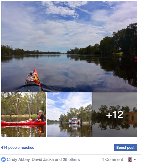
Lock 8 to Kulcurna Station

It had been a warm night at our campsite at Lock 8. The sun has a lot of strength this time of the year and sleeping on the ground was like lying on a hot plate. When we were kids, before we were told to be sunsmart, we used to lie on the concrete at the town pool. It was too hot to walk over, so we would splash water on it first and then enjoy the warmth from below and above at the same time. It was easy to fall asleep, but that didn’t matter. The goal was to be brown, all over, and we thought that you had to get properly sunburnt to get a good tan. However camp was no town pool and with the fast currents and amount of dead fish, not so appetising. I haven’t been for a swim so far on this trip - which is a first.

Today, we finally got ahead of the dead fish. The last couple of days have been shocking. We made macabre jokes about sticking flags in the bigger cod to see who made it the furthest in 24 hours: we had the speed, but the fish went 24/7. Being overtaken by a dead fish is not a point of honour. It seems that blackwater is worse at this end of the river and I wonder whether with each new input of organic matter from the forest, the levels in the river are accumulating. Upstream, blackwater was the result of water flowing through the forest and sitting in shallow sections long enough to soak up the organic matter - like a strong brew of tea. Patches were local and soon diluted by the main flow. Down here, where the river is wider and deeper, and where the river is only just beginning to break its banks and enter the floodplains on either side, the blackwater is clearly from upstream. Perhaps the levels of organic matter are more than the microorganisms can break down and so the effect is transported downstream. Belinda Hansen, manager of Kulcurna Station worries that here, the effect will be worse than in 2011. “Back then, it was all over in one slug, this looks like it is going to go on for months”.

Back in the Middle Murray, the cod survive by finding points of aeration behind snags, especially those with fine twigs. These aerate the water through waves and ripples. They are also know to swim up tributaries, like the Campaspe and Goulburn Rivers. I thought that no such rivers existed down here, but I was wrong. Today we passed by quite stately creeks; Carr’s Creek, Mungo Creek, Rufus River (the outflow from Lake Victoria) and Sharp Point Creek: each as wide as what we would call a river in Victoria and capable of creating their own flood events following heavy rain. There is diversity here that takes time to recognise, that takes time to understand. We tend to look for blanket solutions, when the answer is more complicated than that. “Complicated, but simple”, says Belinda Hansen. Complicated, because it takes time to understand local environments. Simple, because once you do, it makes common sense. Their key is to involve locals, especially those who have built up an understanding of their area over a lifetime, or in cases, much longer.

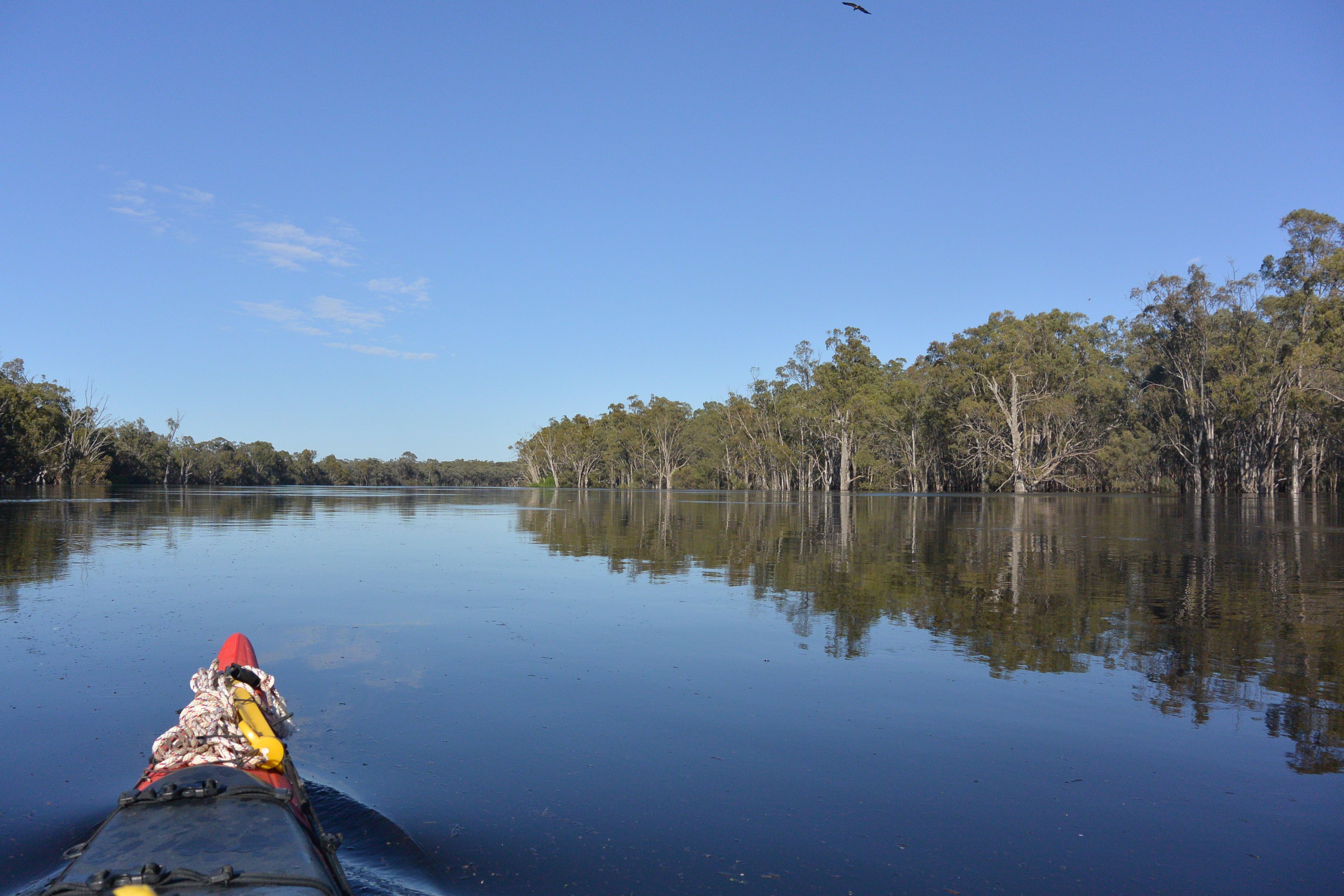
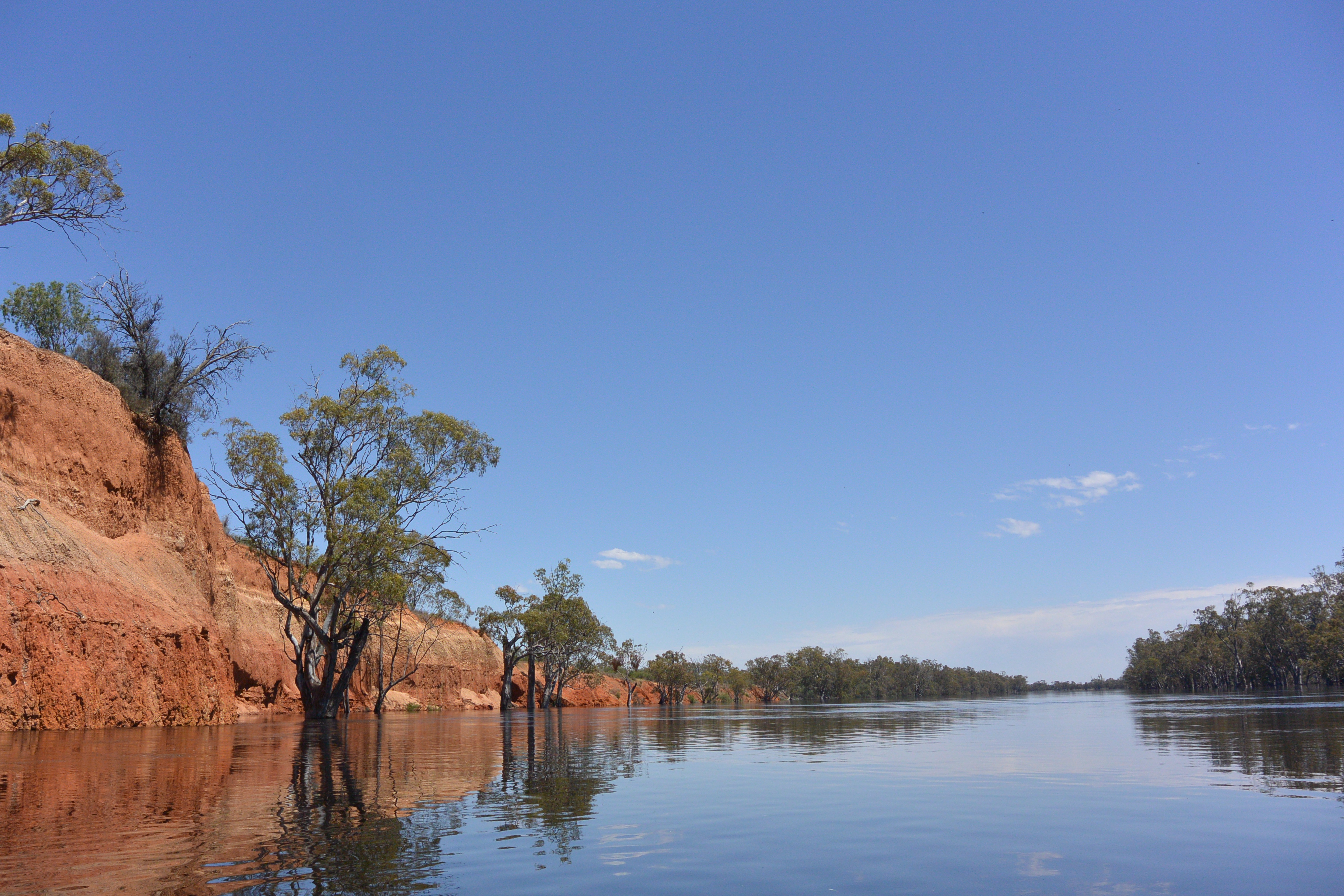
Every now and then the Murray of today, bumps up against its parent banks. The banks left when Australia was much wetter, our mountains kilometres higher and the river as wide as the great rivers created by the great rainforests and tallest mountains in the world today. It was kilometres wide and left banks that were 20 to 30 metres higher than today and bends that ran for 10 to 20 kilometres. Today’s river winds around inside this ancient river course, like a trickle. However, every now and then it bumps into one of these walls and, like a steady drip, erodes into it. When it does so, it reveals something of the past. Our lunch stop at the base of an enormous rise was an example. Erosion was rampant. Gullies had eaten into its face and had worked their way inland hundreds of metres, revealing multi-coloured, soft sediments. The ground was covered in saltbush and the kind of small round limestone pebbles that form in this area when rain dissolves the calcium in this ancient sea bed, growing crystals as it evaporates, much like lime does in kettles. It was hot and the kind of strong wind that heralds a change in weather, was blowing. We had a view over the dry land bordering this corridor of green, the ribbon of life that the river is to the areas it flows through. In the distance we were watched by red kangaroos, licking their forearms to cool down. On the old billabongs, dead trees stood sentinel, telling their story of the past.

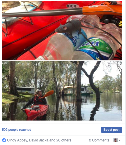
Out on the water, there are few insects to bother you. Coming ashore they lept upon us. Too hot for mosquitoes, but not for flies. Our backs were covered in them and they were determined to find things to nibble on around our faces, including around our eyes. When Anna left the bank in a flurry of splashes and arm waves, all her flies came to me. Thanks Anna! They kept with me through the three thunderstorms that followed that afternoon. They somehow found places to hide in the heavy rain that fell. Emerging to sit on my hat, like dogs on the back of a ute. These flies wanted to travel down the river. It became part of a joke between us, especially when we came together for a break and the flies would swap people.

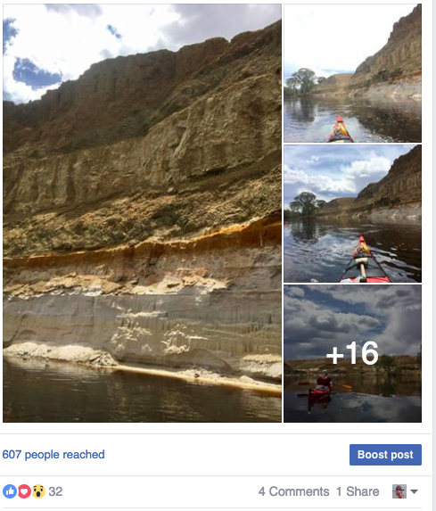
We passed four stations today. The first was Ned’s Corner, a former sheep station which is now run by Fund for Nature, as a wildlife reserve managed for endangered animals, which around here means not just limiting the number of cats and foxes, but also the number of kangaroos. University students from LaTrobe stay in dorm-like accommodation near the kind of big old shearing shed that is typical of the area, as part of their arid zone land management studies. We had planned to call in, but didn’t as we had word that the managers would be away on that day. You have to get supplies some time or other when you live in the bush. It seems that more and more stations are opening their doors to the public, providing an opportunity to see what life is like in this part of the country and sharing their love of the land they live in. Lake Victoria Station offers ‘Possum’s Riverboat Safaris’ as part of a ‘Murray Darling Holidays’. The homestead is set behind the ruined walls of the original limestone building and its owner, Paul Chors is an authority on local history. A little further downstream, Warrakoo Station, is impressively preserved and now run by the Mildura Aboriginal Cooperative. Perhaps because of its proximity to Devils Elbow, arguably the most impressive place on the river where the Murray erodes into its grandfather banks, creating a crumbling vertical face. Here there are clear layers of white sands and green clays. Books talk about the Parilla Sands and Blanchetown Clays. I wonder if these are them. Having the high river I was able to paddle right up close and look. I had to be careful though, as behind me I heard blocks break off and at the end of the cliffs was the most enormous whirlpool. Not far downstream of Devil’s Elbow is Kulcurna Station. If I was to choose one location as being quintessentially Australian on the Murray, it would be Kulcurna. Located at the edge of wetlands, nestled at the base of tall red cliffs, it looks out over red gum forest. This is my third time here. Something in my psyche, the image of what it is to be Australian is twigged here. It is a family home, with all its memories, and Belinda Hansen, our knowledgeable host, is its connection. I have written this post on the wired in veranda, over looking the river, listening to John Williamson’s ‘Galleries of Pink Galahs’. It almost seems written for this place.

After walking up to the top of cliffs to find reception to send this post we will move on. We have a short day today. We can explore, but we will need to rug up, the temperature is 20 degrees lower than yesterday with rain predicted.

Murray River Paddle 2016 Day 36: Moorna Station - Lock 8

Lock 8 Campsite 20th Nov 2016

Moorna Station - Ecology - Dead Cod - Heat - Lock 8 and 9 - Thunderstorms Building


Over toast and a hot cuppa, Annabelle, the manager of Moorna Station, shared her views on why blackwater in the river was such an issue. She takes a holistic view. Seeing the interruption of water cycles on a range of scales, from the seasonal floods which no longer happen most years, to those driven by trees and plants by drawing water from deep down on the soil, or by being a driving force behind the building of beaches and floodplains, as red gums do on the inside of river bends. Annabel argues that salinity is the greatest threat to our environment, but one that can be overcome, if we use native plants carefully. If there had been native grasses she argues, there would not be so much black water. They would have helped decompose the leaf litter that the floods have taken into the river, reducing the sad toll the event is having on the murray cod population.

Throughout the day, we saw many dead cod, usually quite large ones. Shrimp gathered on the side of the river for oxygen, but downstream of lock 9, many had also died. There was a thick layer of dead shrimp along the water’s edge. In this section of the Murray, the river runs from one weir pool to the next, it’s artificially high water level flooding billabongs. Though these areas are usually covered with water and so should not be a source of black water themselves, the lack of current exacerbates the condition when water which has been flowing through the firsts enters them. The situation may be quite different to the middle Murray, where I come from, because there are few flowing rivers that enter the Murray. Although on this paddle I have noticed that blackwater is patchy, that it tends to come from distinct areas and is soon diluted by the river channel, we may be seeing a cumulative effect. Every now and then the river flows through a snags which aerates it, or takes a cutting where two bends of the river near each other. These spots are lifelines for the big fish. People have told us stories of cod following the wake of their fishing boats, because the waves increase the oxygen content of the water, helping them to breathe, or hanging around snags in plain sight, when they are normally quite a shy animal. Much is assumed when it comes to working out how cod survive blackwater. The 2011 event is said to have been much worse than this one and yet the death of large cod shows that many survived. One can only hope that many find ways to survive this event also.

The river landscape continues to be a delight to paddle through. It looks wild, has thick understory shrubs in some places and grassy meadows in others. The old trees are generally recovering very well from the millennium drought - which cannot be said for many other parts of the river - and although there has been some tree fall, most of the older trees are still standing. It seems like we are coming to the front of the main rise. We are starting to see the kind of debris that floods pick up as they rise, sticks, duck weed and leaf litter. In places the river has not yet broken through its natural levees, leaving the areas behind them dry. In others the water can be seen rushing into the forests. There is another benefit to this... less mosses. At the beginning of this trip, I was paddling on a falling river. You know that your campsite is safe on a falling river, because levels are dropping, not rising, however on falling rivers, stagnant pools have had time to form and the mosquitoes are much worse.

Mosquitoes don’t like moving water, so now, being ahead of the main flow there are way less mosquitoes. Now that is a welcome change.

We continued to see plenty of whistling kites. There are more than when I was a kid and I wonder if there is a cooperative deal with fishermen. Their nests are large collections of sticks, high in the tallest trees. Occasionally you can see a young head looking out. No place for fear of heights - or strong winds. We saw a nankeen kestrel and a group of white breasted woodswallows huddled together on a branch of a dead tree. Ibis and spoonbills frequented the river shore. Galahs and little corollas screeched their presence to all who wanted to know and families of kookaburras used family chorus to do the same. In the heat of the day, when all else is silent, we often heard the beautiful whistling of butcher birds. Mudlarks defended their territories against all comers, whether they be marauding crows, or whistling kites who glide on the breeze. Willy wagtails flitted through the undergrowth and occasionally out over the water. Wattlebirds and honey-eaters quarrelled amongst the branches, and where the banks had broken away, we could often find rainbow bee-eaters with their soaring flight. Near older trees, swallows and fairy martins would fly out onto the water and circle us. Perhaps we stirred ups insects sitting on the water’s surface. It also seems like a greeting.

Today was our first real hot day. It was so hot that when Anna and I took a lunch break in the shade of an old box, our paddles were too hot to hold and the deck had softened. We cooled both down with water and hope that the food did not get too warm. Next time we will find a spot for the boats in the shade. A hot day meant impromptu water fights, including sneak attacks. It meant breaking out the serious marathon hats with the side and back flaps and using a sponge to wet ourselves down all over. We invented the armpit challenge. To do this you first soaked your paddling gloves and sleeves in the water and then put them straight up in the air above your head. The water runs ‘refreshingly’ down your sleeves and top. It usually involves some deal of shrieking - but then so too did the sneak attacks. :)

We travelled over two weirs today, lock 9 and lock 8. Lock 8 is one of the more isolated weirs on the Murray. Annabelle noted that we left a surprisingly sane impression on her, noting that this was often the case this far into this kind of journey. Paddlers are often scared of the lack of facilities in this area. There is little mobile contact possible (hence a text only entry tonight... I found a spot near an old tree where I have one bar of reception) and no chance to supply for three or four days. This is not an issue for us, we are able to filter our own water and have weeks worth of food. Tonight we have found a comfortable camp just downstream from lock 8 on a parking spot on the river road. It has shady black box and even a bench. Now that the day has cooled a little I am about to cook our evening meal on that. i have instructions from my wife Ruth to see how classy I can make this, so I am going to try... salmon on a bed of rice, with sautéed zucchini, onion, garlic and a slice of ginger, seasoned with freshly cracked pepper and murray salt (well I’m calling it that). I think we’ll let it cool before we eat it though :).

Around our campsite whistlers a red-lored whistler is proclaiming its territory. It may be hot out in the bush today, but it is still beautiful. Time to grab another wet towel and get dinner going.

Murray River Paddle 2016 Day 35: Wentworth to Moorna Station


784 km Moorna Station 19th Nov 2016

Wentworth Weir - Quiet waters - Blue Sky - The Walsh Family - Flooded landscape


Our day began with discussions with our neighbours about how to go through the Wentworth weir. The discussion had begun the evening before when we registered with the caravan park owners. “Don’t go through the weir”, they said, “a bloke with a tinny lost his boat there a few weeks ago: he swam to shore but his boat was sucked under and only came up a few hundred metres downstream.” Others assured us, it was little more than a ripple. We had made friends with Richard & Leigh and Paul & Marg the night before at the Royal Wentworth Hotel. Both were travelling Australia in converted buses. Richard volunteered to take us down to the weir and have a look. Paul & Marg decided to go down there and keep an eye on us. In the end, everyone went. Approaching the weir I could see quite a bit of turbulence, which concerned me, and it wasn’t until I found the navigation markers for the safe passage that I felt good about going through. We got a good speed up, just in case and slid down the small drop over the weir. It was a safe passage, as the signs suggested and having this officially marked gave us confidence for future weir crossings. As we left the weir our friends photographed and cheered. Actually, it is them that deserve the cheers. Both retired couples, over the past three days they had explored almost 100 km of creeks, rivers and billabongs in the area by kayak. Not your average retirees. Their actions motivated us to take as much time as we could to get into these backwaters during our trip today too.

Travelling down a flooded river is an interesting experience. The river is much bigger in all ways. There is more water. it is higher, flowing through the forest wherever it gets a chance; and the currents and swirls they create are stronger too. The quietness of the river, a complete absence of traffic and even people along the banks, adds to the sense of being alone - which makes it feel bigger too. However, it is when you venture into the forest, between the trees, into the flooded billabongs and alongside the reeds that you see the true value of having a high river. When the river is high, it interacts with the landscape. Once in the forest, everything slows down. Often there is hardly any movement discernible in the water. Even air movement drops, which together with the towering gums, creates the most amazing echoes.

In one of our breaks from the main stream, we saw a pink eared duck, in another, how the old course of the river had shaped one of the ancient sand hills. Where the river once flowed is now a billabong, but it is still as wide and majestic as the river itself. The area is peppered with these river remnants. Long after the high river recedes, these places hold water and become important breeding sites for waterbirds, turtles, frogs and all manner of creatures.

We pulled into the Great Darling Anabranch for lunch. The Anabranch is a section where the Darling River splits in two for around 500km. When I last passed this way in 2012, it was little more than a creek. Now it looked like a major river, certainly larger than the Murrumbidgee was where it entered the Murray when I passed it a few weeks ago and with the kind of flow we expected to see in the Darling, before we found out that most of it is being retained in the Menindee Lakes to sure up the water supply of people living in and around Bourke. As we beached our boats, two goannas raced up the trees nearest to them. One of these was right in front of us. It sat there half interested in what we were doing and half concerned the whole time we had lunch. The other goanna was in a tree a bit further back. It was higher, pretending to be part of the bark: both would have been easy catches and a good feed, however we decided to stick to the contents of our tucker bags.

The sky was beautiful today. The river appeared blue too, as its smooth, dark surface reflected the colours above. Clouds moved through, changing shape and patterns. My need to take photos every 250m prompting me to look at them. They are so often ignored. We tend to look at our level, ignoring what is going on above us. The skies can be magnificent, and not just at sunset.

Around 4:30pm we arrived at Moorna station and waited on the porch overlooking the river for the family to return home. Moorna is a grand house, with high ceilings which hold the heat of the day at bay. From the porch there was an excellent view of the river. Moorna is set high above the water on the edge of one of the high sand dunes typical of the area. A well kept lawn bordered by rosemary and flowering plants runs down to a traditional country fence and a set of broad steps down to the river. Moorna was built before the Cobb and Co coach established its Mail run, when there were only bullock tracks and bush. How exciting must it have been to see the paddle steamers come up the river with supplies and company, and for the captains, or their guests to spend time in this outpost of western civilisation?

Moorna is run by Annabel Walsh. Her family views themselves as custodians of the land. They pioneered the use of fences which allow wildlife to pass, but not stock and are champions of the use of native perennials on farms, especially native grasses. Annabel is one of the driving forces behind 'Stipa', the Australian native grasses association. Native grasses make farms more drought resistant, because of their deep roots and adaptations to local environments. It was plains full of native grasses that led explorer Thomas Mitchell to declare the inland 'Australia Felix'. Paddle steamers provided the means of getting wool to the ports of Melbourne and Adelaide on a scale which brought prosperity to those early settlers. Moorna heralds from those times. Since then, Moorna has handed over most of the river frontage, which runs all the way to lock 8 to National Parks. Today this riparian landscape is managed by an aboriginal cooperative. Whilst she is glad to see that long association with the land continued, the bureaucratic processes involved have led to the fences becoming run down and the native grasses they planted being eaten out by an overpopulation of kangaroos. Annabel believes that local indigenous people still have the knowledge within them to manage the land back to health, and that she could provide them with tools and strategies, but is hindered by the complicated and distanced nature of management. She says that to improve the river, you need to look after its connection with the landscape. By planting native grasses, much of the organic material which is causing the current black water event can be assimilated into the soil, their roots anchor the soil and their tufted growth slows down river currents, protecting the banks. After the recent heavy rains that led up to this high river, the Murray ran red, the colour of the sandhills. Australia needs more people like Annabel Walsh and her family, and to respect and incorporate local expertise into the way we manage our river landscapes.

This has been one of the most diverse, resilient and impressive sections of the river so far. At low river, the beaches are river gold. Now, at high river, the focus is on the trees: no less impressive and with a longer story. The banks too, give hints about the changes that have happened in the past. The river was not always this shape, or ran where it does now. Its story is older than our habitation of this land, of anyone’s habitation, however it is what makes it all possible. For all of our sakes, it needs to be looked after.

Murray River Paddle 2016 Day 34 Mildura to Wentworth Nov 18


Mildura to Wentworth

Anna joins me - Long meanders - Dunes - Cowanna Bend - Royal Hotel

Today was the first day paddling with my daughter Anna. She has decided to join me for the 320 km stretch from Mildura to Renmark. Many say this is the quietest stretch of the river - at least from Wentworth down. It begins with the ancient rolling sand hills of the mallee, alternating with river flats and ends in the tall limestone cliffs of the Murray Gorge region.

The day began with a short chat with the captain of the PS Rothbury, who brought us up to speed on navigating the Mildura Weir. “It is easy”, he said, “there isn’t one - it’s been removed”. Mildura is the only weir on the river still on rails. Torrumbarry Weir used to be like this too, until a new type was built with gates that can be raised in the 1990’s. When the river rises weirs like Mildura can be pulled out of the river and replaced once it falls again. So there was no weir drop to worry about and with the level being the same on either side of where the weir used to be, there was no need to use the lock. As we passed the downstream side of the lock, we saw a team of workmen motoring slowly through the weir garden. No doubt they were inspecting infrastructure, but it just looked like they were having a good time and didn’t want to rush to get back to the office. It was the last boat we were to see for the day. There was no-one on the water for the next 50 km.

The biggest change between today’s river and that of the days before was the bends. Six to ten km long bends became the norm. Around Echuca, where I come from, if the river does not take a corner within a kilometre, we call that a long straight and there are legends about the winds that can blow along them and the battles we’ve had against them. Here we would be laughed at. The river runs in its ancient bed. No meanders within the meanders. This is the ancient river. How old must these banks be?
Around 15 kilometres downstream of Mildura we came across Mildara winery. Mildara is set at the top of a high sandstone cliff. The kind of formations built when the inland seas of 30 million years ago dried up and the sandy sediments were blown into big rolling dunes. Real mallee and gold once you put water onto it. The winery had built a solid set of steps from the top of the dune down to the foreshore where a barbecue was available for staff and visitors on the river bank. The effort put into making the steps was typical of the approach the Mildura community has put into making the river accessible to all. There are roads, picnic places, fences and a walking track which ran for at least 20 kilometres. The river charts we use suggest that this part of a whole Murray River walking trail. What a great thing that would be.

After 26 km we came across Cowanna Bend. This place was special. Cut off by an ever more permanent river cutting, it is virtually an island and by the looks of things, one on which there is no livestock. The diversity and richness of the understory was greater than any place I’ve seen on the Murray so far. I have been used to seeing black box woodlands with either saltbush, or grass, not the intricately patterned wilderness I was seeing here. The trees seemed healthy and wild, tangles of branches and thick canopies of leaves. Beyond the face of the forest, it appeared mythical and untamed. We drifted past this semi-flooded landscape, watching soaking in. On the NSW side were the communities of Coomealla, Dareton and Tucker’s creek. Houses set on high ground, or built on man-made islands of soil - the contrast could not have been greater. There was even a golf course around which people scooted in electric cars. Were they aware of the treasure across the river from them?
To get to Wentworth from Victoria you have to drive over two bridges. One at Abbotsford over the Murray and another over the Darling at Wentworth itself. Abbotsford Bridge is a single lane span lift bridge, designed to let the paddle steamers through. There were gates with stop signs either side of the span, which stopped the traffic when the span was about to be lifted. Wentworth Bridge uses hydraulics to lift its central span. No other bridge on the Murray has the same mechanism. Being between two major rivers, Wentworth is prone to floods. In 1956 when flood waters came down both the Darling and the Murray the town was only saved by the efforts of its farmers and the little grey ferguson tractors. The huge levee they built still surrounds the town, protecting it from future floods. The caravan park we are staying in is outside of that levee. Its vans and cabins are gradually being moved onto higher ground to avoid the rising river.

In the park, and later in the Royal Hotel we got to know two couples who were travelling around Australia. Both had spent the last three days kayaking on the rivers and exploring the streams and billabongs in the area. They too had explored amongst the flooded gums, seen kangaroos hopping to high ground, marvelled at the ancient trees and enjoyed the birdlife as their kayaks glid quietly through the trees.

I think Anna particularly enjoyed this aspect of the day. She photographed many birds, even a nesting tawny frogmouth. How she saw it I do not know. For me, having company was novel and refreshing. That company being my own daughter was special.

Anna photographing a tawny frogmouth in an overhanging tree

Panorama photo

More images

The rat is allowed to ride on the outside today, because we've got company. My daughter Anna has joined me for the 350 or so km to Renmark.

Facebook Post


Murray River Paddle 2016 Day 31 Karadoc to Mildura Nov 16

Mildura 885 km

Super moon - Alan - Gol Gol - Tree health - Bottle Bend

The evening had been a bright one. There had been a ‘super moon’, an exceptionally large full moon. I had watched it rise through the trees and it had lit my tent throughout the night. When I awoke the excitement of people and the urgency of conversations from the night before were but memories. I like that about mornings, there is calm. I packed, keen to be out on the water in the crisp morning light and to be in Mildura around midday, I had not taken much into my tent that night, so packing was easy. I was almost done when I saw Alan, from the cottage next door moving around. He offered me a cup of coffee and breakfast which I gladly accepted. Whilst sitting in Alan’s lounge chairs under his open veranda, overlooking the river, Alan told me more about his life, about his life in a small country town in the Mallee and of one of his adventures, a trip across the Simpson Desert, along the French Line between Dalhousie Springs and Birdsville in Little Grey Ferguson Tractors. He was the support mechanic. Steak and eggs was a luxury. Bryan the musician, who had left a copy of a song he had written about the Murray in my boat, turned up and accepted the offer of a coffee. Within the next ten minutes, the whole community seemed to be gathered around Alan’s fireplace. Subs, who owned the house boat they look after came down with a copy of the weekly newspaper. It had an article on blackwater he wanted to share with me. Accepting the offer of a cup of coffee before going off to work, he told me of his plans to take his houseboat up the Darling River next year. He would keep me informed. I was moved by the sense of community, support and care these river people showed each other and how they had taken me into it. Pushing off, I nosed the current into the fast flowing stream and was soon on my way again.

It was not long before I began to come across residential homes of Gol Gol. Stately homes, with landscaped gardens and terraced river frontages: a contrast to my hosts, simple accommodation. Some of the big trees which lined the river bank had been knocked over in the strong winds of the storm the previous week and were still in the process of being cleaned up. You could see the effect the weir pool had on their roots. Red gum roots will not enter permanent water, but form a layer above it. Where water is at a permanent high level, or young saplings grow on beaches their roots form a intertwined plate rather than penetrate deep into the soil. It is this plate that they balance on, but whilst they do not lack for water, they are vulnerable to falling over in high winds. The smooth water reflected the sky giving it a blue colour in my photos. In reality, it was the colour of dark tea from the tannins that had leached into it from organic material picked up from the forest.

Large areas of black box and river red gum were in the poorest condition of any I have seen on my paddle so far. They even seemed worse than after the millennium drought (the fifteen years of below average rainfall that finished in 2011) when I did my last paddle. Why had this section of the river been particularly hard hit and why had it taken so long to recover? I estimated from the branches of the dead trees that at one time 75% of the forest floor would have been shaded by black box; now it was more like 15%. Even if you accept drought as natural and its effect on trees as a natural thinning event, where the fittest and those in the best positions survive, it was still shocking. Along the river’s edge the red gums had also suffered. On some stretches one in three old trees had died and more had lost strength, cut back to a few young sapling-like branches which had grown since the drought broke 5 years ago. The root systems must cut back too. To be healthy, they need to be fed sugars from photosynthesis in the leaves. When I worked as a landscape gardener, we had a rule of thumb. Actually it had to do with replanting bushes and trees from one place to another. It was that the roots of a plant are as extensive as its foliage. What you see above the ground is what there is below the ground. When we dug out a bush we trimmed back its foliage to maintain a healthy balance. The leaf mass on these trees was only enough to support a tiny root system. With fungi attacking the abandoned roots and so little resources for such big trees, it’s no wonder they take so long to re-establish and no wonder that the younger trees show more vigour. All the more respect to those forest giants that manage to rebuild the spreading crowns that river red gum are famous for. If those trees die, it will be a hundred years before the river is lined with majestic gums again. It will not be something we see again in our lifetimes. I prayed for more good years and that we find a way and the will to help them recover.

Right at the beginning of my paddle, I took a detour into Bottle Bend. This billabong is infamous for having become highly acidic in the drought. People often comment on the smell of murray mud. It has its own peculiar smell. Living thing is the Murray get their energy from organic matter. Some is washed down from the mountain catchments, but in a long river like the Murray this is soon consumed. Some is produced by vegetation along the banks, this is one reason why overhanging trees and areas of reeds and rushes are so important - particularly if you like fishing, or observing birdlife. And some is brought into the river from the forests following floods. This organic matter supports a food chain that begins with micro-organisms that break it down, waterbeds and mussels that filter feed on these, shrimps, frogs, platypus, fish, turtles and birds, as well as land animals and insects that depend on the river as a food source. All use oxygen, but deep in the mud where the oxygen cannot penetrate are micro-organisms which use the naturally existing sulphur from the soil. Under drying conditions this can form sulphide gases, which is what gives the mud its strong smell. In some situations, the sulphide produced by these organisms becomes sulphuric acid. This happened at Bottle Bend. The water was so acidic, it would have dissolved a car body. The little water that was in the billabong was pink. It killed everything it came into contact with. There was concern when the river rose in 2011 that it would kill fish in the river downstream. Luckily it was such a high river, that like the blackwater in most cases this year (so far), it was diluted by freshwater, limiting its effect. Paddling into Bottle Bend 5 years later, it now looked like any other billabong. Young trees lined its shores. The water had the same colour as everywhere else. It had recovered.

Approaching Mildura, I paddled alongside the majestic Mallee Cliffs, 20 to 30m high red cliffs where the river has cut into ancient sand hills, exposing the geological story of past climates and landscapes. A fringe of red gum and river coobah (river myall) grew from sediments which had eroded from its face, the fresh green fringe a contrast to the ancient rock behind them. Planes flew into Mildura airport and jet trails from the flight path between Europe and Australia criss-crossed the sky. I could hear the rumble of traffic in the distance. There is something exciting about coming into towns and cities when having been out in the bush for weeks. There is such a contrast between the two environments, but there are also people.

I found a spot in the Buronga Caravan Park on the NSW side of the river. That afternoon I met with three other source to sea paddlers, Tim Williams who completed the journey round 10 years ago, Kia James, one of the few women to do the journey solo and the legendary Mike Bremers who has paddled both the Bidgee and the Murray and had just come back from a stint exploring sections of the Darling River. We talked all afternoon, after which Mike and I moved on to the pub for dinner and a few beers, where we swapped tales long into the night. Finally a pub that was open (and had beer)!

Day 32 and Day 33 were rest days in Mildura (see calendar)


Link to original Facebook Post with images

Screen Shot 2017-01-22 at 4.08.37 PM.png

More photos

Screen Shot 2017-01-22 at 4.12.41 PM.png

River landscape near Karadoc

Video: Black box woodland near Mildura still recovering from drought


Murray River Paddle 2016 Day 30 Mallee Cliffs (Nangiloc) to Karadoc Nov 14

Mallee Cliffs National Park: Nangiloc - Karadoc

Friggincharlies Hut - In search of the Big Tree - Sandhills - Blackwater - Tree deaths - Bryan the Muso


Sheltered though I was at Friggincharlie’s Hut, my camp was not far above river level. Driven by the wind, the water was surging back and forth like a mini tide. I set two sticks in the bank, one for the lower level and one for the upper. Before going to bed and once in the night I checked the levels. All seemed ok. I tied my boat to the tent and placed it right next to the veranda, so that if it began to move I would know about it. At first light I checked again. The water level had risen about an inch and a half overnight. The amount the water rises depends on how far it can spread out in a place, so a rise of 2 cm in the forest, might be a half a metre somewhere else. It plays to be cautious.

The strong winds from the previous days had dropped, making conditions much nicer for paddling. The sun even came out occasionally. Today’s paddle would take me past the, apparently, biggest tree on the Murray, Mallee Cliffs, Iraak and Colignan. I had missed this last trip, and given the heads up this times determined to try and find it. Once in location I paddled slowly past looking through the bush. When I had no luck this way I headed in amongst the trees. It was fun paddling in the flooded forest, almost surreal, but something I was not game to do on windy days. I had heard too many trees come down. First you hear their cracking roots, then gradually they begin to move. It is usually not as fast as you might think, more of a gradual thing, but with 30 m of tree coming down, you really don’t want to be anywhere nearby. Today was wind-still. In the shade of the canopy, there was a stillness, a silence that is not present in the rush of water in the river channel. I wove my way in and out of the trees, avoiding floating logs and low branches, but could not find the tree. I did find a ‘big’ tree which I photographed in place of the famous one and enjoyed the experience all the same.

With good current and no winds I made good time. I hit 14 km/hr once and averaged 10 km/hr for 20 km. After that I slowed down. After a few cuttings (which I did not take) the Mallee Cliffs after which the park is named came into view. Here the river has cut into the base of an old sandhill, leaving a sheer 20 m high sandstone face. on top, mallee gum can be seen. At the base river red gum and river myall grew. They run for almost two kilometres along the river, but way longer in the background. Cobb and Co coaches used to run along the top of the sand hills as they did all along the Murray - perhaps because the tracks would not get muddy - but it must have been hard on the horses. Where they descended onto the flats was a winding tack called the ‘devil’s racecourse’.

Just after the Murray Cliffs a gentleman called out to me from a houseboat. Not seeing too many people I did not want to waste the opportunity for a conversation. I turned around and pulled alongside. Joe and Margaret welcomed me on board for a warming bowl of soup and a big cup of coffee and told me about their river and life on board their houseboat. They would not swap it for the world they said and they were always having visitors. the grandkids in particular loved being on the boat. Both keen fishermen, they told me that although the shrimp were gathering at the side of the river for oxygen, in the 2011 blackwater they all died. This was not so bad - so far. There has been lots of talk of debris in the river. I hadn’t seen so much until the winds had picked up, however Margaret had photographed a big old tree floating down the river just the day before. I found it caught on another snag about 500m downstream. Interestingly the one inch rise I had seen, had been 4 inches for them. Note to self: set campsite a little higher than planned. Heartened by the soup and good company I set off for the last 20km of the day.

The sun had come out, making photography a pleasure. The sand hills and flats gave way to low banks and distinct zones of vegetation. I was surprised to find that there had been many more tree deaths in this part of the National Park. Not just on the water’s edge, but well into the adjoining planes. It seems that the millennium drought was too long for the trees to survive. Deaths were not limited to red gum, but occurred through the black box communities as well. Even if viewed as a natural thinning event, it was still pretty devastating.

Coming into Karadoc, I drifted past all manner of houseboats and even a paddle steamer. Numbers were down on usual as many people had taken their boats up the Darling River for protection from whatever the flood might bring down. As I was passing a figure ran to the rivers edge to shout encouragement. It was Bryan, musician and engineer, living the dream alongside his friend Alan, deckchairs and fire pits under the stars and next to the river. Looking for a place to stay, I took up Bryan’s invitation to camp on his block and in the process made two new friends. Alan used to be friends with John Williamson’s family. He used to do their accounts. Whenever he visited Mrs. Williamson would have a meal cooked and would not take no for an answer. Both were mallee boys. Their stories are those of the pioneer families, of blockies who began with ten quid in their pocket and worked hard. Who faced life’s challenges and had now found peace by the river. Bryan showed me a tawny frogmouth who sat in his tree. His mate was calling from across the river. With the setting sun building silhouettes of mallee gums against a background of golden red, I climbed into my tent.

Tomorrow I make for Mildura and a rest day. I look forward to that.

Original Facebook Posts with images

Post 1

Post 2


x

Murray River Paddle 2016 Day 28 Tammit Station to Hattah Kulkyne Nov 12


Tammit Station - Hattah Kulkyne NP

The night the thunderstorm hit.


Last night was one hell of a storm. The day had been rather muggy and although a chance of thunderstorms had been predicted, when rainclouds eventually appeared on the horizon they seemed isolated and rather harmless. Just for good measure I made storm preparations, closed and strapped the hatches, put the solar panel back on the boat with its straps, hammered my pegs into the ground, rather than just pushing them in, and tightened the tent fabric. Because it was so hot, I decided not to cook but to snack in my tent, where I could be away from mossies and flies. I set the tent door like a verandah, to let more air in and so I could see the sky. I didn't get to eat much before the wind picked up speed.

The sky turned dark. Suddenly 6pm was like 8 or 9. Sand began blowing through the tent. I packed everything I could in their water proof bags to keep the dust out and in case the rain was heavy, as I found that heavy rain forced its way through the seems and zips. Lightening began to flash all around. Counting the seconds between it and the thunder I knew it was moving closer. I read the last warnings on my phone and turned it off too. By now I had closed the tent door and moved everything to a safe, or useful place in the tent. The wind built in intensity steadily, not in gusts, like it normally does. I kept thinking that it could not get much worse, but it did, stronger and stronger, till it was like an angry beast, like a bull roaring down your throat, like dragon's breath. It was so strong that I thought it would blow my fully laden boat away and I felt certain my ultralight paddle had been blown away like a leaf on on Autumn breeze. I lay on the windward side, and put the heaviest things I had in the corners, so that the wind would not get under the tent so easily. For a full 15 minutes the wind threatened to flatten the tent like a failed pancake and would have done so had I not held it up. Fighting against the wind with one arm, the other braced on the tent floor and lying low to keep a low profile in case of lightening, or falling branches took all the strength I had. After 15 min, the wind eased and then came from the other direction, however no longer enough to crush the tent. In the calm I dashed out and finding my paddle still there, brought it into the tent. About 3 hours after it had all begun, the first nervous bird calls and insect chirping heralded the end. I don't know how the poles didn't break. Perhaps I was spared the worst because I had sheltered behind a single sturdy black box tree. Maybe it was the tree that saved my paddle. I count my blessings.

Thanks to all those people who texted to see if I was ok, or forwarded warning posts.

For most of the day, the wind was strong, but nothing like last night. It formed breakers in the water and threatened to turn my if I stopped to photograph for anything more than the minimum time. My boat handled the waves and things stayed dry, but by 1pm I was ready for a break.

I found a little island, formed by the river on one side and two flood channels taking water to a seasonal wetland on a farm property. On one side of the island was a canoe tree. I sat in a fallen branch eating my lunch and feeling like Robinson Crusoe. The extent of my decision making seemed to be, do I have a sleep, or explore the island? Sheltered from the wind the warm sun was making me dozzy. I was about to decide for the first option when a tinny and two blokes with cold beers and a purpose built boat esky turned up. Ryan from Prill Park Station and his mate Shaun were out for an explore. Although his family have lived in the area for 4 generations and said that high rivers like this happen all the time, he hadn't seen it in his lifetime - at least since he'd been old enough to drive a tinny. Ryan said that in the past, when the flood plains and wetlands would flood regularly, they could run 10,000 sheep, because the soil moisture would last almost the whole summer, now they could only run 3,000 - and that only by opening up additional land. He told me that when it does not flood, the creeks that connect the water holes don't flow and the old gums, many hundreds of years old have died. He said that people only see what is along the river, or in national parks. They don't know about the losses that are happening on private property as a result of river regulation. Ryan blamed water trading. He said that when water has a price, no one wants to let it run into the bush, or out to the sea.

I continued on another 14 km till I found what I hope is a sheltered camp at the base of a sand hill, amongst the box trees and saltbush. Outside the tent mallee birds call. The most beautiful is the smallest, a wren, or pardalotte sized bird with the vocal range of a lyre bird.

Tomorrow I make for Colignan. It is the last predicted day of high winds (50km W / SW).


Murray River Paddle 2016 Day 29 Hattah Kulkyne to Nangiloc Nov 13


Friggincharlies's Hut: Hattah Kulkyne National Park to Mallee Cliffs State Forest (near Nangiloc).


When passing through Hattah Kulkyne National Park make sure you take the time to go for a walk amongst the sandhills. My camp at the base of one of those sandhills was chosen mostly because it afforded me shelter from the wind, but turned out to be a full of birdlife. While I was sitting on my boat cooking dinner a group of rainbow bee-eaters were hunting, so too a large group of fairy martins, both acrobatic gliders. Wanting to join in on the fun a flock of short billed corella glid over the Murray to land in a dead tree, adjusting for the wind, but not flapping. Only one stuffed up the landing. On the sand hill were bablers and a flock of finches, there was also the smallest little song bird, the size of a pardalotte but with the most beautiful voice. Looking it up (there's an app for that) I found it was called a red lored whistler. The landscape is totally different to the Redgum forest that follows the river. Taking a walk through the dunes you walk through casuarina groves, mallee vegetation and open grasslands. It is this intersection between landscape types that creates the diversity of life the national park is famous for. It doesn't take long to get spectacular views of the river either.

In the morning I used the left over fuel in my metho stove to heat up a cup of soup, but otherwise hurried to get in my way. The clouds were building and there were enough dark ones to threaten rain. If I could get it into my boat quickly it would be dry for the evening.

Despite a few drops of rain, the clouds were initially little more than scenery. However, it did not take long for the wind to build, which it did. I faced my second day of 50km/hr headwinds! The long straights and reaches in this part of the river allow the waves to build when driven by a stiff breeze. Soon I found myself edging through white capped rollers. Most were around 30cm high, but of one straight they reached 60cm. I was glad that I had a good spray deck and jacket and that my holds were well sealed. Another boat might have sunk. After one such straight I met a MSB boat on its way to Mildura - and they said they found it difficult!

In such times it is difficult to do my photography. When I stop paddling to take my 250m recording shots of tree condition, the boat threatens to come to a standstill. If it does I lose steerage and the wind begins to turn me sideways to the waves. That's tricky. It's easy to tip. I left out my panorama shots, they take about 30 seconds and don't work out when the boat bounces. I tried to do my videos, but a lot were little more than 'oh here comes the wind again, better go'. Even the normal camera was too slow and complicated. I reverted to my pocket camera, because I could take a photo with one hand and leave the other holding the paddle. This way i managed to get photos in all but the worst conditions, where safety meant the common sense thing was to concentrate on surviving what the weather was throwing at me. Keeping calm was key: deep, slow, steady strokes, not too long or high, least the wind catch the high blade and unbalance you. Flooded landscapes are not the best for swimming, or getting back into the boat. Self talk helped. Slow down, keep calm, concentrate.

Like Wemen, Colignan is situated at the top of a sandhill. It probably offers residents great views of the river and surrounding forest as well as bring flood safe, but it makes them difficult to get to from the river. The only stop I had was at Mt. Dispersion, named after a botched attempt to scare away a group of aboriginals who had been following the explorer Major Mitchell ended with seven shot dead. So not really dispersed, but also more of a sandhill than a mountain. I think the heat may have been getting to him.

Sheltered high ground was hard to find today. With the winds, waves and rain starting to take their toll on my energy reserves I found shelter and set up my tent on the veranda of a bush hut. Out of the wind and rain I could cook up a warm meal and dry my gear. The best thing about the hut was its name, 'Friggincharlies Hut'. Thanks Friggincharlie. I promise to leave no sign of my passing.

Despite the wind, paddling through the Hattah Kulkyne National Park and Mallee Cliffs State Forest has been one of the prettiest stretches on the river so far. Just as impressive as in low water, when it is popular amongst campers for its long beaches, but very different at this level.

I am beginning to realise how important it is in my quest to understand the river, that I get to know it in both high and low water. It is challenging at this level, but I'm glad I'm out here, giving it a go.

Tomorrow the wind should drop - I hope.


Murray River Paddle 2016 Day 27 Robinvale to Tammit Station Nov 11


Robinvale to Wemen


Paddling out of Robinvale caravan park was a bit surreal. I had to dodge the electricity poles that the caravans normally plug their extension cords into, watch out for fences and pick a course into the current through the garden. Once out it was through the bridge and down the wide, high river. The current was flowing well and there was no sign of the predicted light winds, providing the same glassy surface I had been blessed with he last few days. I passed Euston, older but much small than Robinvale, perhaps because NSW in the early days of settlement allowed Victoria to get a head start on them. Melbourne was much closer, but it meant that all the wheat, sheep and wool went to Melbourne rather than Sydney. 


Towards the end of the paddle steamer days, both states competed to get rail to even the most distant communities, but by then one of the twin towns along the Murray had begun to dominate. It was usually the Victorian one. An interesting legacy from those times is that most NSW towns have Victorian area codes. Phone numbers in Deniliquin, 80km North of the border, begin with 03. Euston club looked really welcoming, especially as I could paddle right up to the green lawns leading to its entrance. It looked as if they designed that way, to be welcoming to river people. However, I had only just begun. There was no stopping now.

On quite a few days i have thought, I can take it easy today, there is a good strong current out there, only to find that large segments of the day had dead water. Although there were some tight bends and quite a few places where the river flowed along flood runners and anabranches through the forest, the current was good all day. There were no big anabranches, only cut-offs, short cuts the river had made when the meanders near one another. Its difficult to say how long it takes these meanders to become the main stream, but if they have a clay base it seems that it can take the best part of a life-time.

Around the corner from Euston is the Euston weir. When there is a high river, lock masters let down gates at the top of part of the weir to create what they call a navigation pass. This provides more depth for boats that want to pass over the weir. Because in most cases, the weir is still present beneath the water, water is higher on one side than the other, creating a ‘step’. Frank Tucker, in Oct 2016 Paddle Boat News, says that this system causes trouble for paddle steamers, especially when travelling upstream. To make it up the step, Captains have to approach the weir at full throttle, hoping to bounce up. If they do not have enough speed, or the current is too strong (and it really is quite strong now) then there is a danger that they will get stuck halfway, with the paddle wheel blades biting air. On the way downstream, the rudder can find itself in the air and the paddle steamer drifting sideways. Understandably with this deal of risk involved, it is not paddleboat captains favourite activity. In my kayak I was wary of undertows and so called the weir master, who directed me through the smoothest water. In a kayak it was like going down the smallest of slides. No drama, but better safe than sorry.

Euston weir is set into a high sedimentary rock face on one side. The other side is forest. If nervous about the weir, the lock master said, you can just paddle through the forest. The clay cliffs continue on for 2 kilometres. They have three clear layers, two red layers, with a yellow layer in between, each being about 4 meters thick. River Red Gum and River Myall, the wattle with the pen like leaves grow from its base and seem to be protecting it from the eroding force of the river current by slowing it down next to the cliff face. The vegetation was so effective at slowing the current, that it actually ran backwards close to the cliff. Where ever there are eddies and strong currents there are whirlpools, so breaking out into the current took some care. Ten kilometres later the cliff appear again, this time even more imposing. They make for great photos. I hope some of mine work out.

Red sands of the Mallee Cliffs. Old sand dunes, now being cut into by the river.


Tree martin nests. Safe on the face of a cliff. You can also find them under bridges or in large hollow trees. Preferred spots are over water.


Most of the day the scenery alternated between River Red Gum Floodplain Forest and Black Box Woodland, some of which was grazed. However, just when you settle into a pattern the river throws a curved ball. Just beneath Tammit Station (1078 mark) is Danger Island (also know as Gell’s Island). A lot of things that are dramatic at low river are hardly noticeable at high river (like Euston Weir), but Danger Island is not one of them. Even though you can’t see the rocks which extend halfway across the river - real rocks, and sharp too, that could slice a kayak or tinny open just by looking at them - the swirls (sudden vertical upwellings or downwards movements) were shocking and to make things more dangerous, they would appear in apparently calm water. Using the map as a guide to what was beneath the water I gave it a wide berth and travelled through with speed, so as to have maximum steerage.


Lunch break

Old pumping equipment. Before the weirs, all irrigation was carried out by steam driven pumps along the river banks.


Not long after Tammit, I made camp in the shade of two Black Box trees. All around me thunder is rolling through the clouds and in the distance I can see downpours happening in isolated spots. Occasionally strong gusts of wind come through. I am eating cold tonight and enjoying the comfort and safety of my tent. Though I do hope the predicted large hailstones pass me by.

Tomorrow I will be paddling through Hattah National Park and the following day hope to arrive in Colignan, then Karadoc and arriving in Mildura on Tuesday.

High organic matter content has dropped the pH making the water silky smooth to touch. Like when soapy, rain water forms bubbles which sometimes last for many seconds on the surface.

Strong current sweeping past a tree trunk that would normally be on a river island, but now looks like it is mid channel.

Old shed at Tammit station

My choice of campsite has been chosen by others before me... signs of a midden.

Tammit Station dry irrigation channel

My camp for the night

In the evening I was hit by a powerful storm. It flattened whole areas of trees (and my tent), but I escaped without damage.