Murray River Paddle 2016 Day 6 Yarrawonga Rest Day Oct 21

Yarrawonga rest day today. A chance to catch up with Ruth, meet locals and to go to the library to see what this area of the river used to look like in the early days of settlement.


Transporting my gear around the weir.
Its a long walk so worth calling ahead to the canoe club to see if they might be able to help you out with the portage.

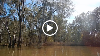
The river is so important to people here that it seems everyone has an opinion or a bit of information they wish to share. Tom, from the yacht club told me how he is editing a book on natural history of the Yarrawonga area and what he has learnt in doing so; about the sand dunes that form on the north western side of bends in the river and how these are millions of years old. Tony from the motel who told me of what it was like in the 93 floods. He is sure of the date because he got engaged the day before over 300,000ML a day as passed through the Yarrawonga weir. This is nothing compared to that he said. There was an older gentlemen who thought the MDBA was to blame for the high river. He had friends who live in Tocumwal who were worried about the high river. He thought that all levels were controlled by people and was angry. He did not realize that most of the current flow at this point of the river comes from two unregulated rivers, the Ovens and the Kiewa. It is easy to blame. It's sometimes difficult to accept that we cannot control everything, let alone the weather. We may have regulated the Murray, but it is still a wild river. It is something to be proud of, but also respected, there are consequences. We can no more stop all floods than we can all droughts. The variation in river height drives river and forest health. River towns and farmers have learnt to live with the risk this presents. It is something to be proud of, not attacking each other about.


Historical records of what Yarrawonga was like before the weir. The weir defines the town, but its history and the memories of the people who live there began long beforehand.

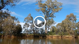
I took these photos from Chinaman's Island, where there is a lovely interpretive walk about lakes environment. The red sky heralds unsettled weather for the next few days. Looks like more jumper days - and in Late October!


Tonight I am enjoying a night in a motel and a meal out. It's been great by the lake but I'm ready to move on. Next stage: 5 days into Echuca. Will be awesome pre-paddling the marathon course. Lots of memories.

Murray River Paddle 2016 Day 5 Collendina Forest (u/s Taylor's Bend) to Yarrawonga Oct 20

Today began with sunrise over the forest. My campsite was wet from dew, so I trampled paths to move on and stay dry. It had been a cold night and my summer sleeping bag managed to keep me warm if I tightened the hood until there was just a hole big enough to see and more or less breathe through. So after a cold night, I stood outside my tent and watched the sun rise over the forest next to me.
I had once again camped on one of the ancient river banks, high above the river. It is a bit like being in a tree house, except with grass. I cooked up a nice hot porridge for warmth and tried to work out how I could carry everything down to my boat in one go to get as little wet as possible. Down below mist rose from the river's surface. It does this when it is warmer than the air. It looked magical.


Once packed I pulled my boat back into the water. I always get wet doing this, so i don't know why I made such a fuss earlier. I guess I just felt clean and wanted to hold onto that for as long as possible. No sooner was I in the water than the current got hold of the boat and turned me into the stream. It was good to be on the way again.


The days paddle started off with the high bank which I had camped on, but with a steep crumbling face and trees on top. Who knew for how much longer. It then passed into the narrow bird filled canoeist's paradise I had paddled the day before. It is pure pleasure to paddle in such a pretty river. I found another camping site which would be suitable for canoeists just after Taylor's Bend. The farm has riparian fencing, like many others in the area, to keep stock off the river banks and help them to regenerate. It is an initiative of the local catchment management authorities and landcare. For paddlers, or fishermen, it leaves room to camp. This bend had a gentle sloping bank and some majestic old gums, but you could go further back to be out of the way of their branches. After about 8 kilometres I reached the main flow. The river was twice as wide and twice as fast.


I was a little confused though. Something didn't make sense. Pulling to the side of the river I realised that according to my map, the river should have been flowing the other way. So much water was passing through the anabranch I had seen the day before that the river had changed direction in this section. I decided to have a go at paddling against the current to try and reach my survey points. After initially attacking it at race speed, I realised that if I use the eddies it was not so difficult after all. It also gave me a good look at the bush - and a workout.

Once at the other end I turned into the original course of the Murray around 'snake island' (sounds like an inviting place to camp), where I experienced a similarly slow and narrow river to earlier in the day. Reeds reached halfway into the river and were so full of reed warblers arguing with each other about who had the nicest voice that I was able to sneak right up on one, before it realised there was a 7 metre red boat with a human in it within arms reach. Suddenly it was no longer so brave and disappeared.


Approaching the Ovens River water levels rose to the top of the banks and spilled over in places. I could see, however that they had been higher. Remarkable how fast the grasses and reeds recover after having been underwater for so long. The closer to the Ovens and Lake Mulwala, the thicker and more frequent the reed beds became. Above me two sea eagles circled causing a ruckus amongst the cockatoos in the trees below them. I began to see swans, one family with signets in tow, the parents trying to hurry them up and keep them swimming in the right direction.


Entering Lake Mulwala via the old river channel, I paddled past an ibis rookery. These don't smell the best, but the sight of so many birds nesting in one place and the way they took off and circled in waves was both music and symmetry. Honestly, I tried not to scare them. Lake Mulwala is full of logs. The recommended path for canoeists is along the southern shore, however you need the eyes of an eagle to spot them. If you go paddling here, be prepared for unexpected jolts. No wonder they want people near the shore. The banks are almost entirely filled by houses, some simple, some grand, each different. The way people interact with water says something about them. Perhaps that is why I used to enjoy walking along the shores of the lakes in Europe. This reminded me of those times.


There are only a few potential camping places that are accessible by canoe on the southern shore. There are two or three boat ramps, where you can pull out, or put in, but the only free ground with a gentle slope are at the furthest south point on the lake. The farmland at this place looked inviting. If I had not prearranged with the Yarrawonga Yacht Club Commodore to camp in their grounds I would have stopped there.

There are advantages to being in the bush. Just as I was trying to get changed, a yoga class who had booked the facilities arrived - lots of laughs (from them), but they let me in, which meant I could take a shower, which was So nice.