Murray River Paddle 2016 Day 6 Yarrawonga Rest Day Oct 21

Yarrawonga rest day today. A chance to catch up with Ruth, meet locals and to go to the library to see what this area of the river used to look like in the early days of settlement.


Transporting my gear around the weir.
Its a long walk so worth calling ahead to the canoe club to see if they might be able to help you out with the portage.

The river is so important to people here that it seems everyone has an opinion or a bit of information they wish to share. Tom, from the yacht club told me how he is editing a book on natural history of the Yarrawonga area and what he has learnt in doing so; about the sand dunes that form on the north western side of bends in the river and how these are millions of years old. Tony from the motel who told me of what it was like in the 93 floods. He is sure of the date because he got engaged the day before over 300,000ML a day as passed through the Yarrawonga weir. This is nothing compared to that he said. There was an older gentlemen who thought the MDBA was to blame for the high river. He had friends who live in Tocumwal who were worried about the high river. He thought that all levels were controlled by people and was angry. He did not realize that most of the current flow at this point of the river comes from two unregulated rivers, the Ovens and the Kiewa. It is easy to blame. It's sometimes difficult to accept that we cannot control everything, let alone the weather. We may have regulated the Murray, but it is still a wild river. It is something to be proud of, but also respected, there are consequences. We can no more stop all floods than we can all droughts. The variation in river height drives river and forest health. River towns and farmers have learnt to live with the risk this presents. It is something to be proud of, not attacking each other about.


Historical records of what Yarrawonga was like before the weir. The weir defines the town, but its history and the memories of the people who live there began long beforehand.

I took these photos from Chinaman's Island, where there is a lovely interpretive walk about lakes environment. The red sky heralds unsettled weather for the next few days. Looks like more jumper days - and in Late October!


Tonight I am enjoying a night in a motel and a meal out. It's been great by the lake but I'm ready to move on. Next stage: 5 days into Echuca. Will be awesome pre-paddling the marathon course. Lots of memories.

Murray River Paddle 2016 Day 5 Collendina Forest (u/s Taylor's Bend) to Yarrawonga Oct 20

Today began with sunrise over the forest. My campsite was wet from dew, so I trampled paths to move on and stay dry. It had been a cold night and my summer sleeping bag managed to keep me warm if I tightened the hood until there was just a hole big enough to see and more or less breathe through. So after a cold night, I stood outside my tent and watched the sun rise over the forest next to me.
I had once again camped on one of the ancient river banks, high above the river. It is a bit like being in a tree house, except with grass. I cooked up a nice hot porridge for warmth and tried to work out how I could carry everything down to my boat in one go to get as little wet as possible. Down below mist rose from the river's surface. It does this when it is warmer than the air. It looked magical.


Once packed I pulled my boat back into the water. I always get wet doing this, so i don't know why I made such a fuss earlier. I guess I just felt clean and wanted to hold onto that for as long as possible. No sooner was I in the water than the current got hold of the boat and turned me into the stream. It was good to be on the way again.


The days paddle started off with the high bank which I had camped on, but with a steep crumbling face and trees on top. Who knew for how much longer. It then passed into the narrow bird filled canoeist's paradise I had paddled the day before. It is pure pleasure to paddle in such a pretty river. I found another camping site which would be suitable for canoeists just after Taylor's Bend. The farm has riparian fencing, like many others in the area, to keep stock off the river banks and help them to regenerate. It is an initiative of the local catchment management authorities and landcare. For paddlers, or fishermen, it leaves room to camp. This bend had a gentle sloping bank and some majestic old gums, but you could go further back to be out of the way of their branches. After about 8 kilometres I reached the main flow. The river was twice as wide and twice as fast.


I was a little confused though. Something didn't make sense. Pulling to the side of the river I realised that according to my map, the river should have been flowing the other way. So much water was passing through the anabranch I had seen the day before that the river had changed direction in this section. I decided to have a go at paddling against the current to try and reach my survey points. After initially attacking it at race speed, I realised that if I use the eddies it was not so difficult after all. It also gave me a good look at the bush - and a workout.

Once at the other end I turned into the original course of the Murray around 'snake island' (sounds like an inviting place to camp), where I experienced a similarly slow and narrow river to earlier in the day. Reeds reached halfway into the river and were so full of reed warblers arguing with each other about who had the nicest voice that I was able to sneak right up on one, before it realised there was a 7 metre red boat with a human in it within arms reach. Suddenly it was no longer so brave and disappeared.


Approaching the Ovens River water levels rose to the top of the banks and spilled over in places. I could see, however that they had been higher. Remarkable how fast the grasses and reeds recover after having been underwater for so long. The closer to the Ovens and Lake Mulwala, the thicker and more frequent the reed beds became. Above me two sea eagles circled causing a ruckus amongst the cockatoos in the trees below them. I began to see swans, one family with signets in tow, the parents trying to hurry them up and keep them swimming in the right direction.


Entering Lake Mulwala via the old river channel, I paddled past an ibis rookery. These don't smell the best, but the sight of so many birds nesting in one place and the way they took off and circled in waves was both music and symmetry. Honestly, I tried not to scare them. Lake Mulwala is full of logs. The recommended path for canoeists is along the southern shore, however you need the eyes of an eagle to spot them. If you go paddling here, be prepared for unexpected jolts. No wonder they want people near the shore. The banks are almost entirely filled by houses, some simple, some grand, each different. The way people interact with water says something about them. Perhaps that is why I used to enjoy walking along the shores of the lakes in Europe. This reminded me of those times.


There are only a few potential camping places that are accessible by canoe on the southern shore. There are two or three boat ramps, where you can pull out, or put in, but the only free ground with a gentle slope are at the furthest south point on the lake. The farmland at this place looked inviting. If I had not prearranged with the Yarrawonga Yacht Club Commodore to camp in their grounds I would have stopped there.

There are advantages to being in the bush. Just as I was trying to get changed, a yoga class who had booked the facilities arrived - lots of laughs (from them), but they let me in, which meant I could take a shower, which was So nice.

Murray River Paddle 2016 Day 4 Eleonora Res Corowa to Collendina Forest u/s Taylors Bend Oct 19

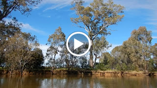
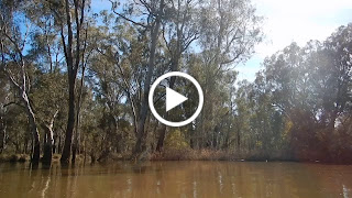
Today I paddled from Eleanora Reserve to just upstream of Taylor's Bend, a distance of 41km. It involved taking 560 photos and 16 videos at predetermined points. By the end of the day I reckon I had seen enough trees. It is a magic stretch of river though, with a feeling of being in the wilderness when really you are not all that far from civilisation.


I loved seeing how people in Corowa enjoy the river. One family had a set of lights, a collection of bar stools and a slab bench, and above all of this, a sign saying "South Bank". There was the tree house made of a pallet, positioned precariously high in a tree and only a knotted rope ladder to get to it. There were house boats of every sort, except big, or professionally built... like they used to be. One, festooned with Australian flags, was called the "Frying Dutchman". Another was little more than rails and a roof supported in a leaning, wobbly way by a collection of plastic drums. Blokes sheds, complete with lawn mowers ready to go, faced the river. There would always be work to do in those sheds. A little downstream I came across "Wirra Wirra". It looked like a family camp, but had three shipping containers, a basketball hoop, a deck and a bocce field, surprisingly soared by the floods that occupied the area up until a week ago.


South Bank

In places parts of the high sandy banks had collapsed, exposing a fresh edge which rainbow bee-eaters found interesting. They nest in burrows in that kind of habitat. Everything has two sides, even erosion creates homes, habitat and diversity. They flew in arching circles, picking insects out of the air. Acrobatic masters, the insects stood no chance. They are also one of the most beautiful of Australia's birds. Look them up if you get a chance.


Further down the river I saw dollar birds, olive green in colour, but with red patches on their heads. They have a odd call, but an even more unusual way of flying. As the flap their wings they bend upwards like a piece of paper. The upward stroke is no better, causing the wings to bend the other way. The end effect is that they look like a creature from one of the original Mickey Mouse cartoons, where everything seems to be made of rubber. How they stay in the air I don't know.

There were some beautifully situated stations, always high above the floods. Families who have been here generations. Often all you see is a pump stand, or a shed and chairs marking the place to go on hot evenings. One of these tanks was high in an old dead tree. People don't put tanks on stands anymore, they use pressure pumps - but my guess is this one is not coming down.


I've noticed that tree health seems to sometimes be worse around towns and campsites. Often these are areas without development. They just happen to be nearby. The older trees in particular seem to be affected. Their branches die back and their crowns thin. They look like they are suffering from the effects of drought. Many of the trees that fall in the river were in that kind of condition, or look like they did not have many roots at all. I wonder if they are experiencing a form of root rot, either through direct contact (infected soil), or because something has reduced their ability to fight the naturally occurring ones. It's usually the older trees that show these symptoms, and this is also true for root rot. It's a puzzle. I'll keep looking and see if this pattern is consistent along the river.

With those few exceptions the forest are in excellent health. There is real diversity of age groups within the forest and everywhere regrow. The only thing that would help the trees develop to their full potential would be if they had more room. In changing over from a forest managed for its timber to one managed for tourism and biodiversity, we seem to have forgotten that what we are hoping to achieve takes nature hundreds and hundreds of years. If we want the forests with majestic gums, we might just have to help it a little. There are quite a few local foresters out there who could lend a hand, and at the same time it would represent an opportunity to learn from generations of experience.


In this confined section of the Murray, anabranches are common, some are little more than short cuts, but there were some significant ones today that seemed to rob the river of its flow. In particular the anabranch that leaves the river after Black Dog Creek. Cutting off at least 4 kilometres, its steeper gradient almost sent the rest of river backwards. Since I'm surveying the main channel, I avoided it (but unless you have local knowledge this is generally a good idea). The river changed almost instantly. With less flow, reeds and rushes colonised the edges of the river, narrowing it down to 20 metres in places (instead of the usual 80 - 100 metres around here). Bird life was closer. Everything was closer. Erosion was less, but it did not seem to stop the trees from falling. In one place two trees almost closed off the river. It is as pretty as the narrows, where the Murray flows between Barmah and Millewa Lakes, but is more gentle.


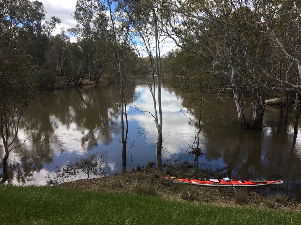
I made camp in a similarly high bank to the one I camped in last night. I found a place with enough of a ledge to pull my boat up onto and high enough to keep out of trouble should the river rise. The camp was worth the climb. Like last night, their was soft green grass on top and again, great views. I'll try and include some photos, though reception is pretty restricted out here.


Tomorrow I make for the edge if Lake Mulwala, before a crossing the next day.

Murray River Paddle 2016 Day 3 Howlong Common to Corowa Oct 18

The people of Howlong lead blessed lives. It is a quiet little town on the road to Corowa from Albury. I have the impression that more people pass through Howlong, than stop there and at least some of the locals prefer it that way. They have their patch of paradise, perched on the edge of the ancient high banks of a river that formed before humankind began to make its mark on the world. Below them the Murray snakes through forests and woodlands. It rises and falls in yearly rhythm, not interrupted by politics, war, or other things that happen on the telly. Howlong is a fisherman’s paradise. Most people have a tinny in the driveway. It does have a modest caravan park; not too big lest it attract a crowd. When the crowd still comes (to the relief of local business, I’m sure) the fishermen can retreat to Black Swan Anabranch, its their secret river. Howlong has two commons, Fig Tree Common and the Howlong Common. The first is a designated camping site, but you have to get through a fence first and it feels like private property. It is also not connected with the river as suggested on the Access Map of the area. for this reason I camped on the later.


Ancient Redgum on Howlong Common, where the traditional grazing of river flats by cattle still takes place.

I should have guessed that the area of land between the Murray and its anabranch would be full of billabongs. It was wet from the recent high river and teeming with insects. Midges that look like mosquitoes on protein powder skated across the water surface like dandelion seeds in the wind. Thankfully they did not bite and even the mosses did not bother me that much. What the common did have was the most majestic old river red gums, hundreds of years old, perfectly adapted to their environment. Each a survivor of changes we can only dream of. Normally I get excited when I find one of these trees in the forest, or along the rivers edge. The common is full of them. It is also full of cows - normally - their footprints were everywhere.

Leaving Howlong I entered into the forest again. My third day with no-one else on the river since Albury. At the Hume people had been keen to fish. In Albury some people even sunbathed on the banks. People went for walks. Since then silence. Nothing but the bird call and a sign: “Please don’t shoot our cats, they are our pets!”

Midges blanket the supports of a river camp.


Today was squally weather. As each group of clouds rolled in, dark and threatening, alarm cries rang through the forest. Cockies screeched. Then the wind would come, warning of the rain that followed and finally the rain. When it does rain on the river it is a relief, the wind decreases and the drops make individual splashes on the water. their circles, initially distinct, intersect and are lost in complexity when the downpour begins, blurring the line between air and water. The water seems to be jumping. In my boat I am well protected, spray deck, jacket and multiple warm layers beneath. I am enjoying being in the rain, like a kid with a new pair of gum boots. Water droplets collect on my camera lens, but I am able to splash them off. Thank God for waterproof cameras. After the rain the air is clear and the colours more crisp. The leaves of the red gums appear more green and their bark more colourful. The river has a tropical feel.

Wooden posts placed to reduce erosion of the river banks - no match for the river's currents.

The banks of the ancient river seem to come closer together as the day goes on. In Corowa they form a bottle-neck for the river, backing it up from the town’s original, the narrowest point. 20 kilometres from Howlong the river is beginning to spill over into its floodplain. There are a myriad of streams, minor cuttings where the river takes a short cut. They sound like little water walls. Larger ones are marked with warning signs and buoys, but they are all best avoided lest you become part of the log jams that inevitably hide within them.

River Gold.


In this flooded landscape I found a piece of paradise: River Gold. Just the I needed a break it was there. A real men's den. A fishing hut with style, even old sofas - though they had seen better days. The hut itself was more of an open shed. It had a slab table, a sink for cleaning fish, no drain, just the sink, more tables, chairs and three big bottles of bleach. Fixed to one of the supporting beams was an angled steel pipe with a hook on the end for hanging fish. Just down from the hut was a sign “Ron’s corner”, in memory of a departed mate. Downstream was its earlier cousin, a weatherboard hut of the same name, but now starting to fall apart.


Camp at Eleanora Reserve, near Corowa, at the top of the banks of an ancient and much broader Murray River within which the current river meanders.

I kept paddling through alternating forest and farming landscape until I reached my camp, a picturesque public fishing reserve named “Eleanora”. To get to it you have to paddle through the trees for a short way and then climb the bank to pitch your tent, but the views are worth it. The ancient river bank I’m camped on is that high I can look out into the tree canopy from my tent. Yellow gums grow on the slope down to the river and wildflowers all over the top. Its the closest thing to a meadow I have seen outside of the high country. The camp is also tree safe, which, given the wind and the number of trees that have fallen over recently, is a good thing.


Sun is forecast for the next few days. It will make a nice change. Should make for some good photos too. I wonder what the river will do below Corowa, whether its character changes, or it remains the same. Not long until the Ovens joins, and then there is Lake Mulwala.