Day 8: 1412 to 1325 km to the sea: Swan Hill to Tooleybuc


Day 8: Sunday 25/11 
Swan Hill to Tooleybuc 
River markers: 1412 to 1325 km from the sea
Distance travelled today:  87 km.
Total distance travelled:  387 km.


Leaving Swan Hill. 7:20am. 39 deg predicted.
A quiet river. No sign of anyone, but the fishermen - and even they are still sleeping.

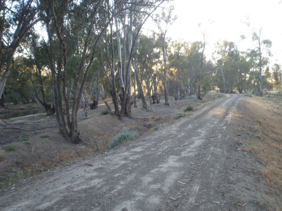
Still water catches the reflections of the thin line of river red gums along the banks. According to a paddlesteamer captain friend of mine, well versed in the history of the river, these gums were planted alongside the river for fuel. he says that there were no river red gums along the river in the early days. Does this mean it was mallee?

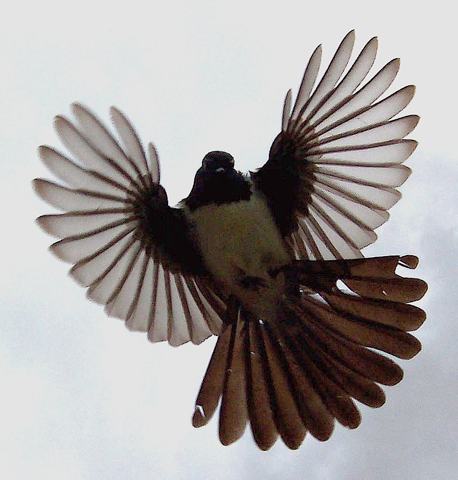
I love it when big flocks of corellas screech along the river - quintessentially Australian. 


River landscape. In this stretch of river downstream of Swan Hill, there were no river red gums until farmers built levees either side of the river. (Thanks to Peter Garfield for this info). This is why they all seem so young and only a few trees deep.
This was a very good day where I put in a massive effort to catch up on my schedule and make use of the good currents downstream of Swan Hill. Despite the one and half rest days in Swan Hill, I am no more than 13 km behind what I hoped to be at this stage of the journey.

Downstream of Swan Hill there are levee banks either side of the river and it is only since these have been put in that the river red gums grow there. This is why they seem so young and are only a few trees deep in most places. 

Another anabranch of the Murray. This time around Tiper Islsnd 22 km downstream of Swan Hill. I am taking the anabranch because I am interested in an old ferry that Still operates over the 'little Murray'.

Curious cows.


I took a couple of anabranches today, the first was behind Beveridge Island and the second was a much younger river cutting behind Murphy's Island. I can really recommend the first and caution strongly about the second. Murphy's island anabranch saves 4 kilometres. That in itself is usually enough to decide in its favour, but my river charts showed an old private car ferry and a collection of wrecked cars. Only now, two days later am I wondering if there might be a connection. It did not take long to get to the historic ferry. Despite the river charts indicating that it was active in 2002, it looked more historic than active now. The recent floods had snapped the cable and covered it with debris. I think it was the only way to get a vehicle onto Beveridge Island. Further down the anabranch were the most extraordinary collection - that is the only thing I can call it - of old cars. They had been pushed over the edge of the river bank when they were no longer needed and now were being absorbed into the bank of the river itself. It almost looked like they were holding the river bank together. Each was piled on the last, as if badly parked. You would almost expect someone to climb out and say, "damn!". It actually looked like something you could pay money to see in a gallery. This pile of rubbish looked wonderful.
Rusted car wrecks becoming part of the river bank. Beveridge Island cutting.


Beveridge Island cutting. Ferry sign.

Ruined in the years of high water between 2010 and 2013 Breveridge Island ferry has seen better days.
Ageing. The Shallimar. Breveridge Island cutting.
The Iron Dry. In better shape. Breveridge Island cutting.
Nyah bridge. Built 1941.

Historic Speewa Island Ferry. This one works! Cables run from one side of the river to the other. it is best to wait until the ferry is docked and then cross in the middle of the river. Ferries are more common than bridges lower down on the river, but it was a real novelty coming across this one. It was so beautifully kept I felt like I was in a toy set.
The second anabranch was a highlight of the day, but also an adrenalin shock. Whenever I am about to navigate something I am unsure of I try and approach as slowly as possible and yet still give myself time to accelerate away from trouble. I wanted to see if enough current was flowing through the cutting to suggest that it went all the way through and would not just end up in a net of snags. The river seemed to love going that way. It looked like it would be the new course in a few years. I decided to take it. The current was so strong that there were little pressure waves leading into the cutting. Maybe I was tired, or maybe just cocky, because I had passed over every other reef so far - but I got stuck in this one. Not good in such a strong current, however with a few surfboard moves I was off. The current would have been running at 10 to 15 km/hr. You would not think our old Murray could do this. I was amongst little rapids, dogging snags in slalom like moves. Fun as! Not to be taken lightly though, you would not want to be washed up against one of the snags, you might never get your boat, or yourself off them again. Water pressure is a very dangerous and often underestimated thing. Anyway, first shock out of the way, I chose my passages correctly and sprinted to gain and keep the right passage. It was a buzz, but a relief to be in the main channel a few hundred meters later. What the cutting did show was that the fall in the river is significant over 4 kilometres here (which is the distance I saved). Just guessing, but I think the cutting would have gone down at least a meter and while they might not sound much, try holding a river back when there is a drop like that. Ain't going to happen.


I took the cutting behind Murphy's Island. Adrenelin rush! A combination of reefs, heaps of snags and rapids like current make this one to avoided if you do not know your way around. Best if a local show you, but I would class it as too dangerous and best avoided.


The day was a hot one (39 degrees celsius). I tried various ways of keeping cool. First I splashed water onto my marathon hat, but finding this a little too ineffective, decided to try wetting the face washer I carry with me and placing that on my head. I like looking a bit ridiculous at times and this fitted that criteria, but a strong gust of wind blew it off and I was lucky to catch it, so I put it away. Finally I used the sponge I keep in my cockpit. This is a big sponge and it sent a serious flow of cold water down my back, sending a shiver down my spine - but very refreshing. Problem solved!

Keeping cool in the heat # 1: it wasn't a very good idea the face washer almost blew away in the first big gust of wind, so I reverted to a whole sponge full of water... Cold! Respect to everyone who paddled and land crewed in the marathon where we had 52 degrees.
Massive pumps near Tooleybuc.

Major Mitchell camped here in June 1836.

Holding on!

Nearing the end of the day, I passed one of the spots that Major Mitchell was known to camp at. It was tempting to pull in there as the spot looked good, but I continued and eventually found a beautiful beach campsite. I like beach camping because I can pull the boat up close to camp and don't have to carry things far. I can also use it as a seat and larder whilst I am cooking. The sand is great for cleaning gear - better than steel soap pads, it is easy to get fresh water for cooking and you can go for a dip to freshen up after the paddle.


Tooleybuc campsite. Loving it. Massive day today. Paddled 87km and now despite one and a half rest days in Swan Hill, am only 13 km behind schedule. This day is the beginning of the long haul to Mildura (500km).


More from this expedition:

  • Google+  Murray River Paddle Echuca To The Sea Photo Album
  • Facebook Murray River Paddle
  • YouTube Murray River Paddle


More information about topics from this page:
  1. Wikipedia:  TooleybucList of crossings on the Murray, Major Mitchell
  2. Discover the Murray: Tooleybuc
  3. Wakool Shire Council: Historic Speewa Ferry
  4. Major Mitchell Trail: Piangil, Expedition notes
  5. Sedimentary Geology: River Processes
  6. River geomorphology: videos
  7. RTA: Self guided driving tour: Bridges between Albury and Swan Hill
  8. P.S. Adelaide: Echuca - Mildura - Echuca for P.S. Melbourne centenary celebrations BlogFacebook
  9. Barry and Maureen Wright's River Murray Charts
  10. Environment Victoria: The Living Murray 
  11. ABC Mildura Swan Hill: News and Community Events


Day 7: 1412 km to the sea: Rest day in Swan Hill.


Day 7: Saturday 24/11 
Rest day in Swan Hill 
River marker: 1412 km to the sea.
Distance travelled today: 0 km
Total distance travelled: 300 km.


Visit from Ruth, shopping, charging devices, R&R.

PS Pyap.


More from this expedition:

  • Google+  Murray River Paddle Echuca To The Sea Photo Album
  • Facebook Murray River Paddle
  • YouTube Murray River Paddle


More information about topics from this page:
  1. Wikipedia:  Pental IslandLoddon RiverLittle MurrayAnabranchSwan HillList of crossings on the Murray
  2. Swan Hill Rural City Council: Visitors to Swan Hill
  3. Discover the Murray: Swan Hill
  4. Swan Hill Genealogical and Historical Soc: A history of paddlesteamers at Swan Hill
  5. Reilly: An experimental voyage: Lady Augusta's passage through SA in 1853. 1995.
  6. Swan Hill Pioneer Settlement
  7. RTA: Self guided driving tour: Bridges between Albury and Swan Hill
  8. An account of the race between the Mary-Anne and the Lady Augusta to Swan Hill in 1853.
  9. Sydney Morning Herald 1869: Pental Island: another boundary dispute
  10. GeoScience Australia: State and Territory Borders
  11. YMCA: Murray Marathon
  12. P.S. Adelaide: Echuca - Mildura - Echuca for P.S. Melbourne centenary celebrations BlogFacebook
  13. Barry and Maureen Wright's River Murray Charts
  14. Environment Victoria: The Living Murray 
  15. ABC Mildura Swan Hill: News and Community Events

Day 6: 1435 to 1412 km to the sea: Pental Island - Swan Hill


Day 6: Friday 23/11
Pental Island - Swan Hill
River markers: 1435 to 1412 km to the sea
Distance travelled today:  23 km
Total distance travelled: 300 km.


All scrubbed up and ready for civilisation at Swan Hill.


My campsite last night was on Pental Island. A parcel of rich farming land which was fought over by Victoria and New South Wales because an anabranch of the Murray runs around it. Since the Murray River forms the border between New South Wales and Victoria, New South Wales argued that their water flows to the South of it, so it was theirs. Victoria argued that more water flowed to the North of it and won the case. It must have been one of the first decisions about state borders that the young parliament made. Anyone know more about it?


The land was fertile because it is a floodplain. With each flood a new layer of fertile river mud was dropped on the soil and salinity flushed away. Looking over the levees that protect the farmers from the floods they still seem to be. I wonder why they made the levees around their whole farms and not just their homes. It would have been why've investment. Was it to protect the infrastructure (fences and irrigation channels) or so that they could farm uninterrupted year round, or something else?

Some of Pental Island is still forested and stock are allowed to graze there. I passed a farmer and his dog rounding up cattle. He was on his motor bike beeping his horn and dog running around making sure the cattle were moving in the right direction. The little motorbike horn can only have been annoying. They can only have feared the dog. Yet I heard it for kilometres, meep, meep, meep-meep. I had to laugh. If I was a cow I would not want to move out of the forest either. I passed several groups of very contented cattle lazing on the river bank. It is a pretty good life for them for a while.


The Loddon River flows into the Murray via this anabranch. I wonder if the levees or the small size of the little Murray (or the Marrador as it is also known), the flatness of the land between here and Barham, or a combination of all three made it so difficult for the Loddon flood waters to drain away. Many homes were surrounded by floodwaters for close to a year. Obviously this is a debate that will continue as long as people live in flood plains. It is not the water's fault. It just wants to get to the sea. Just like me.


It is amazing what sticks in your mind about the river. The last time I paddled this stretch was when I did the Murray Marathon in TK2 with my mate Mark, aka Sharky, We did the full 400 kilometres distance twice, once in 1980 and again in 1981. We gunned it. As 16 & 17 year old we kept up with the Air Force, who had pretty good teams back then. They used to race in formation, like a group of fighter planes and were remarkably disciplined. As I came into Swan Hill 31 years later I could still remember the bends, especially the last ones.


Not as fast now :)


Current is swift, except for when it pools, but you always get that. My favourite birds at the moment are the native hens. When they walk they have their tails up and turned sideways like a flag. They move through the shadows of the shoreline undergrowth in mobs, not in pairs like the ones Nat Echuca. When they are startled, they prefer to run, but if the ducks around them get nervous then they fly low over the water to a safer place. They fly very well, but look rather tasty, bit like partridges - hence the danger for them :)


black tailed moorhen running for cover

I rested under the shade of this majestic red gum. I wasn't the only one; its limbs were full of birds.

Happy cows grazing in forest land. If I was a cow, I would want to live here. :)


Prepared for every eventuality. Caravan to drive away should the river rise rapidly, houseboat as lifeboat and home for the times in between.

Also saw a wedge tailed eagle yesterday, being chased by two tree creepers. 
Brown tree creeper - tougher than it looks.

Wedge tailed eagle - misunderstood?

The toughest birds though are the willy wagtails. They are so proud when they scare away crows who come too near their nest and there is always one parading on lookout.


willy wag tail looking impressive

willy wag tail - even more impressive
This morning I saw three different types of swallows in one bend of the river.


welcome swallow
tree martin

High up in the trees and soaring at the level of the canopy were what looked like wood swallows, but they had orange chests, a black head and a white crown.


White browed wood swallow


Flying around me, as if curious, but more likely interested in the insects I stirred up by my passage, were my old friends the welcome swallow. The type we have in Echuca.. Also, flying low over the water were smaller white and black swallows. Beautiful! 


welcome swallows


More from this expedition:

  • Google+  Murray River Paddle Echuca To The Sea Photo Album
  • Facebook Murray River Paddle
  • YouTube Murray River Paddle


More information about topics from this page:
  1. Wikipedia:  Pental IslandLoddon RiverLittle MurrayAnabranch, Swan HillList of crossings on the Murray
  2. Swan Hill Rural City Council: Visitors to Swan Hill
  3. Discover the Murray: Swan Hill
  4. Swan Hill Pioneer Settlement
  5. RTA: Self guided driving tour: Bridges between Albury and Swan Hill
  6. An account of the race between the Mary-Anne and the Lady Augusta to Swan Hill in 1853.
  7. Sydney Morning Herald 1869: Pental Island: another boundary dispute
  8. GeoScience Australia: State and Territory Borders
  9. YMCA: Murray Marathon
  10. P.S. Adelaide: Echuca - Mildura - Echuca for P.S. Melbourne centenary celebrations BlogFacebook
  11. Barry and Maureen Wright's River Murray Charts
  12. Environment Victoria: The Living Murray 
  13. ABC Mildura Swan Hill: News and Community Events