Murray River Paddle 2016 Day 19 (& 20) Benjeroop - Swan Hill & Rest Day

Campsite on a levee: one of the few river side spots above the flood waters.
Today the weather was perfect for paddling. I awoke early to get a good start and to be up before the mossies. It had been a cold night, too cold for them to be able to fly. I had had a broken nights sleep, dreams of being surrounded by flood waters, mixtures of fact and imagination. Amongst this miasma of semi-consciousness I heard the most unusual sound. Something was approaching the tent. Although things sound bigger at night this did not sound threatening. I couldn’t make it out; heavy breathing and shuffling. It brushed against the tent several times. I thought it might be a possum after my food and tapped against the tent wall to discourage its presence, but to no avail. It wasn’t until I saw a set of spines between the inner and outer tent that I realised what it was, an echidna. It was treating my tent like a log and pushing under it with its long nose, scooping up insect that had sheltered there. It did the same to my boat, knocking my paddle noisy about in the process. On the river a mist was rising, giving it a tropical look. The birds had begun their chorus, some way before dawn, but although I was in an agricultural area, there were still no sounds of man. Breaky was going to be on the water today. If I could get on the water soon I could capture some of that light. By the time I launched they were stirring.


Snake swimming across the river


Benjeroop: morning light. The town's newsletter calls the area 'A little patch of paradise where the waters meet' , however in the summer of 2011 things were not so rosey. Benjeroop was inundated for over a month when floodwaters from the combined high flows of the Loddon and Murray Rivers breached the towns levees in 13 places. The sixty families living there have worked hard to support each other and for the community to recover. In the wake of the floods Prince William visited the community recognising their efforts and bringing attention to their plight.

Benjaroop
Morning light in Cobramunga.

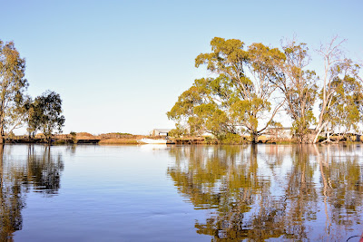
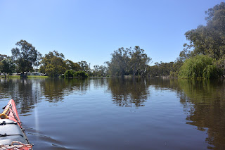
The mist had lifted, but the trees and rural landscape in the morning light was stunning. They appear so crisp and clear, and in the golden light of early morning it is as if everything is born anew. I drifted a lot, taking it in. Slowly the sounds of work life on the farms began. Early morning jobs. Irrigation has begun, but it was still too early for the pumps. I heard the sounds of machinery being prepared, chicken being fed. The cars starting that would be used to drive kids to school buses. Country kids and their parents have to get up early. On the farms canola is beginning to be harvested, the first hay cut and firebreaks maintained. From the water I get a different perspective. I see the danger and the opportunities the river provides its communities, how they protect themselves from flood, how water is used for the crops and for leisure, I see the first attempts at settlement and the latest and the machinery from everything in between. It is an open book, full of people’s life stories.


Overhanging branches

Old pump house, slowly collapsing into the river. — in Mellool.
One of the more remarkable pump boilers along the river. Why was it encased in brickwork and an iron frame?
Fairly early in the day, I came across an old steam pump. One of the most interesting on the river. Now with the high water, i was able to get close. It was encased in a framework of brick and had heavy iron bracing. Was this meant to stop it exploding if pushed beyond its limits? Now it sits, overtaken by bush as a symbol of the ingenuity and creativity of those times. Times before weirs, when boilers came by ship from England and farmers became experts through trial and error. When the bush was to be tamed, trees were to cut down and outposts of western civilisation created. The canary island palms and pepper trees scattered through the bush are also a testament to this thinking. Long after all traces of buildings are gone, their presence can be a hint to where farms used to be.

Suggestion not to use sailing boats on the Murray River.


Kayaking amongst water ribbon on low lying land near Fish Point Rd. Mellool, NSW. Water ribbon breaks its dormancy when the soil is saturated, its long ribbon like leaves grow up towards the water's surface and then float on top of it, providing protection for young fish and other small water life. These kind of wetlands are also found in billabongs which regularly dry out and the flood runners that link them. They play an important role in maintaining the diversity and health of river ecosystems, but seeing them grow like this has become a rare thing since river regulation. 1452 km mark.


The river is narrow here. It forms what paddle steamer captains used to call ‘the cutting’. Stretching from Barmah to Swan Hill, it circumnavigates the uplifted block of land know as the Cadell Tilt. In a series of earthquakes that lasted over 50,000 years the path of the Murray was blocked, causing it to first flow northward and later south. Both paths exist today, this one and the Edwards-Wakool system in the North. They rejoin at the Wakool junction near Boundary Bend. This southern course of our mighty river is the youngest in the whole system, it may have happened as recently as 800 years ago, or perhaps 10,000. It is still the subject of research. From Echuca onward, the Murray flows through the ancestral Goulburn. In parts of this section, it looks as if that original channel have not changed. Its twisting narrow course is bounded by ancient trees on both sides. They lean into the river, covering up to half of its width, extraordinarily resilient and a wealth of habitat for all that lives here. A cockatoo lets me know that I am trespassing by screaming into its nest. This may have increased the loudness of his call, but what would it be like for its partner sitting on the eggs in there I wonder?


Fallen timber and cut logs from forestry and wood cutting stuck amongst the regrowth along the river's edge. This happens when over bank flows pick up old dry timber lying in the forest and redistribute it, or when water from the river channel flows straight through the forest, rather than along the river channel. in both cases logs get caught on trees.

Murray Downs Homestead

Murray Downs Homestead
As I neared Swan Hill the rich riparian forests began to become thinner and more degraded. Some farmers only have a single layer of trees along the water’s edge. when these fall in there will be nothing to replace them. Others have removed them altogether. In some places where cattle have been allowed down to the water’s edge the ground is often bare and weeds form the only understory. Whereas in the resilient part of the river with the old trees and multi-age forest there had been no erosion, here the rich red of mallee soil was visibly crumbling. Not as bad as in other sections, but the contrast was interesting.

One row of trees: not enough.

In the distance I could hear the sound of traffic. In Swan Hill I would catch up with my wife Ruth and do some organising for the rest of the trip. I am looking forward to that.


Murray river Paddle 2016 Day 18 Barham - Benjaroop

Barham - Benjaroop 55km


I am camped opposite checkpoint alpha on day 5 of the Murray Marathon. Usually it is a nice little beach, but today it is in the form of its alter ego - a wetland. All around the bush is buzzing. The air is rich with the sounds of insects, frogs and calling birds. In the afternoon, as the mosquitoes get bolder, swallows swoop low over the water, picking up mosquitoes and other tasty morsels. They certainly are welcome to their weight in mossies every day and all the hollow trees I can muster to breed freely. I was going to camp at Alpha for nostalgia’s sake, but rain water has filled the wheel ruts in the tracks on the other side of the levee and grass was over a metre high. So, I paddled across the other side of the river and am camped on a nice broad levee bank. So long as the farmer doesn’t want to drive his ute along here, or a herd of cattle decide this is the way they want to travel, then I’m set. There is a huge old boiler discarded behind the levee. My guess is that it was used to drive irrigation pumps, before the advent of the small and more efficient combustion engine which has taken its place. In the riparian fringe of flooded red gums honeyeaters bounce off the water’s surface and then settle on a branch to complete their toilet. A fish came in and snapped at something before disappearing. Cockatoos are trying to dominate the evening chorus. It seems chaotic tonight. Perhaps that is because I’m on the edge between forest and agricultural land - or perhaps it really is the cockatoo’s fault.

Today’s paddle began in the forest. More correctly, it began in a forest town. The dominant sound in Barham is of the Arbuthnot Sawmills. The whine of the saw blade and the growling of the busy front end loader that rushes around feeding it. The saw mill is the last operating red gum saw mill on the Murray. There is more demand than they can fill. The mill cuts timber from the ecological thinning projects under trial in some of the river red gum forests. Should the removal of crowded saplings and trees be successful in promoting the regeneration of the forest, as is hoped, then they might soon more timber available. Our red gum national parks are dominated by one age group, reflecting the last timber harvest. Forestry workers have the tools and the experience to be able to reinstate that diversity. It is a change from what used to be done, but it is the road to sustainable local industry. Hopefully this cooperation between parks and industry will spread and we will see more local sawmills reopen along the Murray.

Out of the buzz and under the bridge. With one and a half metres clearance I made it easily. Larger boats need to give 48 hours notice for the central span to be raised. It wasn’t necessary for me. Once past the waterfront houses with their barbie boats, canoes and tarzan swings I was in the forest again. Unlike upstream of Barham, the water soon reached the top of the natural levees and was slowly spilling into the forest. There were the usual runners, but it was spilling everywhere. It was easy to imagine how these levees grew. With such thick grass growth, the water would slow and drop its sediment before continuing. It was 40 kilometres between Barham and Murrabit, most of it forest, and most of it under water. it was not as threatening as the Barmah Forest however, I could have stood up on the flooded banks had I wanted to. About 10 kilometres before Murrabit I heard tractors working the fields, I also saw the first pump irrigating crops. No shortage of water this year. Last time I paddled here it was low river. Today i could see the old farm houses with their beautiful rose gardens. I could paddle right up to the huge old shearing shed before Gonn Crossing and I almost could have paddled into the front yard of the house where day 5 of the marathon starts. Like so many other farmers, they had a tinny tied as close to the house as possible. In this case it was the garden gate.

I called into the Murrabit launching ramp for a break - first time out of the boat in 5 hours! It was good to stretch the legs. I was also curious to see how this would be for the start of day 5 in the marathon. All was good. Inadvertently I pulled up next to sign explaining navigation hazards on the Murray. It looked like I was one of them. Pulling into shore gave me a chance to look beyond the reeds, rushes and sedges along the waters edge. In the backwaters, water ribbon were growing after years of dormancy. Amazing how plants like these survive the many dry years.

After forest being the dominant form of bank vegetation for my first 700km I was enjoying the agricultural flavour. I had a look at the old pump houses, some of them clearly built to house steam engines, and tried to imagine what it would have been like in those times. I saw a settlers hut, falling apart now, but somehow survived the ravage of the years with its tin chimney. I passed by the site of the old Gonn crossing. In the distance you can see a wattle and daub building, now a ruin. Proud stations on either side of the river may have determined the punt’s location. Stations and farm houses often have all sorts of old interesting things lying around - but one of them had what looked like an old DC3 passenger airplane and a sizeable chunk of the fuselage of a world war two transport plane, shrapnel holes and all. It looks like both projects were a bit ambitious.

As usual, once out of town, the river was quiet. It is a work day, perhaps things will change as I approach Swan Hill, tomorrow’s destination. The river has dropped here, but only just. I wonder what it will be like at Swan Hill.

The new wharf at Barham Koondrook. Due to be opened Nov 2016.
Rural landscape
Rural landscape
Row of old trees along the river bank.

A ruin at the site of the former Murrabit River Crossing.

This camp although inundated was still occupied by its owner.
Some farmers have rescued kilometer signs from fallen trees and placed them on their sheds.
Approaching Barham Bridge.
Passing under Barham Bridge

I know that farmers have a name for collecting things, but I was surprised to see a DC3 and a war plane wreck in the forest.
Shearing Shed
Shearing shed, pump and tinny.

Murrabit bridge. 1.5m clearance.
Water ribbon colonising backwaters behind the levees.
Navigational hazards... had I become one?
Old pump house.
Every farmer needs their tinny.
Old tree with hollow base.
Cattle grazing in the forest.

River landscape.
Flooded forest on river's edge
Rushes thriving on the natural levees between Murrabit and Barham.
Wild roses.
Quiet time


Levee bank at checkpoint alpha, day 5 Murray marathon.
Dry land was hard to find today. A levee will have to do.

Levee banks are the only high spots in places. This was wide enough to camp on comfortably.
Ready made washing line.
Boiler near my campsite on the levee.
Massive boilers which were used to drive irrigation pumps before the internal combustion engine.

Sunset from my tent on top of the levee between Murrabit and Swan Hill.


Murray River Paddle 2016 Day 17 Gunbower Perricootta Koondrook Forest to Barham


Gunbower Perricoota Koondrook Forest - Barham 73 km


My campsite at Stanton Break, about 30km into the Gunbower Perricootta Koondrook Forest.


The Murray is full of surprises. This is a distributary (a stream which leaves a river, spreading the flow over the floodplain) next to my camp. It kept my area mossie free and provided beautiful, fresh, easy to access, flowing water for cooking and cleaning. The only thing I had to watch out for was that on launching I would not get washed into the forest instead of heading down the river.

Up with the sparrows and ready to go. Mornings are beautiful on the river.

I got up early this morning, not long after I heard a big roo bound through my camp. It was impossible for it to do this quietly, as it had to hop through the little streams that surrounded my tent first. The morning chorus was wonderful, as it has been every day in the forest, however, today the bird call continued the whole day with none of the usual pauses. Perhaps it has something to do with the floods and the abundance of food this has brought.

The Gunbower Perricoota Koondrook Forest (GPK) is quite different to its cousin, the Barmah Millewa Forest. Although both are river red gum forests adapted to flooding, the Barmah choke restricts water flow, turning the area into one huge lake. I was worried about the townships of Barham and Koondrook having the same effect. It is over 100km from Torrumbarry weir to Barham. 100km without landfall is too much. Without advice and encouragement from locals I would have called this section off. There are natural levees which run throughout the forest, making it possible to get out almost anywhere and plenty of camping opportunities. I'm glad I paddled this section. Not only will my study of the condition of river red gums be complete for the length of the river, but it was really beautiful.

The reason why the river is so much higher than the forest is not just due to the levees. When Australia had an inland sea, this was where the Murray entered it, building its own delta, much like the Coorong is today. Trapped within its levees the river continues to run along high ground, with anabranches like the Gunbower Creek and Thule Creek feeding the lower parts of the forest before returning to the river lower down. Fascinating.

Near Burkes Bridge, Gunbower-Perricootta-Koondrook Forest


For most of the day I saw no-one. It's a quiet stretch - another thing to recommend it. However, about 20km out from Barham I came across a four wheel drive. My first thought was that it had been abandoned. I've seen a few abandoned vehicles and vans, when people didn't manage to get them out in time, or were surprised by the rising water. However this one was not deserted. I called out its resident, asking whether he had taken the river road (it follows high ground). He let me know that he had been there 'for some time' after having become 'inundated'. He didn't want help, or me to let anyone know he was ok, so I left him to his fishing. At least he would not lack for water. I hope he had plenty of repellent.

In the Murray Marathon (aka Massive Murray Paddle) the section from Murrabit to Swan Hill is famous for swirls and whirlpools that can turn a boat. This section is just the same, the current swells and whirlpools have to be seen to be believed. I am not sure what causes them, but they are on almost every corner.

The forest is clearly worked. Most trees are tall and straight (encouraged that way because they are more valuable as saw logs). Old trees were rare. In a natural forest these will be scattered throughout and particular along old water courses. In worked forests they tend to be along the banks, however here they have been removed for some reason.

Another surprise was how big an effect the millennium drought has had. In higher areas, trees are still recovering. It might still take another 10 years before the forest reaches full health again - assuming it has access to water in that time.

As I near Barham, farms began to appear, then fishing shacks, then houses. Going off the number of picnic tables, bush furniture and Tarzan swings, the people who live here really love their river.

I pulled into Barham Lakes Caravan Park because it had units right down at the water’s edge (and it was the first one I came to). Park manager Helen said "The forest protects the town, it always floods the forest first. You know, the river is actually higher than it was in 2011".

Tomorrow I make for Morton Lane, a high spot near Benjeroop, halfway between here and Swan Hill.

I paddled past a big floating log today. I hope I've gone far enough that it does not pass me while I sleep. The river never stops.

Calm reflection.

Park hut.

Brad's Bend.

Bush carpentry.

Paterson's curse? The bees love it.

Ring barking. One reason why there aren't many old trees on the banks along this stretch of the river.

Wildflowers along the river bank.

River landscape.

Forestry often provide firewood. Kind.

Loo with a view. It has also been used for target practise - hopefully not at the same time.

Reflections.

Fishing shack. Weekend glimpse of paradise.