A journal of canoe expeditions along the rivers of Australia's Murray Darling Basin using photographs, stories and information to highlight the beauty, challenges and history of these rivers and the communities they flow through.
Day 27: 302 to 274 km to the sea: Pelican Point - Blanchetown.
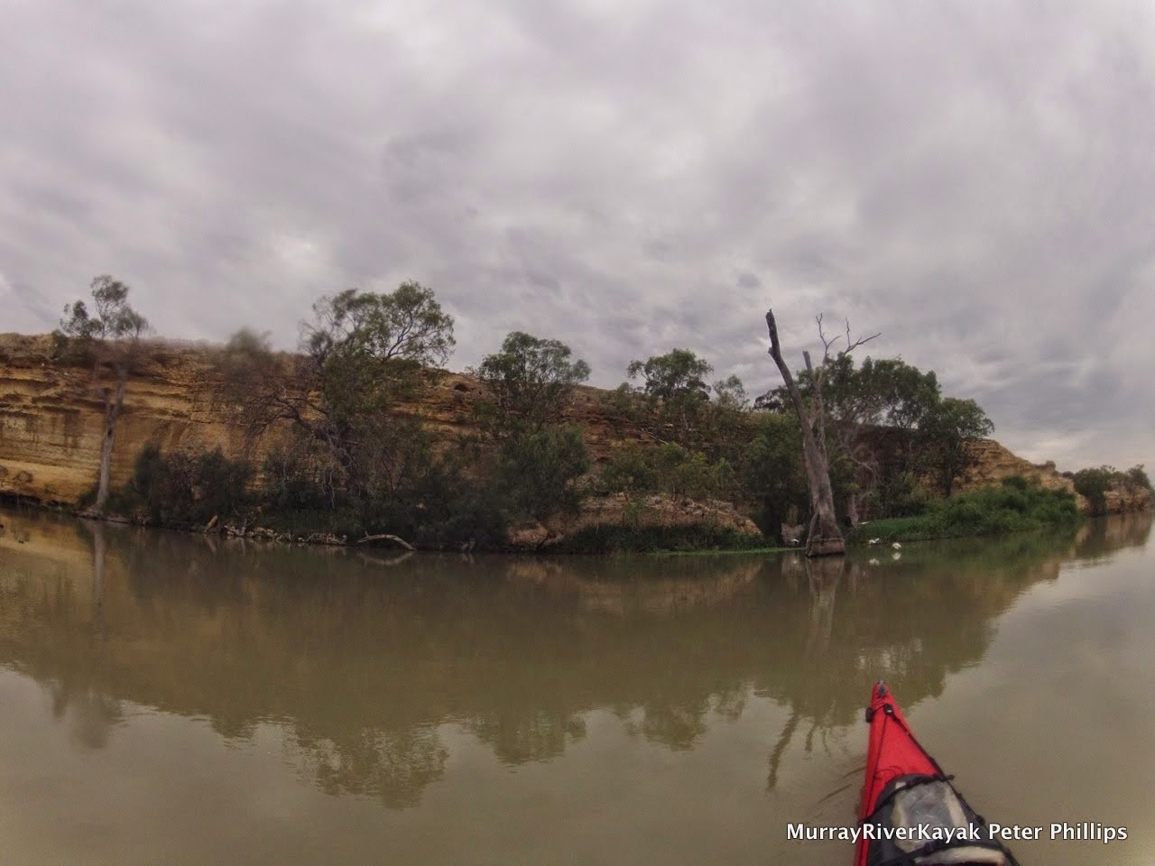
Day 27: River landscape between Morgan and Blanchetown.
There is something different about being in South Australia. The environment is more extreme. There is no hiding from the fact that you are in Australia. Many of the early Europeans wanted to tame the environment. You can see this in the planned towns of Renmark and Mildura, the streets are grid like. They have mathematical names and run at 90 degrees to each other regardless of the terrain. Pictures in Mildura's open air museum show with pride how trees areas were flattened by huge steam rollers and landowners proudly displaying their armies of steam engines in front of houses with gardens devoid of trees. In South Australia you can't afford to think like that. Water is too scarce, the environment too hot. All of it. I have the impression that people learnt quickly to work with nature, not against it, to learn from it.
Day 27: River landscape between Morgan and Blanchetown.
Day 27: Around Blanchetown the river is hemmed in between two more or less parallel cliff lines. It meanders between them, moving through all the available space over time, slowly making the gorge wider. As it moves it leaves backwaters like this one and billabongs which teem with life. A beautiful stretch of the river.
There is another difference, South Australians like to have their own minds. From the beginning they were different. A colony of thinkers. They were the only colony in Australia to have exclusively free settlers. Western Australia tried to go convict free, but had to give up. Adelaide was founded in 1836, 3 years earlier than Melbourne in 1839. The settlers came on a special passage of ships, like the first fleet that sailed to Sydney in 1788, but these were all paid migrants, keen to make a new start in a country away from the political, kingdom based skirmishes of Europe. What it would have been like to be amongst those first pioneers. I have included a sailors song from that time which captures the spirit, (Bound for South Australia) as a Youtube link on the Facebook page. It is sung like sailors, building bravado, not as pretty, or as nostalgic as many other versions. I feel the presence of those pioneers as I paddle down the river and walk through the old towns. What was it like? What is it like?
Day 27: Advertising for migrants to South Australia in 1836.
Day 27: Advertising for migrants to South Australia in 1836.
I had lunch at the Blanchetown pub - the oldest in the Riverland - older than the Overland Corner by 2 years, the publican tells me, a smile on his face. "Mind you, they had to move the pub, stone for stone, because the rest of the town got washed away in the 1870 flood." Not good for customers. The first settlement was too close to the river, but then the 1870 flood was the largest on record (however there is evidence that in 1780, there was a much larger one). At Overland Corner the owner told me a story of an old aboriginal fellow who refused to camp down near the hotel despite frequent invitations. He is said to have pointed to a tree trunk carried by the floods and left 8 metres higher than the Overlander. "You crazy. I not camping down there!" In the games room of the Blanchetown hotel are a series of paintings of the original settlement (called Moorundie, the name of the local Aboriginal Tribe). I have included one in the Facebook album. It shows a slab hut, with smoke coming from the chimney - a sign that everything is fine - and a clipper sailing up the river. This would have meant news from home, but also indicates the depth and width of the river here.
Blanchetown lies on a significant boundary recognising the limits of human aspiration, the Goyder line. This line is the longstanding boundary of where crops can be sown and where only light grazing is possible. It was drawn up by South Australia's Surveyor General of the same name after repeated failure of settlements. In a two month ride Goyder used vegetation as a guide to rainfall and soil properties. Settlement was discouraged beyond the line. When good years came again the public pressured the government to abandoned the policy. Many of these places are now the ruins that are so picturesque when driving through the South Australian countryside. Everyone knows about the Goyder line here. The lady in the fish and chip shop-come hardware-come newsagent told me. It is a mark of pride to be living on the edge. Irrigation does change the picture a little though.
Day 27: Houseboats are beginning to look more like little ships as we near the sea. This one, a Halverson Cruiser looks almost like a 1930's destroyer. Very retro. Unfortunately, with the original petrol engine, they also had a habit of blowing up. Petrol fumes built up in the poorly ventilated hull were ignited by the flick of the starter switch. Not the beginning to a weekend on the river that you would hope.
Day 27: My kind of Christmas decoration. A tree full of short billed corellas.
Day 27: Corellas in
flight.
Today I spoke to Franz Imhof. He paddled to the Murray from his hometown of then, Myrtleford, to Murray Bridge in 1968 with his brother. The year before the first Murray Marathon. His brother was in a Canadian canoe and he was in a kayak. Few kayaks were available that were designed for long distance journeys. Franz had gear on the front, gear on the back and wore a back pack as well. They did the trip around Christmas time. Franz said they got horribly burnt. They completed the trip in two months. In South Australia, Franz said they were often blown backwards, upstream by the wind. His brother liked the image if the bronze Aussie. We did not understand much about skin cancer back then. There was no such thing as sunscreen and Franz's brother liked to paddle without his shirt. He died of skin cancer shortly afterwards.
Day 27: The original settlement near Blanchetown, named Moorundi after the local aboriginal tribe followed the granting of the position of protector of aborigines to Eyre in reward for his exploration achievements. This picture from the Blanchetown hotel shows his hut and the first cutter to travel this far upstream, the Waterwitch. Eyre kept the peace, but the tribe dwindled and was extinct within 40 years, probably as a result of disease. The settlement, including its stone barracks and Eyre's own house succumbed to the Gundagai flood of 1850. The floods were named after the areas they came from and could be recognised by the colour of the water.
Day 27: Street art. Blanchetown.
Blanchetown is the first and last lock on the Murray. How will the current be from here? How long will the cliffs go on for? Are there really 90 metre high cliffs near Big Bend? Will the character of the Murray change as it nears the sea? The next three days will tell. By that time, all going well, I will be in Wellington and watching the heavens for signs signalling whether it is suitable to paddle Lake Alexandrina or not.


No comments:
Post a Comment