Day 25: 426 to 359 km to the sea: Overland Corner - Waikerie - Lock 3 -Riversleigh beach.


Day 25: Wednesday 12/12

Overland Corner - Waikerie - Lock 3 - Riversleigh beach.
River markers: 426 to 359 km from the sea.
Distance travelled today: 67 km. 
Total distance travelled: 1351 km


With an early start, I managed 20 kilometres before brekky. I was blessed with the most beautifully calm water, tempting me on more than one occasion to reach for my camera. There was more than photographic ambition and a sense of the aesthetic motivating me to get off earlier than ever; 6:11am. The winds are calmer in the morning (particularly the early morning) and the forecast had predicted a change from southerly winds to hot northerlies, bringing the temperatures into the high 30's with potential thunderstorms. I wanted to get as far as I could before that happened and not feel under time stress to get to and set up camp - or for that matter, get to Lock 3, 60 km downstream. The current has fallen away in the last few days as well. Every kilometre it drops means an extra hour on the water. They are the logical reasons; always good for justifying things; wisdom of hindsight / experience. The deciding factor was actually that my campsite was infested with mossies. The tent was covered in them. There was no way I was spending any longer outside than I had to! I was off!


Day 25: Early morning light: near Overland Corner.


Day 25: Having fun paddling close to cliffs between Overland Corner and Waikerie.


The morning paddle was a treat however, and it was a good way of breaking up the big distance I always try and get done before lunch. Waikerie was the goal I had set for my big break of the day and I determined to have a stroll there and find a little bit about the place. The 40 kilometres to Waikerie contained many stretches with cliffs. It seems they just keep getting better and better. The morning light highlighted their different layers. Pondering about their patterns was a welcome distraction on the long straights and reaches. There were several 6 kilometre straights, one in the afternoon's headwind and a massive 16 kilometre bend. So, plenty of ponder time. Down the bottom of the cliffs was a thick layer of limestone. In some places this dominated the cliff. It was the same material as the Overland Hotel was made of. Where the rock came in contact with the water it was full of hollows. So full, it would make Swiss cheese look like value for money. These hollows extended to about four to six metres above current level, perhaps caused by a combination of floods, rain, or ground water seepage. When the waves from my wake lapped against these stone hollows they amplified the sound and provided an echoing quality. Swallows loved the hollows. I saw many nests. I even saw cockatoos sitting in one up high. As I drifted past, I saw a small lizard poke its head out, curious as to what might happen next. Stones did not fall off the cliff as I was passing; they obviously had in the past. I was pretty happy about that.

Day 25: Reflections on the water in the calm air of early morning.

Day 25: River landscape between Overland Corner and Waikerie.

A goyne marking the river channel.


Above the limestone layer was one of soft sand. You can tell it was soft because it tended to erode faster than the other layers, leaving hollow layers midway up the cliff, as if it was the cream in a sponge cake and someone had decided to test it with their finger.

As I write this, thunder is rolling through the sky, the occasional crack signals a lightening strike somewhere, but not so close. Most of the lightening seems to be generated between the colliding air masses, rather than by connecting with the ground. As the storm blew in the wind picked up, as if warning of what might come. I was glad that I had camped well away from the old gum trees that lined the beach. Very fine sand managed to get through my fly wire, a bit like a sieve and covered everything. At least I am not being sand blasted. The tent was protecting me. I feel grateful to the designers and manufacturers of my tent. Aldi. 

Day 25: Approaching storm. Baton down the hatches!


Back to the cliffs. Above the soft sandy layer is a hard dark sandstone, the redness in it indicating iron. Iron often toughens rock. As it rusts it acts like glue. So how did they get there and why is the Murray cutting through them? Limestone is formed by the remains of marine life, so there must have been an inland sea, perhaps a time when sea levels were much higher than today. The sand appeared to be massive deposits, rather than by a current, so could also have happened in the ocean, but close to the shore, perhaps at an estuary, or beach. The red sandstone I am unsure of. The whole thing must have been lifted up as a block as there is no twisting, or bending of the layers. There must have been a massive earthquake, or series if earthquakes to do that. My guess is that the Murray already existed when this happened. It is a very old river. It has worn down our mountains to a fraction if the height they once were and created the vast inland plains in the process. The uplifted land would have blocked the Murray, creating a vast inland lake, which would have stretched at least as far as Renmark and perhaps as far as Wentworth. When the lake reached the top of the range the overflow gradually carved out gorges, the edges of which are the cliffs we see today. Floods through these gorges must be spectacular!

My tent is moving like the skirts of a Spanish dancer in the whirling winds if this thunderstorm. I hope I put those pegs in well. :) 

Waikerie was a really pleasant stop. After waiting for the car ferry to cross and the cables it travels along to sink enough for safe passage, I headed for a lovely grassy area, full of BBQ's, sun shades and a combination of school kids happy not to have to spend one of their last days at school in the classroom and international backpackers. At first a confusing mix. A few people approached me and asked about what I was doing, before, in reply to my questions, directing me to the centre of town. Conscious that I looked and probably smelled grotty, with my three day old paddling thermal top and matching beard growth I changed my shirt and hat, had a quick wash using the basin in the public toilets and gave my hair a finger comb. One helpful local asked if I wanted a shower. Great - that bad! He also said not to worry :), we are not too fussy in Waikerie, though I am not sure that this helped. I wasn't going to have a shower. I went to town.

Yarn bombing on a tree next to the art gallery.

Day 25: Waikeri Art Gallery: mural by local kids.
On the front it says 'set yourself free and your mind will soar'.

Murray River Queen, once the most luxurious boat on the river - now a backpackers hostel.


Oranges are big in Waikerie.


Two close lightening strikes. I reckon that they hit the tops if the cliffs on the opposite side of the river. I was hoping they might protect me. 

Waikerie is a modest town, but it has got style. Both in the main street and tucked away are houses from the late 1800's and early 1900's, almost as they were then. They would be worth a mint in any major city. There is something else that is special about the main street, it is full of oversized oranges. In closer inspection these prove to be rubbish bins.

Ok that lightening strike made me jump. I wonder what it hit. It spooked a cockatoo, it won't stop screeching as it flies away. At least it is flying. That is a good sign. It means that it still has all of it's feathers. Not a cooked cocky (yet).

Oranges are also the explanation for the backpackers. I met a Scottish carpenter who was living in the Murray Queen, once the pride if the new Murray cruise ships, now purchased by the caravan park and a very popular hostel - mind you, it is not luxury he said. No backpacker hostel ever is. He explained that everyone on the boat was here to satisfy the condition of working three months in rural Australia in order to get a year's extension in their tourist visas. Orchards need labourers, and for the wages they pay and the hard nature of the work, it is hard to get Aussies who are keen to move with the seasons. So it helps both camps. Everyone seems happy with the system. I met one Aussie bloke who was travelling Australia following the fruit harvest, Raymond. He had converted an old Toyota Coaster bus, to include a queen size bed, a stove, fridge and a lot of other stuff. He had some seats free and was taking fellow puckers shopping when I noticed him earlier, but they had to climb over everything first to get to their seats. On the roof were two kayaks. It looked pretty cool. Without having to pay rent, or power bills, Raymond said he could live very cheaply and enjoyed meeting backpackers as they moved through. He was loving it. 
Day 25: Flow metre showing recorded floods and current amount if water travelling down the Murray.


Day 25: Cooling off in the heat. The first dip in the water sent shivers down my spine... And then ahh, so refreshing :)

Remains of a midden.

Day 25: Praying Mantis on my hat. His colours camouflaged him when hunting on soil.


The lightning struck for about 30 minutes.
Thunder pealed and echoed from the cliffs... and then came the calm.


Pink sky after the storm.


I learnt that Waikerie means rain moths in the local aboriginal language. Apparently after the rain thousands of these little, fast flying moths would emerge. It must have been as special to them as the Bogong moths were to the people of the high plains. The local gallery is named after them and is well worth a visit. 

Safe in my tent, the thunderstorm seems to have passed. All have come through well, except for a now neurotic cockatoo. I can live with that.


More from this expedition:

  • Google+  Murray River Paddle Echuca To The Sea Photo Album
  • Facebook Murray River Paddle
  • YouTube Murray River Paddle


More information about topics from this page:
  1. Discover the Murray: Overland Corner Hotel, WaikerieRiver Murray Locks, Weirs, Dams and Barrages.
  2. Wakerie Tourism: Info
  3. Sydney Morning Herald: reflection
  4. National Trust: 
  5. Rilli Island Conservation Park Management Plan
  6. Barry and Maureen Wright's River Murray Charts
  7. Environment Victoria: The Living Murray 
  8. Ecology of Floodplain Lakes and Billabongs 
  9. Geology: Murray Valley Geography (A geological timeline of the development of the Murray).
  10. Victorian Geology: Tectonic Framework of the Lower Murray. (from Red Cliffs).
  11. ABC Riverland SA: News and Community Events

Day 24: 500 to 426 km to the sea: Rilli Island Conservation Reserve -Moorook - Lock 3 - Overland Corner.


Day 24: Tuesday 11/12

Rilli Island Conservation Reserve - Moorook - Lock 3 - Overland Corner.
River markers: 500 to 426 km from the sea.
Distance travelled today: 74 km. 
Total distance travelled: 1286 km.


Day 24: Leaving camp at sunrise. Rilli Conservation Reserve.

I left my island home with the intension of making it to either Kingston 'on the Murray' or Lock 3. During the day, I realised that if I made it to Lock 3, I would be in striking distance of the Overland Corner. The story around that hotel and what happened compelled me to try. 

The current was not as fast as in the past days, but I had a light tailwind. This was good news as today's distance included the infamous seven mile reach (known to inland outriggers as the 11 kilometre straight). It is said to be the longest reach on the river. For once the river seems to know where to go. The problem is that us freshwater sailors are used to and have come to like and feel secure in its twistings and turnings. It also keeps the journey interesting because you never really know what will be around the next bend. Enter the 11 kilometre straight and the horizon disappears. It is as though you have become a cartoon character in someone's perspective drawing where the path you are following just disappears into the infinite distance. The difference to the ocean is those guide rails. They just keep saying “go ahead, doesn't look like you've done much, but keep trying”. It took an hour and a half to reach Moorook, a few kilometres past the end of the straight. I called in for sanity, food and a rest.


Day 24: I like coming in close to overhanging trees. This one was full of flowers, others have nests. The most common are the darters, they make a messy nest out of gum leaves.

Day 24: Reeds on the river banks are common around here. The moorhens love them.


Day 24: The beginning of the seven mile reach . Otherwise known as the 11km straight.
The longest straight on the Murray. It went on and on and on...


There were things to look at on the banks going up the straight. There were the elaborate houses on the tall banks that looked like they belonged to people from Adelaide. There were the smaller, more modest farm houses with home-built sitting areas down near the river to escape the summer's heat and all too often fields with tall sprinklers that once would have watered orange trees, but were pulled out in the last drought when water could not be guaranteed these farmers, or as the result of government water buy backs, after the drought. The houses were on the taller southern bank. On the lower flood prone northern bank were red gums and mulga trees. The mulgas have low drooping branches that almost hang to the ground, tempting some people to call them native willows. Wallabies and kangaroos like to lie near the river protected from the sun's strong rays under these trees. I caught many snoozing. They often awoke with a start. Many were mothers with joeys. The joeys would bound away a short distance and then look back at mum. Mum seemed to know that I was not a threat, but stayed alert watching all the same. Under one tree was a collection of swallows’ (tree martin) nests, and, as it was close to the water I was able to take a photo.

The constant bank watching caused neck ache after a while. I listened to an album. Finished. Now what? Still 5 kilometres straight paddling to go. I tried paddling with my eyes closed, feeling the rhythm of the boat. Staying upright, but not maintaining a reliably straight course. The act of closing eyes also let sunscreen into them. Failure. Keep paddling. Just do it. At least there was no head wind.

Day 24: Swallows nest under an old gum on the water's edge.


In Moorook I dried off on a park bench and then went into the store, as much to talk to the shop assistants as to buy something. I bought my normal performance food, pie and a chocolate Big M. The lady serving me told me about life in this small town, how with thirty years there, she was almost a local. The shop was a cafe, supermarket, post office and petrol station. The owners were selling after five years of seven days a week. She hoped that she would continue working there. She had seen out three owners now. Thongs seemed to be the uniform for men in Moorook. With my river shoes, I felt overdressed. One bloke hurriedly brought a pair. Maybe he had had a blow out.

From Moorook to Lock 3 was 22 kilometres and I had just two and a half hours to get there. I would have to maintain an average of 10 kilometres per hour to get there on time. That is fast for my kayak. Burping up pie and the other performance food I had so greedily consumed, I raced to the weir. Time had gotten away on me, the weir was further than I thought and the last lock age was 30 minutes before closure. I made it three minutes past the cut off, but was let through anyway. The drop in the weir was three and a half metres, the biggest outside of Torrumbarry. Jamie, the Lockmaster, explained that because the river is hemmed in between two sets of hills here - the same that form those magnificent cliffs - floods happen quickly here and are fast flowing, as the water is squeezed through this natural bottleneck.


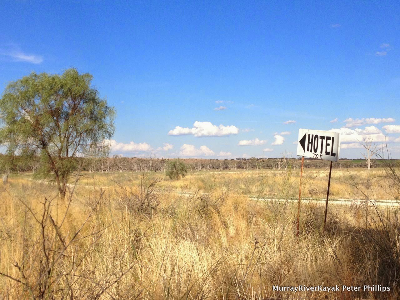
Day 24: The way to the Overland Hotel from the river.
For their sake I hope that they also have another road. (They did).


Day 24: The Overland Corner Hotel. Original and compelling. A living museum.

Day 24: View towards the river from the Overland Hotel. Like so many other places along the river, precious habitat - this time to the endangered Southern Bell Frog - which has incidentally done very well here following the recent high river.


Pulling into Overland Corner, I met Graham who was on an extended cycle tour of Australia before returning to his home country of New Zealand to live. I persuaded him to come to the hotel with me. Built in 1850, it is one of the oldest country buildings in South Australia. The name comes the times of migration from the coast to inland Australia. People hoping to forge a new life on the land took the paddle steamers from Goolwa, where the Murray enters the sea to the Overland Corner, where they continued their journey by stage coach. This was the last point that the river could reliably be travelled on in summer. From here on, it was goodbye to the smooth luxury of a paddle steamer with its parlours and cabins and onto a stage coach to Wentworth. The entrepreneurial founder of the hotel had first released brumbies into the bush here. With these as a breeding stock, he was able to supply the 300 horses needed for the coach run. He used the natural bends of the river and narrow gorges between its cliffs to trap the brumbies when they came down for a drink in the evening and so always had a supply of horses when he needed them. He built a solid building, which is virtually unchanged to this day. Its thick walls are made from limestone quarried from the cliffs behind it. I enjoyed my few beers and overland burger and with the sun setting over the river returned to camp.

I recommend that you seek out this hotel and its friendly staff when in the area. You won't be disappointed.
Day 24: Campsite near the Overland Hotel.


Day 24: Sunset on the river from my campsite.


More from this expedition:

  • Google+  Murray River Paddle Echuca To The Sea Photo Album
  • Facebook Murray River Paddle
  • YouTube Murray River Paddle


More information about topics from this page:
  1. Discover the Murray: Overland Corner Hotel, River Murray Locks, Weirs, Dams and Barrages.
  2. Postcards South Australia: Postcard of Overland Corner.
  3. National Trust: 
  4. Rilli Island Conservation Park Management Plan
  5. Barry and Maureen Wright's River Murray Charts
  6. Environment Victoria: The Living Murray 
  7. Ecology of Floodplain Lakes and Billabongs 
  8. Geology: Murray Valley Geography (A geological timeline of the development of the Murray).
  9. Victorian Geology: Tectonic Framework of the Lower Murray. (from Red Cliffs).
  10. ABC Riverland SA: News and Community Events


Day 23: 566 to 500 km to the sea: Renmark - Lock 5 and 4 - Rilli IslandConservation Reserve, Loxton.


Day 23: Monday 10/12

Renmark - Lock 5 and 4 - Rilli Island Conservation Reserve, Loxton.
River markers: 566 to 500 km from the sea.
Distance travelled today: 66 km. 
Total distance travelled: 1212 km


Farewell comfort and dryness... time to hit the water again.

The 8:30 am start was late for me, but most of the caravan park was still asleep. They can't have had a river to paddle down - yes that was it. This was the friendliest caravan park I had ever been in, as well as the cleanest. Not sure about cheap, but the experience is close to resort like. So, secure in their comfort people slept, whilst I packed and got ready to go. An elderly gentleman who had chatted to me the day before came down to wish me well. He was going to come back before I left, but then even in conversation, he kept forgetting things.

Being tired, I set myself a more modest goal of Lock 4, just 52 km today. I could get most of it done by lunch and cruise in the rest. I paddled steadily, in no particular hurry, lucky to have a good current - something I had not banked on at this end of the river. The flow from the Darling was helping. The current was about the speed it is at Echuca (about 1.5 km/hr); given that the water here is pooling between weirs, that is something. Enjoying the scenery and the waves from the wind (think positive).

Day 23: Afternoon sun on the river near Berri
Day 23: Pulled up at the shady lawns at Martins Beach in Berri for some lunch.
Day 23: It doesn't take much to get me in the Christmas spirit, but you don't see much tinsel or hear many carols on the river, so I got really excited when I saw the caretaker's decorations at Martin's Bend in Berri. So many reindeer!

Day 23: Serious boat, Berri.
This houseboat actually looks like one.

I passed through two locks today, Lock 5 just 6 kilometres out of Renmark and Lock 4, 46 kilometres later. I shared the first lock with a couple who were travelling the Murray in a tinny. It was fast and well appointed, but given that a lot of their load was petrol, it was a good thing that neither of them smoked! They were off to Kingston for lunch. I later looked up where Kingston lay. It was about 140 kilometres away. No wonder they sped off. They would finish in Goolwa in about a week, they told me. This was interesting, because I expected only to take 2 or 3 days longer in my kayak. A lot of tinny travellers are fishermen. They like to whizz from place to place, but in the end spend a lot of time sitting still. Quite often the fishermen will see things that I haven't seen, because they have been still and quiet. As my two companions were not fishermen and had had enough of camping, i wondered where they might be spending their time. To their credit, when I arrived at lock 4, the lockmaster said he had been inspecting me. Two tinnies had said that a mad bloke in a kayak was still coming and to keep an eye out.


Day 23: Scar tree. The shape of the canoe was cut into the wood and then the sap wood was pried loose from the tree using wedges. This was then shaped and hardened using fire.


There is so much to see on the Murray. It is not possible to write about it all the time, or to photograph or film it. It just happens all around you. I find each bend changes from the last and my friends who have paddled this stretch before tell me on seeing my photographs that it has changed so much since they came through. The bush changes with the seasons, in the early summer I am travelling through the gums are flowering and the air is full of the sounds of bees. At night frogs take over, happy to have reeds to hide in and rich mud nourishing the insects and larva they feed on. The trees still have birds sitting on nests, although most of the young have left. I saw a couple of young darters yesterday, their plumage white and downy. They had very fat tummies - full of baby carp no doubt. Unable to fly away, they dropped like stones into the water and did not resurface until I was gone. Ducklings were doing the same thing around Barham. It is amazing how well they can swim underwater being just a few days old. 


Day 23: Wilabalangaloo wildlife reserve. Managed by National Trust, the reserve contains remnant native Mallee vegetation and wildlife habitat including specimens of the rare Blue-leaved Mallee (Eucalyptus cyanophylla), Native Jasmine (Jasminum didymum ssp lineare) and 9 species of rare birds. http://www.nationaltrust.org.au/sa/wilabalangaloo-reserve

Day 23: Dead tree reaching for the sky in front of cliffs near Berri.

The river level changes too. Six weeks ago it was a metre higher. I can tell that on the island I am camped on tonight, the sand is still hardening. On the beaches, many young trees fall over in the big winds as this young soil, like the mud at my campsite in Murrabit, just has no strength to it. The shallow cutting coming in to Robinvale had been a raging torrent with rapids when Rose Fletcher paddled through in it in October. I don’t think the river is actually the same any two times you travel down it. 


Day 23: Can anyone remember where I put my boat?


I think that whenever and however one travels the Murray, so long as you spend enough time, you will see things. Today I saw a water rat emerge from its burrow. The first time I had even seen one do that. It snuck along behind the tree roots till it thought that I could not see it anymore. Swans leading me away from their young, protected in the shallow billabongs are a common sight. I get a thrill when they take off, their long necks stretched, legs racing to help build speed and to push off the water, their wings beginning to whistle as they build up air speed. And pelicans! No wonder it used to be a derogatory term to be called a pelican. I love them, but they are funny, and awkward. They begin their flight effort with strong two legged hops, thrusting their heavy bodies forwards and upwards, building momentum, assisting their huge wings. Then, in order to gain the height they need to clear the river red gums lining either side of the river, they need to turn in tight circles at least three times, all the time beating their wings strongly. All when they need not have taken off at all. My boat was no threat - but they got nervous - and then had to do all this work. They really must be at the limit of how big a bird can be. Yesterday, I saw a family a wedge tailed eagles, with the young ones in flight training. I thought they might be little eagles at first because of their size, but then I noticed the adults calling the shots.


Today's scenery continued to be punctuated by the most majestic cliffs. There were long straights and generous reaches, which, if into the wind called for patience. I passed through Berri and spent a cool restful lunch at Martins Bend, where the lawns are beautifully cared for and the camping is free. The caretaker, who lives on site, had a large cut-out Santa Claus and so many reindeer, each with their own name pulling them. How cool! I am a sucker for Christmas things and have been missing the lead up. I seem to be well ahead of schedule now, so getting back on time for Christmas with the family will not be a problem. 

Day 23: River landscape near Berri.
The constant water levels from the weirs help create ideal conditions for reeds to grow.


Tomorrow I will aim for Kingston, or perhaps even to go through Lock 4, a journey of 64 and 69 kilometres respectively. The next location after that is the overland corner after 75 kilometres of paddling, but I don't know much about that at this stage.

Really enjoying the journey!


More from this expedition:

  • Google+  Murray River Paddle Echuca To The Sea Photo Album
  • Facebook Murray River Paddle
  • YouTube Murray River Paddle


More information about topics from this page:
  1. Wikipedia: Renmark, Berri
  2. National Trust: Wilabalangaloo Reserve
  3. Rilli Island Conservation Park Management Plan
  4. Loxton Tourism: Campsites MapTourism info,
  5. Barry and Maureen Wright's River Murray Charts
  6. Environment Victoria: The Living Murray 
  7. Ecology of Floodplain Lakes and Billabongs 
  8. Geology: Murray Valley Geography (A geological timeline of the development of the Murray).
  9. Victorian Geology: Tectonic Framework of the Lower Murray. (from Red Cliffs).
  10. ABC Riverland SA: News and Community Events