Despite growing up on the river, I am always surprised how much I did not know. In addition, I enjoy learning of the stories of people who had gone before, as well as those who continue to work on these projects, but go unnoticed and unheralded.
Beginning our trip at this work of engineering which has such a big effect on our lives, it only felt right to honour the foresight, courage and continuing expertise and planning which enables so many hundred of thousands of people to live in the interior of our dry land of drought and flooding rains. There is a lot more information than I have included here; I have included links to websites with more information and to the sources of photos which are not my own. Each has its own story.
 |
Because of dry years from 1904, severe El Niño events in 1914 and 1915, and the pumping of water for irrigation, in 1915 the River Murray dried up completely. Families took the opportunity to picnic in the river bed at Koondrook. Culture Victoria
|
It did not take the early settlers who arrived a few years after Hume in 1824 long to realise that water flow in the Murray was highly seasonal and that 10 times more rain fell in wet years than in dry years. They also dreamt of that if they could spread the massive winter flows over the year then the Murray could be used as a transport system. Hopes were to rival the great European rivers like the Rhine and the Danube, and Mississippi and Great Lakes of North America. By the time that it was built the river trade was already dying, rail had reached the inland towns and stations and could be used all year round. It did, however fulfil its secondary goal, further than any expectations. The Hume allowed a steady flow of water throughout the year. The raised river levels from the weirs that had been constructed for the river trade allowed irrigation channels to bring use gravity to convert large areas of grazing country into productive farmland. It provided drinking water security for river towns and cities, like Adelaide and allowed them and Australia's population to grow. It truly was an act of nation building. More than any other piece of infrastructure, we can thank the Hume Dam that so many people live and profit from the Murray Darling Basin today.


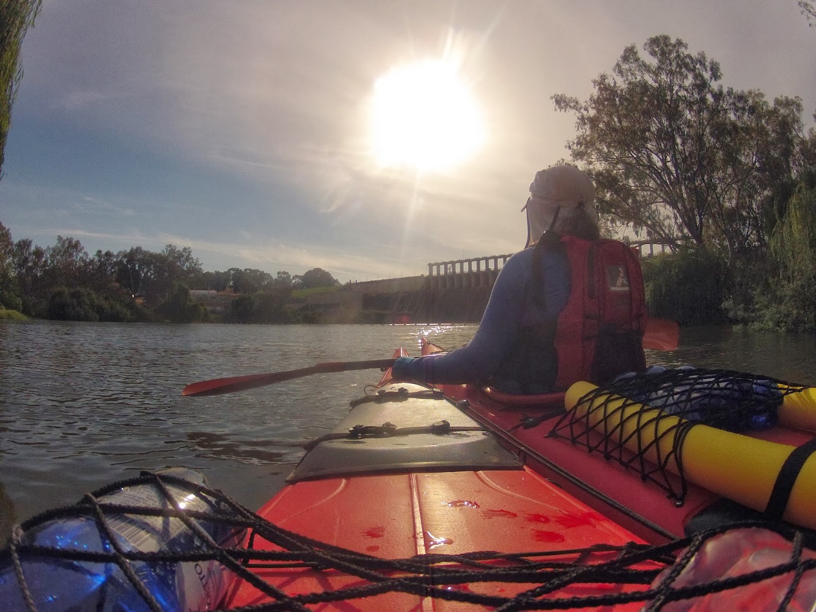
As we start our journey beneath its ageing edifice I will honour those people who created it and those who strive to use it wisely for the benefit of others.
The Hume Dam was constructed between 1918 and 1936 (and was at the time the biggest dam in the Southern Hemisphere and one of the largest in the world). Horses, steam engines and manual labour, including hand to hand passing of rocks was used to create the wall.
To improve efficiency, a flying fox capable of carrying 10 tonnes of rocks was built on the NSW side. Clay was loaded onto small trains and transported to where it was needed on the supporting banks on both sides of the concrete core. From there it was taken and distributed by 130 horse drawn scoops and compacted by their hooves and wheels in the process. Construction peaked in 1926 with 1000 men working on the project. Workers lived in their own little village, single men in barracks and married men in cottages. The village had its own church, school and stores.
When the project was finished in 1936, it was the biggest dam in the Southern Hemisphere and one of the largest in the world. It was hailed alongside Sydney Harbour Bridge as one of the mightiest Australian structures of the inter-war years and was one of the first great inter-government co-operative projects facilitated by Federation.
The site was originally called ‘The Mitta Mitta Dam Site', but in February 1920 the River Murray Commission chose the name ‘Hume Reservoir' to honour Hamilton Hume.
 |
Hamilton Hume (19 June 1797 – 19 April 1873)
The main use for Hume Dam is to supply water for irrigated agriculture. This is critically important to downstream communities and the wider economy. However Hume Dam also provides water that is ultimately used for urban drinking water (including Adelaide), as well as stock and domestic use, river flows, industry, flood mitigation and increasingly for environmental flows in the Murray River.
Murray Darling Basin Authority:
Hume Dam follows an annual cycle of filling and drawdown (where water is released to the River Murray). Water comes into the Dam during winter and spring each year. Water is released between December and May, usually to less than half its capacity by the end of autumn.
During the filling phase minimum releases are maintained for as long as possible. The minimum release from Lake Hume is 600 megalitres per day (ML per day). This is increased if needed to ensure that a minimum flow of 1,200 ML per day is maintained at Doctor’s Point to provide sufficient water for the environment. Doctor’s Point is immediately downstream of the junction with the Kiewa River, a few kilometres below Hume Dam. Typically the filling phase runs from the end of the rural irrigation season in mid-May to some time in the late winter or spring, depending on seasonal conditions and irrigation demand.
During peak farming season, water demand in South Australia and the irrigation areas along the Murray River can exceed 30,000 ML per day. This is more than the flow that can pass along the river channel without causing flooding. To avoid the need to supply such high flows, efforts are made to get the required water down to mid-river storages such as Lake Victoria earlier in the season. The river channel between Hume and Yarrawonga has a capacity to pass 25,000 ML per day without flooding.
|

Further downstream at the Barmah Choke, at the western end of the Barmah-Millewa Forest, the maximum flow is about 8,500 ML per day. Flows greater than 8,500 ML per day cause flooding in the forest, which is undesirable in certain seasons of the year. When it is necessary to transfer water downstream at rates greater than can pass through the Barmah Choke, alternative routes through the Mulwala Canal and the Edward River may be used to pass additional flows. Such transfers are usually required when Darling River resources and downstream tributary flows are low.
Water released from Lake Hume takes about a month to reach the Murray Mouth, so releases must be made up.
http://www.lakehume.org.au/management.aspx This estimate is made assuming a 3km an hour average flow in the Murray, so sometimes it might take a lot longer and sometimes somewhat less. I think the figure is optimistic.
Current release from the Hume is 20,800ML per day, an increase of 3,000 over 3 days ago.
http://waterinfo.nsw.gov.au/drr/murray.shtml this website is very interesting as it gives an up to date picture of how water is flowing down the Murray Valley and how its tributaries and canals are being used to get water where it is needed in peak times. I was unaware of the effect of the Barmah Choke on limiting the amount of water that could be passed down the river to SA and how important the Edwards and Yarrawonga Mulwala channels are to fulfilling the needs of users all along the river.
Murray River Paddle