Hume Dam - Albury - Island Camp.


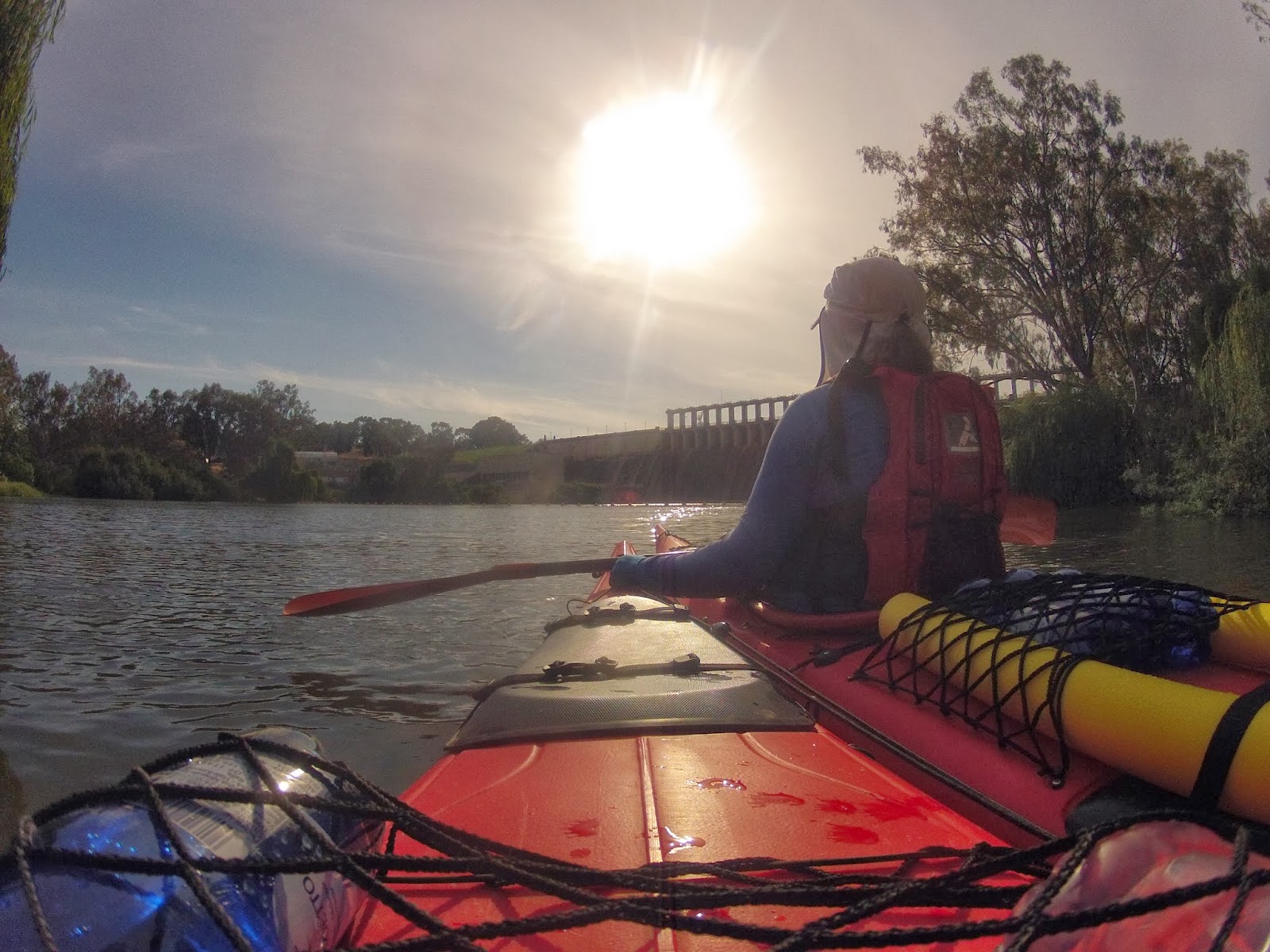
Bridge just below the Hume Dam.

River of islands.

The river is so different up here, fast flowing and low banks. Here we navigated two small islands in the middle of the river. From the air the river twists and turns. Billabongs are everywhere. It is a haven for wildlife. We saw flocks of black and brown kites, wedge tailed eagles, pelicans, ibis, rainbow bee eaters, grey tree creepers and at one stage flocks of low flying swallows which seemed to cover the river.

Its banks are lush and green. It feels as if it would be easy to pull up and camp anywhere. There is little or no housing development to be seen. This seemingly tame, rural environment is a stark contrast to the dry bush of further downstream. European trees are common, in particular poplars and willows. One island we passed was covered in elm trees and ivy, in the moist soil the forest looked like a patch of Europe.
Poplars and willows are common along the Upper Murray.

The river is swirly and fast. Care needs to be taken to steer away from willows well before the bends as the current often sweeps directly into and under their overhanging branches. It is also a good idea to have minimum gear on deck on these first few days: the likelihood of losing it is high.


Taking a break as the heat of the day settles in.


In this satellite photo you can see how the river twists and turns, abandoning old courses as billabongs and forging new ones. It is hemmed in by hills to the North and South. The Hume freeway in the South and Riverina Highway in the North run along the edges of those hills.


The Murray is a natural waterway managed in a human environment. Whilst the satellite picture that you have just seen shows how the river has changed and continues to change, the amount of water allowed to run down it and when that water is allowed to run is controlled in a bid to meet the needs of people all along the river as well as to keep the river and its wetlands healthy. At present, about 20,000 ML a day are being released from Hume dam, so the river is near the tops of the banks and most of the gravel races are underwater. This is because the summer months is when farmers irrigate. In the winter months, flow can be as low as 600 ML a day. This is in stark contrast to the natural patterns of flood and low river along the catchment. It has contributed to the demise of health of river red gum forests which depend on short, sharp winter floods to reproduce and rejuvenate the soil. In the last drought many wetlands and lakes were filled or allowed to dry out depending on the effectiveness of lobbying from groups and states concerned about them. The communities of Lake Boga and Pyramid Hill almost disappeared when the water they depended on did. The new Murray Darling Basin Plan contains strategies to ensure that these areas are not forgotten. It is motivated by the stories of real people and real places behind the controversy. 

The basin plan is an attempt to make the way we use water in the Murray Darling Basin sustainable. The Living Murray Initiative in addition identifies six icon sites as being of particular significance and focus. One of these is the river bed itself, others are areas which the river supports, like the Barmah-Millewa Redgum Forests. Wetlands and lakes can now be filled using systems of channels which run off weirs like Yarrawonga, Torrumbarry and reserves like Lake Victoria. They keep the river alive and help us to grow enough food for our increasingly urban populations. Improved systems of dams, gates, channels and levees in the red gum forests mean that these can now be watered at the right time, whatever the level of the river (Barham Koondrook Perricoota Forest Works. Updates).

Whilst the management of the Murray River and its flow are a necessity for the populations that live along it, it is refreshing to find an unregulated river. The Kiewa river may flow through farmland for much of its course, but it is still wild. It enters the river quietly most of the time, but can be a raging torrent. It is easy to paddle past and not recognise its significance: one of the last free mountain catchments in the Murray Darling Basin.

The Kiewa River Junction.
The junction of the Murray and Kiewa rivers. The Kiewa, Ovens (and its tributary, the King river) rivers remain undamed, the only mountain catchments to remain in their natural state. This means that they can flood quickly following heavy rain. Care needs to be taken when camping on their shores. The Kiewa has its headwaters around Mt Bogong, whereas the Ovens begins near Mt. Buffalo. Both are very pretty valleys, are heritage listed and are very popular amongst fishermen. There was not much coming down the Kiewa today, but there were times when it was in flood last year. Things would have looked different then.


Goulburn Murray Water: Kiewa river.
Goulburn Murray Water: Ovens river management plan.

Active steps are being taken to improve the catchment health of both basins. Fish are being used as indicators of the river quality, in particular the presence of cod and trout cod. The following oral history was is an exerpt from True tales of trout cod: River Histories of the Murray Darling Basin: Ch 11, Kiewa River Catchment. You can read more at Australianriverrestorationcentre.com.au.

OH 95


Bill Murphy of Kergunyah was interviewed in April 2008 at an age of 73 years.

I was born in ’35. I remember my uncle went down here and all the lobsters were in the back of the Ford. I saw the lobsters; they were coming out of the river after the fires. He was fishing down here and there was a 70 pound cod dead, down near Doug Austin’s. Cliff Cooper told me there was cod all the way up past Tawonga before the fires. Apparently there was a few about 90 pound caught around here. There was an old bridge just below my boundary; there was a 90 pounder there. There used to be a few Catfish here, my father used to catch them in ‘the old river’, where it cuts through the paddock. He also talked about getting some other type of fish there. The Blackfish were in the little creeks, some people used to get a feed of them. There used to be some in the Bells Creek and the Running Creek. There were no yellowbelly here, not as I remember, and grunter, no.


When I left school the river was full of trout, you could catch them on worms up to 11 pound, then they started to disappear. The redfin then used to be thick, then they disappeared with a fish disease. I saw them dying in the river about 25, 30 years ago. I haven’t caught a carp for two to three years. I once saw six about 10 pound each eating the leaves off the willows. Now the river is full of small cod, though they get a bit of a hiding. Felix Carmody was a character and a well-known poacher.. He used to catch black snakes and once he tipped one out in the pub, that soon cleared the bar!
Ref: True Tales of the Trout Cod: River Histories of the Murray-Darling Basin: Ch 11 Kiewa River Catchment.


The Red Eye Cicada can be very common in one year, with thousands of individuals in one tree and completely absent the next (ref). Different cicadas emerge at different times of the year.  They make good, although short-lived children's pets (ref).
This little fella was too big for the camera. Almost broke the lense. The cicadas are enormous up here... And loud. We had to abandon one potential campsite because we thought we would not be able to get to sleep with the noise. The cicadas answered each other on different sides of the river; one side would listen whilst the other would perform, before performing itself. They make their loud noise by rubbing thick chitinous plates on their abdomen together. These vibrate as they pass over each other causing the noise - much like finger nails on a black board. Later, we were told that cicadas are only noisey in the daytime, that they are quiet at night. Potentially we could have kept that first campsite, but we would have needed ear protection if they hadn't quietened down... and we would never have found the lovely island campsite that we eventually found for the night.

If you have really had enough, I found out that cicadas may be eaten, they were on the menu in China, Burma, Latin America, the Congo and in a single batch of ice-cream at Sparky's in Missouri, Columbia. They were warned by health authorities not to make a second batch and complied.

Cicadas spend most of their life feeding on the roots of trees, they emerge en masse to overwhelm predators.


Island campsite.

Cooling down after a long day in the sun.

We eventually found a nice spot a little over 50km down from the Hume. It is a small island, which is nice. I like camping on Islands. The current is fast here. Not even sand can settle. There are little trails of sand behind the tree trunks from when it has been covered by flood waters. All around the island are pebbles and gravel races.

Other paddlers have since told me that they too had camped on this island, however no trace of their passing could be seen. This is the way it should be. We should strive to leave so little impact that the people who follow experience the environment in as good, or better condition than we found it in.

More and more people want to enjoy our rivers, which is great, however the very people who love the environment can destroy it. Outdoor education teaches mantras such as leave only the lightest of footprints, take only photographs. As canoeists, our touch should be particularly light. Make it a challenge.

This website from Backcounttry Atittude outlines steps you can take to minimise your impact. It starts with good planning. Leave No Trace Outdoor Ethics & Skills For Outdoor Users. Many families who camp along the Murray pick up rubbish left by less careful occupants. It is a good example to follow.

The Murray River Guardian is a free magazine put out as a cooperative project between Parks Victoria and NSW National Parks. It is a guide to camping along the Murray in both of those states and contains practical tips and valuable information. It is worth getting your hands on one before you paddle.


Parks Victoria's website on the River Murray Reserve provides up to date information on changes in conditions along the river. Check it out.


Evening light from our river island.


Evening light on our island.

Dinner.


Preparation for our paddle from the Hume Dam to Echuca.


Cleaning out the boats. They should at least start free of Murray Mud. :)

This will be the first time for me on the Upper Murray and the first time paddling with my beautiful wife and soul-mate, Ruth.  

We are looking forward to exploring this beautiful stretch of water and sharing each other's adventure so much! I swore after my trip from Echuca to the sea, that my next trip would be with my wife. Journeys like these are as affirming and life changing as they are beautiful. For me, it is important to share them and with the most significant person in my life, doubly so. The trip was a chance for Ruth to witness how the river is important to me and for me to further understand why. In addition I had the pleasure of the company of my best friend and, as it turns out, after 23 years of marriage, being thrilled by her strength, bravery, good nature and humour. I was also humbled by her tolerance of me. I have quite a few rough edges.

But I am jumping to the end before I have even begun. Now that we had decided to go, how does one go about getting a show like this on the road?

The first step in preparing for this trip was working out what we were up for. This means tapping into the experience of others, both in the form of river guides and other paddler's experiences.


There is a very good river guide called 'River of Islands: Charts of the River Murray - Yarrawonga Weir to Hume Dam' by Kath and Leon Bentley (1985) which is worth acquiring. It is mentioned in Barry and Maureen Wright's 'Murray River Charts' and available on the CD version of their charts by agreement with the authors.


http://www.rivermurraycharts.com.au/

Murray River Access Guides provide an alternative to the above publications and at around $8 a booklet in 2014, they are a good deal. They include roads and river kilometres, but do not show snags, or include insights and history about stretches of the river as the other publications do. Whilst it is possible to see where you are using google maps, for the convenience and safety of knowing where you are at all times, it is worth having one of these maps. Phone reception is poor along many stretches and technology requires batteries and charging strategies which can fail. It is better to have a hard copy.

https://svmaps.com.au/ 


We were lucky to have advice from others based on their experiences in the Upper Murray. This helped us feel much more confident on approaching this stretch of river. Even though conditions change dramatically with river level and time of the year, reading the accounts of others helps to understand the nature of the river and its potential dangers.

River levels change rapidly depending on the time of year and the needs of users and the environment downstream. In preparation for the irrigation season, 50 times more water is released than during the winter. Check water levels before you go. If the river has dropped recently, banks can be steep, high and muddy. Some paddlers have even experienced quicksand. Beware, a wet beach may not be firm - test with your paddle first. If your paddle slips in, don't step out. Mud can make camping in caravan parks an attractive alternative to bush camping in these conditions. Boat ramps, especially larger ones, are reliable exit points. High water is easier to deal with. At times of high water it is easy to find camping spots. There are beautiful islands, grassy banks and plenty of safe room away from tall red gums. At high water Albury is difficult to pull up at. There is a boat ramp just downstream of the park in town, or, if you can manage it, roots to clamber up. Floods are rare as this section of river is usually able to be managed within its capacity and the effect of irrigation water rejections due to unexpected rainfall events is more of a problem from the Barmah Forest onwards.

If the river is low, there are many gravel races and pebble islands as far as Howlong. These will be shown in the river charts, but not the access guides. Alternatively you can see them using google maps before your trip.
Example of map from Murray River Charts


Shallow water near Albury: Google Earth

Generally follow the current, (this will be where the deepest water is), however, beware of being washed into willows and snags. The fast current means that you need to turn away from hazards well before you get to them, otherwise the current can take you sideways into them. The fast current also makes large and at times, powerful swells, which can appear suddenly and unexpectedly move your boat around. It is not the best place to learn how to paddle: this is better done downstream of Echuca where the river is slower. If you do fall out of your boat, keep your legs up and in front of you, so that they do not become trapped in snags (and you can use them to bounce off them should you be swept into them). Look after yourself. Your boat can be replaced. Do not allow yourself to be between your boat and a snag, you may become trapped. If you are a new paddler, only take on this section if you have good balance and are confident. It is a good idea to have an experienced paddler with you. People have descended the upper river alone with little paddling experience, but it is not a wise thing to do.

In sea kayaks turning can be difficult. To turn around, use the eddies on inside corners and snags. Nose into these and allow the current to do the work for you. It will bring the back of the boat around. Approaching the bank facing into the current is a much slower and gentler process where you will have more control. When pulling out from the bank, leave your stern against the bank, allow the current to catch the bow. Only start paddling once you are facing the direction that you want go. Given how narrow the river is at times, how fast the current is, and the number of snags it can be the only way to turn around at times. It is best practiced before you go to the Upper Murray. The same skills are very helpful in the narrows upstream of Picnic Point.


Turning into the shore using the current to bring around the stern.


Using the current to take bring around the bow when leaving a beach.


Navigation near and in Lake Mulwala can be difficult. To add to the complexity, the Ovens river joins the Murray river here. Without good charts it is easy to go off into side channels, or even end up in the Ovens. It may pay to have a topographic map, or use your smart phone for a GPS fix through here. Keep a sharp eye out for channel markers. Take time to explore the billabongs and side waters if you can. Locals and fishermen call the area 'the Everglades of the Murray'.

Since the weather is expected to be hot we have prepared meals which can be eaten hot, or cold, without creating too much rubbish. This includes a lot of fruit and vegetables. We chose hot weather things as these seem to last longer. Each day we inspected their quality and ate thise which needed eating first. We had very little wastage.

Fruit and veg for ten days for two people, with some top up possibilities along the way. This all went in the front compartments of one of our boats.

This initial pack list for my paddle from Echuca to the sea, which we used as a guide for what to take. Every trip is different, but it is good to develop a check list and work from there.


The next step is to actually get everything out, get a visual and check the condition and amount of gear..


Then check everything on your boats. Take tools and know how to fix them.

Facebook entries: Murray River Paddle

Why the Hume Dam?

Despite growing up on the river, I am always surprised how much I did not know. In addition, I enjoy learning of the stories of people who had gone before, as well as those who continue to work on these projects, but go unnoticed and unheralded.

Beginning our trip at this work of engineering which has such a big effect on our lives, it only felt right to honour the foresight, courage and continuing expertise and planning which enables so many hundred of thousands of people to live in the interior of our dry land of drought and flooding rains. There is a lot more information than I have included here; I have included links to websites with more information and to the sources of photos which are not my own. Each has its own story.

Because of dry years from 1904, severe El Niño events in 1914 and 1915, and the pumping of water for irrigation, in 1915 the River Murray dried up completely. Families took the opportunity to picnic in the river bed at Koondrook. Culture Victoria

Raft in Fiery Creek, Mininera East, Victoria, 1935
Museum of Victoria

It did not take the early settlers who arrived a few years after Hume in 1824 long to realise that water flow in the Murray was highly seasonal and that 10 times more rain fell in wet years than in dry years. They also dreamt of that if they could spread the massive winter flows over the year then the Murray could be used as a transport system. Hopes were to rival the great European rivers like the Rhine and the Danube, and Mississippi and Great Lakes of North America. By the time that it was built the river trade was already dying, rail had reached the inland towns and stations and could be used all year round. It did, however fulfil its secondary goal, further than any expectations. The Hume allowed a steady flow of water throughout the year. The raised river levels from the weirs that had been constructed for the river trade allowed irrigation channels to bring use gravity to convert large areas of grazing country into productive farmland. It provided drinking water security for river towns and cities, like Adelaide and allowed them and Australia's population to grow. It truly was an act of nation building. More than any other piece of infrastructure, we can thank the Hume Dam that so many people live and profit from the Murray Darling Basin today.


As we start our journey beneath its ageing edifice I will honour those people who created it and those who strive to use it wisely for the benefit of others.


The Hume Dam was constructed between 1918 and 1936 (and was at the time the biggest dam in the Southern Hemisphere and one of the largest in the world). Horses, steam engines and manual labour, including hand to hand passing of rocks was used to create the wall.


http://www.bordermail.com.au/story/56571/75-years-on-no-plaque-for-hume-dam-deaths/

To improve efficiency, a flying fox capable of carrying 10 tonnes of rocks was built on the NSW side. Clay was loaded onto small trains and transported to where it was needed on the supporting banks on both sides of the concrete core. From there it was taken and distributed by 130 horse drawn scoops and compacted by their hooves and wheels in the process. Construction peaked in 1926 with 1000 men working on the project. Workers lived in their own little village, single men in barracks and married men in cottages. The village had its own church, school and stores.

http://www.abc.net.au/local/photos/2013/04/12/3735488.htm

When the project was finished in 1936, it was the biggest dam in the Southern Hemisphere and one of the largest in the world. It was hailed alongside Sydney Harbour Bridge as one of the mightiest Australian structures of the inter-war years and was one of the first great inter-government co-operative projects facilitated by Federation.


http://en.wikipedia.org/wiki/Mitta_Mitta_River

The site was originally called ‘The Mitta Mitta Dam Site', but in February 1920 the River Murray Commission chose the name ‘Hume Reservoir' to honour Hamilton Hume.


Hamilton Hume (19 June 1797 – 19 April 1873)

The main use for Hume Dam is to supply water for irrigated agriculture. This is critically important to downstream communities and the wider economy. However Hume Dam also provides water that is ultimately used for urban drinking water (including Adelaide), as well as stock and domestic use, river flows, industry, flood mitigation and increasingly for environmental flows in the Murray River. 


Murray Darling Basin Authority: 


Hume Dam follows an annual cycle of filling and drawdown (where water is released to the River Murray). Water comes into the Dam during winter and spring each year. Water is released between December and May, usually to less than half its capacity by the end of autumn. 


During the filling phase minimum releases are maintained for as long as possible. The minimum release from Lake Hume is 600 megalitres per day (ML per day). This is increased if needed to ensure that a minimum flow of 1,200 ML per day is maintained at Doctor’s Point to provide sufficient water for the environment. Doctor’s Point is immediately downstream of the junction with the Kiewa River, a few kilometres below Hume Dam. Typically the filling phase runs from the end of the rural irrigation season in mid-May to some time in the late winter or spring, depending on seasonal conditions and irrigation demand.

During peak farming season, water demand in South Australia and the irrigation areas along the Murray River can exceed 30,000 ML per day. This is more than the flow that can pass along the river channel without causing flooding. To avoid the need to supply such high flows, efforts are made to get the required water down to mid-river storages such as Lake Victoria earlier in the season. The river channel between Hume and Yarrawonga has a capacity to pass 25,000 ML per day without flooding.


Further downstream at the Barmah Choke, at the western end of the Barmah-Millewa Forest, the maximum flow is about 8,500 ML per day. Flows greater than 8,500 ML per day cause flooding in the forest, which is undesirable in certain seasons of the year. When it is necessary to transfer water downstream at rates greater than can pass through the Barmah Choke, alternative routes through the Mulwala Canal and the Edward River may be used to pass additional flows. Such transfers are usually required when Darling River resources and downstream tributary flows are low.

River Murray System Poster

Water released from Lake Hume takes about a month to reach the Murray Mouth, so releases must be made up.http://www.lakehume.org.au/management.aspx This estimate is made assuming a 3km an hour average flow in the Murray, so sometimes it might take a lot longer and sometimes somewhat less. I think the figure is optimistic.

Current release from the Hume is 20,800ML per day, an increase of 3,000 over 3 days ago.http://waterinfo.nsw.gov.au/drr/murray.shtml this website is very interesting as it gives an up to date picture of how water is flowing down the Murray Valley and how its tributaries and canals are being used to get water where it is needed in peak times. I was unaware of the effect of the Barmah Choke on limiting the amount of water that could be passed down the river to SA and how important the Edwards and Yarrawonga Mulwala channels are to fulfilling the needs of users all along the river.


Murray River Paddle


Day 31: 76 km to the sea: Wellington - Goolwa.


Day 31: Tuesday 18/12

Wellington - Goolwa
River markers: 76 to 0 km from the sea.
Distance travelled today: 76 km. 
Total distance travelled: 1712 km

Facebook


Day 31: Wellington, view from our balcony at the old Wellington Hotel. The evening before the lake crossing, with Jack's Boat in the foreground.

Day 31: Dawn in Wellington. By the time this photo was taken, I had already been on the water for 2 hours and was well away from the shoreline. I could now start to use my compass and maps and was less reliant on my iPhone 'radar'.

Starting off at 4:30am there was no moon, I had to be very careful where everything was and that I would be able to find my way. The beginning was a little deceptive because the strong lights from the ferry at Wellington lit up the whole river. Once past the island of light around the ferry, I paddled into increasing darkness. I had given up the idea of a torch. The river was too wide and it would ruin my night vision. I paddled gingerly into the void, trying to make out where the banks of the river began and which direction the river was headed. One way to make it out was the absence of stars. The sky was full of them. The milky way stretched high across the heavens and the Southern Cross was clearly visible, indicating South. On my deck and tied to the net in front of my cockpit I had my favorite old bushwalking compass. Don’t let me down, old friend. Next to it in its own waterproof bag was my new friend, the one which has made all these reports and photo uploads possible - my iPhone. In addition to this, in its own waterproof  map case, I had a small copy of a map of the lake to which I had added the bearings that I would need to take to get to stages of the journey across the lake and the approximate distances. In the same map case, I had a copy of the Murray River Pilot, which gave more detail on beacons, bearings and dangers. 
Day 31: Pelicans have been my companions on the Murray since before Mildura. Whilst crossing the lake they often circled low overhead, curious I suppose, but it was nice to think they were kindred spirits.


It was so dark that the maps were useless for the first 13km. It took the one and a half hours I needed to get to the open lake to be able to see them. Up until this time I had to rely on the Maps App from my iPhone. This was brilliant. That CEO should not have resigned! I was able to get a satellite image of where I was, see which direction I was headed and how close to the banks I was. It was close as a sea kayak ever had to having a radar screen. I remember the times I spent on the Nella Dan in the Antarctic. I used to like spending time with the Captain, or mate up in the bridge when I could not sleep and would watch the radar screen which was used to keep a constant lookout for icebergs. The maps app gave a similar sense of security. I used it to navigate safely out into the lake and then used sight and compass bearings from there as my main tools. The maps app was still useful on the open lake however, because it gave me an absolute fix on my position. When navigating it is important to compare where you think you are and where you actually are. This is why the sea captains in the days of sailing ships had to have such accurate clocks and to be able to work with theodolites. The maps app filled this spot for me.

We had heard tales from the old fishermen in the pub about how wild the lake can be. One gentleman with a long grey beard, bad teeth and a firm hand grip said that you have to hope that you have been treating the lady right, because she’ll turn and throw anything at you that she wants. it can be as calm as day everywhere else and she will throw in a storm. Another said that because it is so shallow, only a couple of meters deep the waves whip up quickly. He can remember being out their in a tinny with three other blokes and a storm blew in. The waves were 6 feet and only 6 feet apart. In every trough the outboard motor hit the ground and with every wave water entered the boat. It was so rough, they all had to sit on the bottom of the boat, and all three who weren’t driving bailed the incoming water. “ok”, he said, “the waves were not quite that bad, but it felt like it. “it’s called the Coorong Doctor”, said Heather, one of the party headed for Goolwa the next day, “the Coorong and Lake Alexandrina have their own weather.”


Day 31: Dawn, on Lake Alexandrina.


I headed out into open water. Despite the gentle breeze, there was quite a chop up. I had assured everyone that I would take the coastal route. The fishermen suggested I curve towards the coast but not deviate too far from the passage. I decided to give it a go. After all, Jack’s Boat was also coming this way and would be keeping an eye out for me. I found the first (and it turned out, the last) navigation beacon, set my bearing for Sturt’s Point  26 kilometres away and set off. If I was to have difficulty I could always head South to the coast. The chop became waves which hit me from the right and rear. In addition to the waves being driven by the wind, a second set seemed to exist from the weather that had passed through previously. This bounced the boat around and turned it, either into, or away from the waves, depending on their pattern. Yet the boat kept its course and momentum. I went further and further. At one point I hazarded a look to my left towards the coast, 4 kilometres away. Rolling waves, one after the other raced towards the coast. The sun reflecting off their backs had a different colour, a greyer shade , than the rest of the lake. It was quite unnerving. I knew the same was coming from the 20 kilometres of lake on my left. I told myself, keep calm. People travel around Australia on ocean voyages. If you can handle 5 minutes, you can handle 5 hours. Just keep going, keep calm and keep safe. Every half an hour I rewarded myself with something to nibble on, a 20 second stop and a navigation check with the iPhone. I had my compass on my deck and constantly followed my bearing. This was necessary every wave, because every wave changed my direction. After two hours the land I was headed for became visible. In another hour I was there. Sturt’s point in four and a half hours, with an average speed of eight kilometers an hour. I tell you what though, I am glad all that chop was a tail wind. Did you know that people also swim the Murray... and the lake. How tough would that be?!


Day 31: The Murray, coming into Goolwa.
Day 31: Something comforting and humorous about arriving in civilisation after crossing the lake. There was the most wonderful and friendly yacht club here. The members opened the facilities for us here and told us of all the ways one could get to the mouth. The swimmers always take Mundoo Channel they said. Swimmers! Tough cookies!
Day 31: Clayton Bay, neighbour to Goolwa. Now the Murray has a distinctive marine atmosphere.
Day 31: Arriving in Goolwa.
Day 31: Pulling into my final campsite. My boat has been a good friend. Nothing at all went wrong, there was plenty of room for everything... and it behaved as if it was in its element in Lake Alexandrina. Now it gets a clean and rest.
Day 31: Coming into Goolwa, into the caravan park where we are staying.
The Murray is more of an estuary here than a river. It is very wide.


Day 31: Honouring the river. I now understand that the river does not naturally have a mouth, but rather a series of entrances to the sea. The Coorong is its interchange. Except in times of flood, there is no natural estuary. We have tried to change this with the barrages which join the islands that border Lake Alexandrina, keeping salt water from fresh. The Coorong is the Murray's inland estuary. When the river stopped flowing at this end for much of the last 10 years the Lake was a meter lower than the sea and 5 times as salty. For the sake of the Coorong it would have been better to allow the sea in. I think the idea is to use Alexandrina as a fresh water reserve however. Must find out more about this.


Homeward journey.


I reached the best possible goal I had set that morning, to arrive in Clayton Bay by evening, at 11:30. I had contacted Ruth and Anna and we met for lunch at the yacht club. Whilst there we met Hal and Lucy who had travelled from Goolwa to Echuca and back earlier this year in their yacht (mast removed) to take part in the hundred year celebration of the PS Melbourne. They congratulated me and shared their own story and love for our river and its history. They told how once they hit a snag and the whole front of their yacht rose up and out of the water, it kept going and the yacht was balanced in the air, until it edged on, slipped off and even cleared the motor. It reminded me of all I have seen, all the stories I have heard, all the experiences I have had and am thankful for the opportunity to have experienced these. 

The Murray is so full of stories, so full of life, so dynamic. It is waiting to be discovered, again and again, by each in their own way.